Estimated Value: $241,000 - $282,000
3
Beds
2
Baths
2,016
Sq Ft
$128/Sq Ft
Est. Value
About This Home
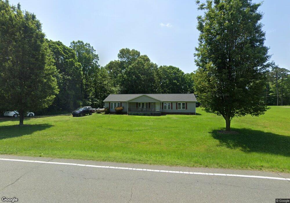
This home is located at 401 Trinity Church Rd, King, NC 27021 and is currently estimated at $257,333, approximately $127 per square foot. 401 Trinity Church Rd is a home located in Stokes County with nearby schools including King Elementary School, Chestnut Grove Middle, and West Stokes High.
Ownership History
Date
Name
Owned For
Owner Type
Purchase Details
Closed on
Feb 5, 2016
Sold by
Merritt Mickey Carlton
Bought by
Merritt Mickey C and Taylor Sherry M
Current Estimated Value
Home Financials for this Owner
Home Financials are based on the most recent Mortgage that was taken out on this home.
Original Mortgage
$116,000
Interest Rate
4.04%
Mortgage Type
New Conventional
Create a Home Valuation Report for This Property
The Home Valuation Report is an in-depth analysis detailing your home's value as well as a comparison with similar homes in the area
Home Values in the Area
Average Home Value in this Area
Purchase History
| Date | Buyer | Sale Price | Title Company |
|---|---|---|---|
| Merritt Mickey C | -- | Attorney | |
| Merritt Mickey Carlton | -- | Attorney |
Source: Public Records
Mortgage History
| Date | Status | Borrower | Loan Amount |
|---|---|---|---|
| Closed | Merritt Mickey C | $116,000 |
Source: Public Records
Tax History
| Year | Tax Paid | Tax Assessment Tax Assessment Total Assessment is a certain percentage of the fair market value that is determined by local assessors to be the total taxable value of land and additions on the property. | Land | Improvement |
|---|---|---|---|---|
| 2025 | $1,655 | $231,400 | $35,100 | $196,300 |
| 2024 | $1,655 | $166,200 | $27,000 | $139,200 |
| 2023 | $1,346 | $166,200 | $27,000 | $139,200 |
| 2022 | $1,230 | $166,200 | $27,000 | $139,200 |
| 2021 | $1,230 | $166,200 | $27,000 | $139,200 |
| 2020 | $1,092 | $147,500 | $26,000 | $121,500 |
| 2019 | $1,092 | $147,500 | $26,000 | $121,500 |
| 2018 | $1,092 | $147,500 | $26,000 | $121,500 |
| 2017 | $1,084 | $147,500 | $26,000 | $121,500 |
| 2016 | $1,050 | $142,900 | $26,000 | $116,900 |
| 2015 | $1,043 | $142,900 | $26,000 | $116,900 |
| 2014 | $1,061 | $142,900 | $26,000 | $116,900 |
Source: Public Records
Map
Nearby Homes
- 101 Hemlock Ct
- 623 Longcreek Way
- 901 Kingsway Dr
- 436 White Rd
- 108 Provence Ct
- 128 Provence Ct
- 119 Brae Ridge Ln
- 140 Little Brook Dr
- 227 Dixieland Ct
- 101 Tail Star Ct
- 109 Courtland Dr
- 119 Courtland Dr
- 104 Tail Star Ct
- 123 Macintosh Dr
- 108 Tail Star Ct
- 116 Courtland Dr
- 112 Tail Star Ct
- 116 Tail Star Ct
- 239 Macintosh Dr
- 120 Tail Star Ct
- 409 Trinity Church Rd
- 106 Sun Dr
- 113 Dusty Ln
- 2 Sun Dr
- 332 Trinity Church Rd
- 108 Dusty Ln
- 113 Skeeter Ln
- 325 Trinity Church Rd
- 114 Dusty Ln
- 420 Trinity Church Rd
- 317 Trinity Church Rd
- 18+/- Trinity Church Rd
- 428 Trinity Church Rd
- 124 Dusty Ln
- 130 Dusty Ln
- 309 Trinity Church Rd
- 121 Skeeter Ln
- 425 Trinity Church Rd
- 102 Maple Ln
- 304 Trinity Church Rd
Your Personal Tour Guide
Ask me questions while you tour the home.