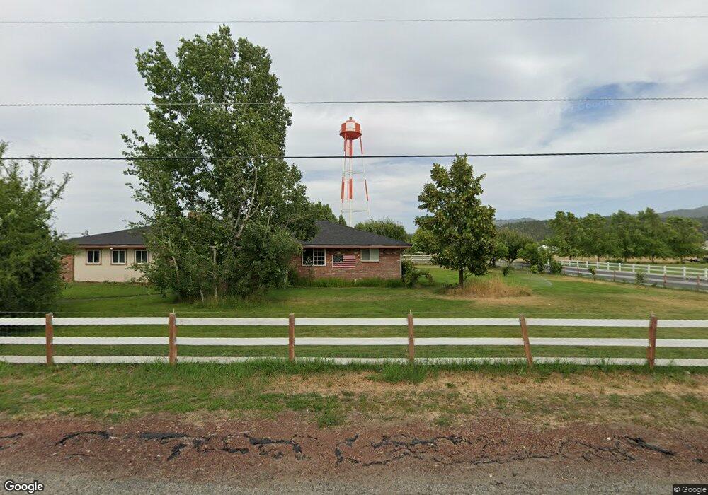
4010 N Simpson Rd Otis Orchards, WA 99027
Otis Orchards-East Farms NeighborhoodEstimated Value: $431,000 - $488,000
3
Beds
2
Baths
1,335
Sq Ft
$337/Sq Ft
Est. Value
About This Home
This home is located at 4010 N Simpson Rd, Otis Orchards, WA 99027 and is currently estimated at $450,444, approximately $337 per square foot. 4010 N Simpson Rd is a home located in Spokane County with nearby schools including Otis Orchards School, East Valley Middle School, and East Valley High School & Extension.
Ownership History
Date
Name
Owned For
Owner Type
Purchase Details
Closed on
May 31, 2005
Sold by
Kimpton Kevin E and Kimpton Korrine A
Bought by
Eloe Timothy A and Eloe Melissa A
Current Estimated Value
Home Financials for this Owner
Home Financials are based on the most recent Mortgage that was taken out on this home.
Original Mortgage
$159,600
Outstanding Balance
$83,213
Interest Rate
5.74%
Mortgage Type
Fannie Mae Freddie Mac
Estimated Equity
$367,231
Create a Home Valuation Report for This Property
The Home Valuation Report is an in-depth analysis detailing your home's value as well as a comparison with similar homes in the area
Home Values in the Area
Average Home Value in this Area
Purchase History
| Date | Buyer | Sale Price | Title Company |
|---|---|---|---|
| Eloe Timothy A | $141,000 | Stewart Title Of Spokane |
Source: Public Records
Mortgage History
| Date | Status | Borrower | Loan Amount |
|---|---|---|---|
| Open | Eloe Timothy A | $159,600 |
Source: Public Records
Tax History Compared to Growth
Tax History
| Year | Tax Paid | Tax Assessment Tax Assessment Total Assessment is a certain percentage of the fair market value that is determined by local assessors to be the total taxable value of land and additions on the property. | Land | Improvement |
|---|---|---|---|---|
| 2025 | $3,817 | $395,300 | $126,800 | $268,500 |
| 2024 | $3,817 | $367,500 | $121,800 | $245,700 |
| 2023 | $3,760 | $367,500 | $121,800 | $245,700 |
| 2022 | $3,549 | $364,100 | $121,800 | $242,300 |
| 2021 | $3,372 | $252,200 | $86,200 | $166,000 |
| 2020 | $3,274 | $231,680 | $81,080 | $150,600 |
| 2019 | $2,910 | $207,620 | $75,720 | $131,900 |
| 2018 | $2,840 | $188,580 | $60,480 | $128,100 |
| 2017 | $2,719 | $180,780 | $60,480 | $120,300 |
| 2016 | $2,448 | $162,730 | $50,530 | $112,200 |
| 2015 | $2,526 | $162,930 | $50,530 | $112,400 |
| 2014 | -- | $162,930 | $50,530 | $112,400 |
| 2013 | -- | $0 | $0 | $0 |
Source: Public Records
Map
Nearby Homes
- 24005 E Garland Ave
- 24672 Hawkstone Loop
- 24872 E Hawkstone Loop
- 4806 N Drury Rd
- 24672 E Hawkstone Loop
- 24443 E Pinnacle Ct Unit 24443
- 2669 N Talon Ln
- 2669 Talon Ln
- 2725 Talon Ln
- 24846 E Coopers Hawk Ln
- 24822 E Coopers Hawk Ln
- 24503 E Feather Loop
- Yukon Plan at Stonehill - Haven Collection
- Briarwood Plan at Stonehill - Cottage Collection
- Sedona Plan at Stonehill - Haven Collection
- 24662 E Hawkstone Loop
- Goldenwood Plan at Stonehill - Cottage Collection
- Willow Plan at Stonehill - Cottage Collection
- Hazelwood Plan at Stonehill - Cottage Collection
- Sherwood Plan at Stonehill - Cottage Collection
- 3910 N Simpson Rd
- 3927 N Simpson Rd
- 4108 N Simpson Rd
- 4111 N Simpson Rd
- 4112 N Simpson Rd
- 4120 N Simpson Rd
- 4120 N Simpson Rd
- 4119 N Simpson Rd
- 24123 E Garland Ave
- 4210 N Simpson Rd
- 3822 N Simpson Rd
- 3817 N Simpson Rd
- 24105 E Garland Ave
- 24108 E Garland Ave
- 24025 E Garland Ave
- 3710 N Simpson Rd
- 4222 N Simpson Rd
- 4221 N Simpson Rd
- 24016 E Garland Ave
- 3711 N Simpson Rd