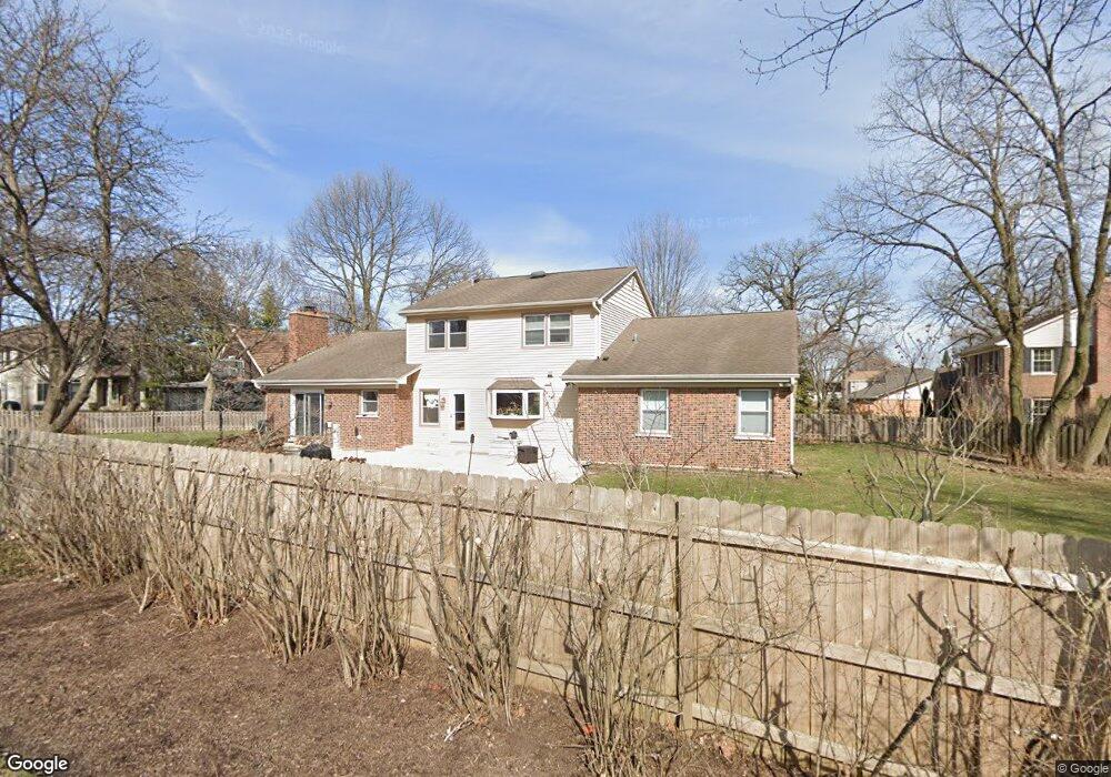
4010 Walnut Ct Rolling Meadows, IL 60008
Creekside NeighborhoodEstimated Value: $656,634 - $761,000
4
Beds
3
Baths
2,611
Sq Ft
$276/Sq Ft
Est. Value
About This Home
This home is located at 4010 Walnut Ct, Rolling Meadows, IL 60008 and is currently estimated at $719,409, approximately $275 per square foot. 4010 Walnut Ct is a home located in Cook County with nearby schools including Central Road Elementary School, Plum Grove Jr High School, and William Fremd High School.
Ownership History
Date
Name
Owned For
Owner Type
Purchase Details
Closed on
Jun 15, 2000
Sold by
Rubel Gregory J and Rubel Maryval C
Bought by
Niersbach Michael E and Niersbach Jill M
Current Estimated Value
Home Financials for this Owner
Home Financials are based on the most recent Mortgage that was taken out on this home.
Original Mortgage
$190,000
Interest Rate
8.65%
Purchase Details
Closed on
Jun 30, 1994
Sold by
Moninger Daniel and Moninger Kathleen
Bought by
Rubel Gregory J and Rubel Maryval C
Home Financials for this Owner
Home Financials are based on the most recent Mortgage that was taken out on this home.
Original Mortgage
$203,150
Interest Rate
8.61%
Create a Home Valuation Report for This Property
The Home Valuation Report is an in-depth analysis detailing your home's value as well as a comparison with similar homes in the area
Home Values in the Area
Average Home Value in this Area
Purchase History
| Date | Buyer | Sale Price | Title Company |
|---|---|---|---|
| Niersbach Michael E | $307,000 | -- | |
| Rubel Gregory J | $263,000 | -- |
Source: Public Records
Mortgage History
| Date | Status | Borrower | Loan Amount |
|---|---|---|---|
| Previous Owner | Niersbach Michael E | $190,000 | |
| Previous Owner | Rubel Gregory J | $203,150 | |
| Closed | Niersbach Michael E | $75,000 |
Source: Public Records
Tax History Compared to Growth
Tax History
| Year | Tax Paid | Tax Assessment Tax Assessment Total Assessment is a certain percentage of the fair market value that is determined by local assessors to be the total taxable value of land and additions on the property. | Land | Improvement |
|---|---|---|---|---|
| 2025 | $14,107 | $57,815 | $10,997 | $46,818 |
| 2024 | $14,107 | $48,001 | $9,306 | $38,695 |
| 2023 | $13,551 | $48,001 | $9,306 | $38,695 |
| 2022 | $13,551 | $48,001 | $9,306 | $38,695 |
| 2021 | $12,058 | $38,601 | $5,921 | $32,680 |
| 2020 | $11,943 | $38,601 | $5,921 | $32,680 |
| 2019 | $12,005 | $43,130 | $5,921 | $37,209 |
| 2018 | $12,568 | $40,973 | $5,498 | $35,475 |
| 2017 | $13,167 | $43,525 | $5,498 | $38,027 |
| 2016 | $12,523 | $43,525 | $5,498 | $38,027 |
| 2015 | $12,709 | $41,574 | $5,075 | $36,499 |
| 2014 | $12,452 | $41,574 | $5,075 | $36,499 |
| 2013 | $12,127 | $41,574 | $5,075 | $36,499 |
Source: Public Records
Map
Nearby Homes
- 208 Brookdale Ln
- 2600 Brookwood Way Dr Unit 316
- 2600 Brookwood Way Dr Unit 305
- 2600 Brookwood Unit 314
- 2650 Brookwood Way Dr Unit 108
- 3200 Thrush Ln
- 4101 Owl Dr
- 2401 Rohlwing Rd
- 4795 Woodcliff Ln
- 1620 Waxwing Ct
- 1931 Prairie Square Unit 1931
- 1609 Waxwing Ct
- 1926 Prairie Square Unit 302
- 1926 Prairie Square Unit 103
- 1926 Prairie Square Unit 210
- 4301 Euclid Ave
- 1 Harrogate on Oxford
- 1813 Hemlock Place Unit 109
- 1813 Hemlock Place Unit 107
- 1813 Hemlock Place Unit 311
- 5 Hampton on Auburn
- 4006 Walnut Ct
- 4007 Walnut Ct
- 8 Hampton on Auburn
- 2 Hampton on Auburn Unit 1
- 4 Hampton on Auburn
- 3950 Balmoral Ct
- 3950 Balmoral Ct Unit A
- 3 Calchester on Auburn
- 5 Woodbine Rd
- 6 Hampton on Auburn
- 4 Black Twig Rd
- 4002 Walnut Ct
- 3948 Balmoral Ct
- 3 Black Twig Rd
- 4003 Walnut Ct
- 1 Calchester on Auburn
- 3946 Balmoral Ct Unit 6
- 1 Hampton on Auburn
- 3 Hampton on Auburn
