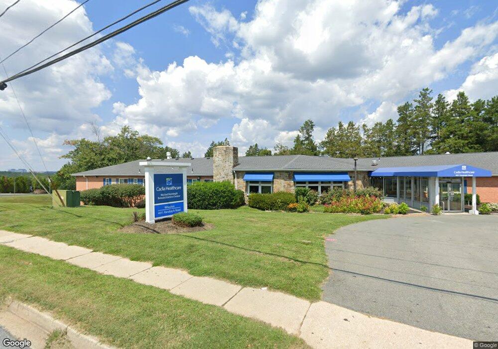
4011 Randolph Rd Silver Spring, MD 20902
Connecticut Avenue Park NeighborhoodEstimated Value: $26,228,524
Studio
--
Bath
42,524
Sq Ft
$617/Sq Ft
Est. Value
About This Home
This home is located at 4011 Randolph Rd, Silver Spring, MD 20902 and is currently priced at $26,228,524, approximately $616 per square foot. 4011 Randolph Rd is a home located in Montgomery County with nearby schools including Sargent Shriver Elementary School, A. Mario Loiederman Middle School, and Wheaton High School.
Ownership History
Date
Name
Owned For
Owner Type
Purchase Details
Closed on
Feb 1, 2023
Sold by
Sabra Health Care Northeast Llc
Bought by
Wheaton Md Propco Llc
Current Estimated Value
Home Financials for this Owner
Home Financials are based on the most recent Mortgage that was taken out on this home.
Original Mortgage
$113,269,100
Outstanding Balance
$109,676,481
Interest Rate
6.27%
Mortgage Type
New Conventional
Purchase Details
Closed on
Jun 30, 2015
Sold by
Randolph Road Llc
Bought by
Sabra Health Care Northeast Llc
Purchase Details
Closed on
Nov 27, 2013
Sold by
E & H Associates
Bought by
Randolph Road Llc
Home Financials for this Owner
Home Financials are based on the most recent Mortgage that was taken out on this home.
Original Mortgage
$10,575,000
Interest Rate
4.14%
Create a Home Valuation Report for This Property
The Home Valuation Report is an in-depth analysis detailing your home's value as well as a comparison with similar homes in the area
Home Values in the Area
Average Home Value in this Area
Purchase History
| Date | Buyer | Sale Price | Title Company |
|---|---|---|---|
| Wheaton Md Propco Llc | $22,648,767 | Old Republic National Title | |
| Sabra Health Care Northeast Llc | $57,160,000 | Commonwealth Land Title Insu | |
| Randolph Road Llc | $10,500 | First American Title Ins Co |
Source: Public Records
Mortgage History
| Date | Status | Borrower | Loan Amount |
|---|---|---|---|
| Open | Wheaton Md Propco Llc | $113,269,100 | |
| Previous Owner | Randolph Road Llc | $10,575,000 |
Source: Public Records
Tax History
| Year | Tax Paid | Tax Assessment Tax Assessment Total Assessment is a certain percentage of the fair market value that is determined by local assessors to be the total taxable value of land and additions on the property. | Land | Improvement |
|---|---|---|---|---|
| 2025 | $143,704 | $15,142,267 | -- | -- |
| 2024 | $143,704 | $12,000,000 | $2,080,500 | $9,919,500 |
| 2023 | $143,386 | $12,000,000 | $2,080,500 | $9,919,500 |
| 2022 | $146,343 | $12,795,033 | $0 | $0 |
| 2021 | $0 | $12,000,000 | $2,080,500 | $9,919,500 |
| 2020 | $153,107 | $12,000,000 | $2,080,500 | $9,919,500 |
| 2019 | $153,107 | $13,471,100 | $2,080,500 | $11,390,600 |
| 2018 | $247,116 | $21,956,700 | $1,981,400 | $19,975,300 |
| 2017 | $210,954 | $17,902,567 | $0 | $0 |
| 2016 | -- | $13,848,433 | $0 | $0 |
| 2015 | $91,694 | $9,794,300 | $0 | $0 |
| 2014 | $91,694 | $9,317,333 | $0 | $0 |
Source: Public Records
Map
Nearby Homes
- 12300 Downer Dr
- 12303 Barbara Rd
- 4104 Tulare Dr
- 12220 Centerhill St
- 12514 Turkey Branch Pkwy
- 3405 Fredale St
- 3410 Embry St
- 3608 Janet Rd
- 12106 Bluhill Rd
- 3726 Ferrara Dr
- 3720 Ferrara Dr
- 3921 Lantern Dr
- 11852 Huggins Dr
- 12312 Valleywood Dr
- 3409 Janet Rd
- 3908 Lantern Dr
- 12605 Bluhill Rd
- 12015 Claridge Rd
- 3505 Kayson St
- 4008 Adams Dr
- 3912 Ilford Rd
- 3910 Ilford Rd
- 3916 Ilford Rd
- 3908 Ilford Rd
- 4005 Randolph Rd
- 3918 Ilford Rd
- 3906 Ilford Rd
- 4004 Randolph Rd
- 4004 Randolph Roadway
- 3920 Ilford Rd
- 4003 Randolph Rd
- 4002 Randolph Rd
- 3904 Ilford Rd
- 3922 Ilford Rd
- 3913 Ilford Rd
- 3915 Ilford Rd
- 3911 Ilford Rd
- 3917 Ilford Rd
- 12220 Bushey Dr
Your Personal Tour Guide
Ask me questions while you tour the home.