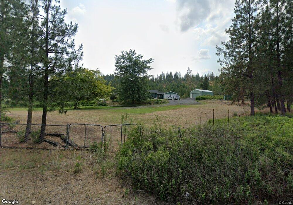
4011 W Monroe Rd Spokane, WA 99208
Dartford NeighborhoodEstimated Value: $450,000 - $560,000
3
Beds
2
Baths
2,330
Sq Ft
$221/Sq Ft
Est. Value
About This Home
This home is located at 4011 W Monroe Rd, Spokane, WA 99208 and is currently estimated at $514,572, approximately $220 per square foot. 4011 W Monroe Rd is a home with nearby schools including Brentwood Elementary School, Northwood Middle School, and Mead Senior High School.
Ownership History
Date
Name
Owned For
Owner Type
Purchase Details
Closed on
Jan 17, 2024
Sold by
Schroeder David P and Schroeder Penny D
Bought by
Holmberg Michael T and Blais Cindy L
Current Estimated Value
Home Financials for this Owner
Home Financials are based on the most recent Mortgage that was taken out on this home.
Original Mortgage
$456,000
Outstanding Balance
$448,140
Interest Rate
7.03%
Mortgage Type
New Conventional
Estimated Equity
$66,432
Create a Home Valuation Report for This Property
The Home Valuation Report is an in-depth analysis detailing your home's value as well as a comparison with similar homes in the area
Home Values in the Area
Average Home Value in this Area
Purchase History
| Date | Buyer | Sale Price | Title Company |
|---|---|---|---|
| Holmberg Michael T | $440,000 | Vista Title |
Source: Public Records
Mortgage History
| Date | Status | Borrower | Loan Amount |
|---|---|---|---|
| Open | Holmberg Michael T | $456,000 |
Source: Public Records
Tax History
| Year | Tax Paid | Tax Assessment Tax Assessment Total Assessment is a certain percentage of the fair market value that is determined by local assessors to be the total taxable value of land and additions on the property. | Land | Improvement |
|---|---|---|---|---|
| 2025 | $4,654 | $488,980 | $153,880 | $335,100 |
| 2024 | $4,654 | $459,600 | $128,500 | $331,100 |
| 2023 | $3,344 | $405,300 | $128,500 | $276,800 |
| 2022 | $3,338 | $366,600 | $120,500 | $246,100 |
| 2021 | $3,108 | $303,940 | $105,540 | $198,400 |
| 2020 | $3,061 | $274,160 | $88,460 | $185,700 |
| 2019 | $2,872 | $259,660 | $88,460 | $171,200 |
| 2018 | $3,017 | $228,860 | $70,460 | $158,400 |
| 2017 | $2,816 | $215,060 | $70,460 | $144,600 |
| 2016 | $2,748 | $205,450 | $67,850 | $137,600 |
| 2015 | $2,804 | $215,450 | $77,850 | $137,600 |
| 2014 | -- | $206,510 | $70,710 | $135,800 |
| 2013 | -- | $0 | $0 | $0 |
Source: Public Records
Map
Nearby Homes
- 72XX W Bernhill Rd
- 21018 N Austin Rd
- Nka W Ballard Rd
- Nka W Ballard Rd
- NKA W Ballard Rd Unit Lot 2-A
- NKA W Ballard Rd Unit Lot 3-A
- NKA W Ballard Rd Unit Lot 1-C
- NKA W Ballard Rd Unit Lot 1-B
- 1702 W Monroe Rd
- 17118 N Logan Ln
- 39XX W Wild Rose Rd Unit Lot 1
- 39XX W Wild Rose Rd Unit Lot 4
- 39XX W Wild Rose Rd Unit Lot 2
- 3900 W Wild Rose Rd Unit Lot 3
- 21XXX N Ln
- NKA N Moose Drool Ln Unit Lot F
- NKA N Moose Drool Ln Unit Lot C
- NKA N Moose Drool Ln Unit Lot E
- Nka N Moose Drool Ln
- 21411 N Spotted Rd
- 4109 W Monroe Rd
- 3924 W Monroe Rd
- NKA N Monroe Rd Unit Lot 2
- 3926 W Monroe Rd
- 3819 W Woolard Rd
- 3923 W Monroe Rd
- 3703 W Woolard Rd
- 3812 W Woolard Rd
- 3621 W Woolard Rd
- XXX W Woolard Rd
- XXXX W Woolard Rd
- 3520 W Woolard Rd
- 00000 W Woolard Rd Unit 27141.9071 & 27141.9
- 3630 W Woolard Rd
- 3721 W Monroe Rd
- 36xx W Unassigned Address Rd
- 3710 W Woolard Rd
- 3626 W Woolard Rd
- 3524 W Woolard Rd
- 3502 W Monroe Rd
Your Personal Tour Guide
Ask me questions while you tour the home.