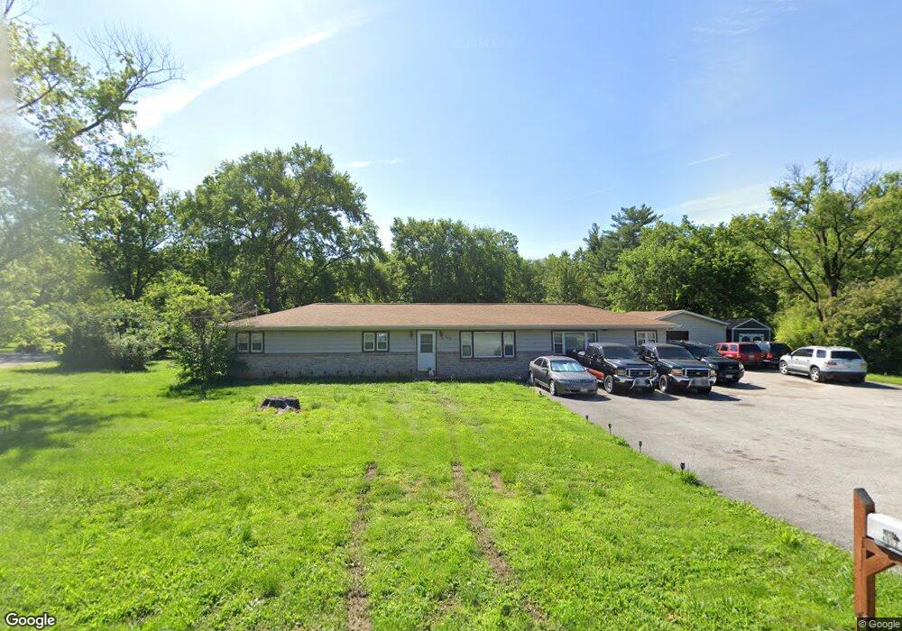
4012 Carol Park Rd House Springs, MO 63051
Estimated Value: $229,762 - $335,000
--
Bed
--
Bath
1,800
Sq Ft
$161/Sq Ft
Est. Value
About This Home
This home is located at 4012 Carol Park Rd, House Springs, MO 63051 and is currently estimated at $289,691, approximately $160 per square foot. 4012 Carol Park Rd is a home with nearby schools including Northwest High School and St. Anthony School.
Ownership History
Date
Name
Owned For
Owner Type
Purchase Details
Closed on
May 9, 2025
Sold by
Sandstedt Kenneth
Bought by
Ogle Judy
Current Estimated Value
Purchase Details
Closed on
Dec 30, 2023
Sold by
Peyton Kathy A and Peyton Jerry D
Bought by
Sandstedt Kenneth John and Sandstedt Nancy
Home Financials for this Owner
Home Financials are based on the most recent Mortgage that was taken out on this home.
Original Mortgage
$85,000
Interest Rate
7.29%
Mortgage Type
New Conventional
Create a Home Valuation Report for This Property
The Home Valuation Report is an in-depth analysis detailing your home's value as well as a comparison with similar homes in the area
Home Values in the Area
Average Home Value in this Area
Purchase History
| Date | Buyer | Sale Price | Title Company |
|---|---|---|---|
| Ogle Judy | -- | None Listed On Document | |
| Sandstedt Kenneth | -- | None Listed On Document | |
| Sandstedt Kenneth John | -- | None Listed On Document |
Source: Public Records
Mortgage History
| Date | Status | Borrower | Loan Amount |
|---|---|---|---|
| Previous Owner | Sandstedt Kenneth John | $85,000 |
Source: Public Records
Tax History Compared to Growth
Tax History
| Year | Tax Paid | Tax Assessment Tax Assessment Total Assessment is a certain percentage of the fair market value that is determined by local assessors to be the total taxable value of land and additions on the property. | Land | Improvement |
|---|---|---|---|---|
| 2025 | $1,531 | $23,300 | $2,700 | $20,600 |
| 2024 | $1,531 | $21,200 | $2,700 | $18,500 |
| 2023 | $1,531 | $21,200 | $2,700 | $18,500 |
| 2022 | $1,524 | $21,200 | $2,700 | $18,500 |
| 2021 | $1,514 | $21,200 | $2,700 | $18,500 |
| 2020 | $1,390 | $19,000 | $2,500 | $16,500 |
| 2019 | $1,389 | $19,000 | $2,500 | $16,500 |
| 2018 | $1,407 | $19,000 | $2,500 | $16,500 |
| 2017 | $1,286 | $19,000 | $2,500 | $16,500 |
| 2016 | $1,174 | $17,200 | $2,500 | $14,700 |
| 2015 | $1,206 | $17,200 | $2,500 | $14,700 |
| 2013 | -- | $16,500 | $2,300 | $14,200 |
Source: Public Records
Map
Nearby Homes
- 5899 Midridge Dr
- 6042 Carol St
- 4138 Elizabeth Dr
- 173 Cardinal Ln Unit 173
- 5919 Brookside Place
- 5916 Brookside Place
- 74 Mockingbird Hill Unit 74
- 65 Mockingbird Hill Unit 65
- 0 Manor Crest Dr Unit MIS25054810
- 6144 Misty Meadow Dr
- 0 Lots 6 Cedar Dr
- 0 Lot 40 & 41 Fernwood Unit 21026109
- 3833 Dorchester Ct
- 0 Lot 45fernwood
- 5814 Mayfair Ct
- 5975 Ridge Dr
- 5916 Roger Rd
- 0 Fernwood Cir
- 0 Fernwood Cir
- 0 Holly Place
- 6015 Alley Dr
- 4006 Carol Park Rd
- 4018 Carol Park Rd
- 4007 Carol Park Rd
- 6009 Alley Dr
- 3974 Carol Park Rd
- 6016 Circle Dr
- 4024 Carol Park Rd
- 4045 Birch St
- 6022 Circle Dr
- 4047 Birch St
- 4001 Carol Park Rd
- 4030 Carol Park Rd
- 4044 Birch St
- 3969 Carol Park Rd
- 4048 Birch St
- 6028 Circle Dr
- 6035 Circle Dr
- 4031 Carol Park Rd
- 4049 Birch St