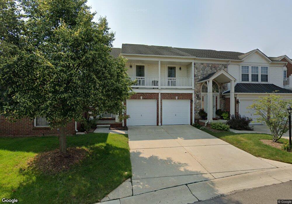
4013 Ravensfield Dr Unit Bldg-Unit Canton, MI 48188
Estimated Value: $330,000 - $362,289
--
Bed
3
Baths
2,050
Sq Ft
$172/Sq Ft
Est. Value
About This Home
This home is located at 4013 Ravensfield Dr Unit Bldg-Unit, Canton, MI 48188 and is currently estimated at $352,322, approximately $171 per square foot. 4013 Ravensfield Dr Unit Bldg-Unit is a home located in Wayne County with nearby schools including Rawsonville Elementary School, Owen Intermediate School, and McBride Middle School.
Ownership History
Date
Name
Owned For
Owner Type
Purchase Details
Closed on
Jun 19, 2025
Sold by
Hansen Hans K
Bought by
Hansen Hans K and Hans K Hansen Revocable Trust
Current Estimated Value
Purchase Details
Closed on
Feb 12, 2018
Sold by
Bar Paul
Bought by
Hansen Hans K
Purchase Details
Closed on
Aug 7, 2017
Sold by
Bar Brandy
Bought by
Bar Paul
Purchase Details
Closed on
Aug 21, 2006
Sold by
C A Kime Inc
Bought by
Bar Paul
Create a Home Valuation Report for This Property
The Home Valuation Report is an in-depth analysis detailing your home's value as well as a comparison with similar homes in the area
Home Values in the Area
Average Home Value in this Area
Purchase History
| Date | Buyer | Sale Price | Title Company |
|---|---|---|---|
| Hansen Hans K | -- | None Listed On Document | |
| Hansen Hans K | -- | None Listed On Document | |
| Hansen Hans K | $214,000 | None Available | |
| Bar Paul | -- | None Available | |
| Bar Paul | $194,365 | Fidelity National Title |
Source: Public Records
Tax History Compared to Growth
Tax History
| Year | Tax Paid | Tax Assessment Tax Assessment Total Assessment is a certain percentage of the fair market value that is determined by local assessors to be the total taxable value of land and additions on the property. | Land | Improvement |
|---|---|---|---|---|
| 2025 | $2,106 | $160,000 | $0 | $0 |
| 2024 | $2,106 | $162,800 | $0 | $0 |
| 2023 | $2,007 | $132,300 | $0 | $0 |
| 2022 | $4,847 | $126,100 | $0 | $0 |
| 2021 | $4,708 | $127,900 | $0 | $0 |
| 2020 | $4,647 | $116,300 | $0 | $0 |
| 2019 | $4,564 | $108,490 | $0 | $0 |
| 2018 | $964 | $102,230 | $0 | $0 |
| 2017 | $3,275 | $100,500 | $0 | $0 |
| 2016 | $2,569 | $101,100 | $0 | $0 |
| 2015 | $6,110 | $90,370 | $0 | $0 |
| 2013 | $5,919 | $61,940 | $0 | $0 |
Source: Public Records
Map
Nearby Homes
- 3913 Ravensfield Dr
- 4160 Wrenwood Ln Unit 29
- 48522 Bridge Way Unit 565
- 48516 Bridge Way Unit 564
- 48510 Bridge Way Unit 563
- 48504 Bridge Way Unit 562
- 48492 Bridge Way Unit 559
- 48486 Bridge Way Unit 560
- 48480 Bridge Way Unit 570
- 48474 Bridge Way Unit 569
- Abbeyville Plan at Grandview Estates
- Bayport Plan at Grandview Estates
- Bedrock Plan at Grandview Estates
- 4191 Cornerstone Dr Unit 200
- 3956 Cornerstone Dr Unit 568
- 48526 Eastbridge Dr
- 3932 Cornerstone Dr Unit 567
- 3928 Cornerstone Dr Unit 566
- 4035 Cornerstone Dr Unit 176
- 4029 Cornerstone Dr Unit 177
- 4013 Ravensfield Dr
- 49006 Hawksburry Rd Unit 116
- 49097 Hawksburry Rd Unit 30
- 49083 Hawksburry Rd Unit 28
- 4004 Ravensfield Dr Unit 126
- 4034 Ravensfield Dr Unit 124
- 49054 Hawksburry Rd Unit 113
- 49036 Hawksburry Rd Unit 1115
- 49036 Hawksburry Rd Unit 115
- 3913 Ravensfield Dr Unit 7
- 3894 Ravensfield Dr Unit Bldg-Unit
- 3933 Ravensfield Dr Unit Bldg-Unit
- 3883 Ravensfield Dr
- 4071 Wrenwood Ln Unit 121
- 4033 Ravensfield Dr Unit 119
- 4205 Wrenwood Ln
- 4195 Wrenwood Ln
- 4185 Wrenwood Ln
- 4175 Wrenwood Ln
- 4165 Wrenwood Ln