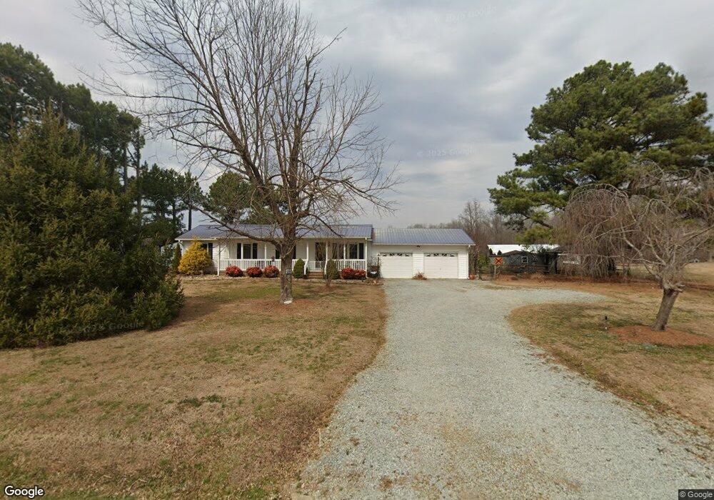
4015 Dennys Store Rd Roxboro, NC 27574
Estimated Value: $246,000 - $278,257
3
Beds
2
Baths
1,578
Sq Ft
$166/Sq Ft
Est. Value
About This Home
This home is located at 4015 Dennys Store Rd, Roxboro, NC 27574 and is currently estimated at $261,314, approximately $165 per square foot. 4015 Dennys Store Rd is a home located in Person County with nearby schools including Person High School.
Ownership History
Date
Name
Owned For
Owner Type
Purchase Details
Closed on
May 8, 2018
Sold by
Duncan Keith H and Duncan Donna K
Bought by
Duncan Keith H and Duncan Donna K
Current Estimated Value
Home Financials for this Owner
Home Financials are based on the most recent Mortgage that was taken out on this home.
Original Mortgage
$147,000
Outstanding Balance
$115,008
Interest Rate
4.4%
Mortgage Type
New Conventional
Estimated Equity
$146,306
Purchase Details
Closed on
Aug 9, 2010
Sold by
Welch Donna S
Bought by
Duncan Keith H
Home Financials for this Owner
Home Financials are based on the most recent Mortgage that was taken out on this home.
Original Mortgage
$152,000
Interest Rate
4%
Mortgage Type
Construction
Create a Home Valuation Report for This Property
The Home Valuation Report is an in-depth analysis detailing your home's value as well as a comparison with similar homes in the area
Home Values in the Area
Average Home Value in this Area
Purchase History
| Date | Buyer | Sale Price | Title Company |
|---|---|---|---|
| Duncan Keith H | -- | Fidelity National Title | |
| Duncan Keith H | -- | -- |
Source: Public Records
Mortgage History
| Date | Status | Borrower | Loan Amount |
|---|---|---|---|
| Open | Duncan Keith H | $147,000 | |
| Closed | Duncan Keith H | $152,000 |
Source: Public Records
Tax History Compared to Growth
Tax History
| Year | Tax Paid | Tax Assessment Tax Assessment Total Assessment is a certain percentage of the fair market value that is determined by local assessors to be the total taxable value of land and additions on the property. | Land | Improvement |
|---|---|---|---|---|
| 2025 | $1,663 | $240,624 | $0 | $0 |
| 2024 | $1,343 | $172,288 | $0 | $0 |
| 2023 | $1,344 | $172,288 | $0 | $0 |
| 2022 | $1,340 | $172,288 | $0 | $0 |
| 2021 | $1,294 | $172,288 | $0 | $0 |
| 2020 | $1,059 | $140,934 | $0 | $0 |
| 2019 | $1,074 | $140,934 | $0 | $0 |
| 2018 | $956 | $133,865 | $0 | $0 |
| 2017 | $943 | $133,865 | $0 | $0 |
| 2016 | $943 | $133,865 | $0 | $0 |
| 2015 | $943 | $133,865 | $0 | $0 |
| 2014 | $1,020 | $133,865 | $0 | $0 |
Source: Public Records
Map
Nearby Homes
- 6708 Old Roxboro Rd
- 6688 Goshen Rd
- 1806 Polk Huff Rd
- 1 McCoy Jeffers Dr
- 1002 Dennys Store Rd
- 652 Hazel Lawson Rd
- 204 Deep Woods Trail
- 0 Old Roxboro Rd Unit 10027603
- 670 Tingen Mine Rd
- 00 Pulliam-Tingen Mine Rd
- 1387 Saint Paul Church Rd
- 1060 Saint Paul Church Rd
- 153 Ninovan Place
- 2201 Mollie Mooney Rd
- 316 Acorn Ct
- 1469 Mollie Mooney Rd
- 1923 Lawson Chapel Church Rd
- 0 Noel Tuck Rd
- 6079 Zachary Ln
- 2081 Peed Rd
- 4091 Dennys Store Rd
- 3926 Dennys Store Rd
- 3882 Dennys Store Rd
- 100 Bunnie Huff Rd
- 4181 Denny Store Rd
- 3102 Lonnie Gentry Rd
- 4205 Denny Store Rd
- 3715 Dennys Store Rd
- 3650 Dennys Store Rd
- 2877 Lonnie Gentry Rd
- 3625 Dennys Store Rd
- 122 Bunnie Huff Rd
- 002 Dennys Store Rd
- 0 Dennys Store Rd
- 0 Dennys Store Rd
- 4588 Dennys Store Rd
- 4610 Denny Store Rd
- 2772 Lonnie Gentry Rd
- 515 Bunnie Huff Rd
- 124 Bunnie Huff Rd