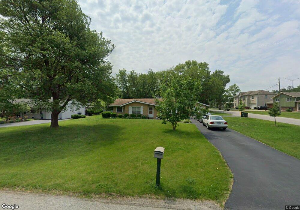
4015 Emerson Ave Rolling Meadows, IL 60008
Estimated Value: $292,000 - $325,680
3
Beds
1
Bath
1,079
Sq Ft
$288/Sq Ft
Est. Value
About This Home
This home is located at 4015 Emerson Ave, Rolling Meadows, IL 60008 and is currently estimated at $310,920, approximately $288 per square foot. 4015 Emerson Ave is a home located in Cook County with nearby schools including Kimball Hill Elementary School, Carl Sandburg Junior High School, and Rolling Meadows High School.
Ownership History
Date
Name
Owned For
Owner Type
Purchase Details
Closed on
Jun 27, 2002
Sold by
Mcarthur James and Mcarthur Teresa
Bought by
Trejo Emilio
Current Estimated Value
Home Financials for this Owner
Home Financials are based on the most recent Mortgage that was taken out on this home.
Original Mortgage
$136,000
Outstanding Balance
$55,731
Interest Rate
6.79%
Estimated Equity
$255,189
Purchase Details
Closed on
May 1, 1997
Sold by
Braun Kenneth M and Braun Patricia L
Bought by
Mcarthur James and Mcarthur Teresa
Home Financials for this Owner
Home Financials are based on the most recent Mortgage that was taken out on this home.
Original Mortgage
$104,000
Interest Rate
11.2%
Create a Home Valuation Report for This Property
The Home Valuation Report is an in-depth analysis detailing your home's value as well as a comparison with similar homes in the area
Home Values in the Area
Average Home Value in this Area
Purchase History
| Date | Buyer | Sale Price | Title Company |
|---|---|---|---|
| Trejo Emilio | $186,000 | -- | |
| Mcarthur James | $130,000 | -- |
Source: Public Records
Mortgage History
| Date | Status | Borrower | Loan Amount |
|---|---|---|---|
| Open | Trejo Emilio | $136,000 | |
| Previous Owner | Mcarthur James | $104,000 |
Source: Public Records
Tax History
| Year | Tax Paid | Tax Assessment Tax Assessment Total Assessment is a certain percentage of the fair market value that is determined by local assessors to be the total taxable value of land and additions on the property. | Land | Improvement |
|---|---|---|---|---|
| 2025 | $5,696 | $27,000 | $8,485 | $18,515 |
| 2024 | $5,696 | $21,639 | $7,180 | $14,459 |
| 2023 | $5,481 | $21,639 | $7,180 | $14,459 |
| 2022 | $5,481 | $21,639 | $7,180 | $14,459 |
| 2021 | $4,758 | $17,179 | $4,242 | $12,937 |
| 2020 | $5,536 | $19,615 | $4,242 | $15,373 |
| 2019 | $5,579 | $21,917 | $4,242 | $17,675 |
| 2018 | $5,539 | $19,854 | $3,916 | $15,938 |
| 2017 | $5,446 | $19,854 | $3,916 | $15,938 |
| 2016 | $5,351 | $19,854 | $3,916 | $15,938 |
| 2015 | $5,757 | $20,120 | $3,589 | $16,531 |
| 2014 | $5,653 | $20,120 | $3,589 | $16,531 |
| 2013 | $5,496 | $20,120 | $3,589 | $16,531 |
Source: Public Records
Map
Nearby Homes
- 2401 Rohlwing Rd
- 2600 Brookwood Way Dr Unit 316
- 2600 Brookwood Way Dr Unit 305
- 2650 Brookwood Way Dr Unit 313
- 2650 Brookwood Way Dr Unit 108
- 304 E Tall Trees Ln
- 2 Croydon on Duxbury
- 4406 Euclid Ave Unit 2C
- 3 Holyoke on Auburn
- 2 Stuart on Oxford
- 1 Harrogate on Oxford
- 3345 Kirchoff Rd Unit 5C
- 3000 California Ave
- 3265 Kirchoff Rd Unit 116
- 4704 Euclid Ave Unit 1B
- 4704 Euclid Ave Unit 47042D
- 3135 Town Square Dr Unit 401
- 3100 Town Square Dr Unit 308
- 3100 Town Square Dr Unit 204
- 2705 Park St
- 3975 Emerson Ave
- 2457 Ashland Ave
- 2456 Ashland Ave
- 3951 Emerson Ave
- 2455 Forest Ave
- 2400 Ashland Ave
- 2458 Ashland Ave
- 4010 Emerson Ave
- 2459 Ashland Ave
- 2431 Forest Ave
- 3891 Emerson Ave
- 2459 Forest Ave
- 2391 Forest Ave
- 2350 Ashland Ave
- 2400 Forest Ave
- 2454 Forest Ave
- 3845 Emerson Ave
- 2345 Ashland Ave
- 2461 Forest Ave
- 3840 Emerson Ave
Your Personal Tour Guide
Ask me questions while you tour the home.