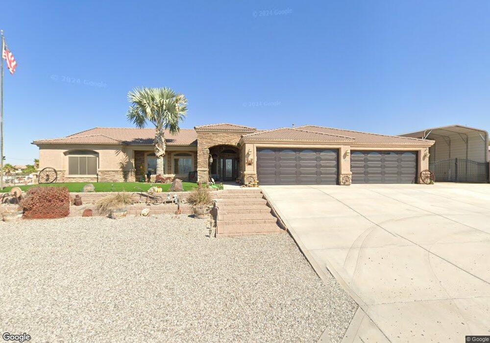
4015 Little Finger Rd Lake Havasu City, AZ 86406
Estimated Value: $953,000 - $1,056,000
4
Beds
3
Baths
5,675
Sq Ft
$178/Sq Ft
Est. Value
About This Home
This home is located at 4015 Little Finger Rd, Lake Havasu City, AZ 86406 and is currently estimated at $1,011,648, approximately $178 per square foot. 4015 Little Finger Rd is a home located in Mohave County with nearby schools including Jamaica Elementary School, Thunderbolt Middle School, and Lake Havasu High School.
Ownership History
Date
Name
Owned For
Owner Type
Purchase Details
Closed on
Aug 2, 2006
Sold by
Underwood Chad L
Bought by
Underwood Donald E and Underwood Susan K
Current Estimated Value
Home Financials for this Owner
Home Financials are based on the most recent Mortgage that was taken out on this home.
Original Mortgage
$319,890
Outstanding Balance
$191,062
Interest Rate
6.76%
Mortgage Type
Construction
Estimated Equity
$820,586
Purchase Details
Closed on
Feb 6, 2004
Sold by
Hay Nora D
Bought by
Underwood Donald E and Underwood Susan K
Home Financials for this Owner
Home Financials are based on the most recent Mortgage that was taken out on this home.
Original Mortgage
$50,000
Interest Rate
5.57%
Mortgage Type
Seller Take Back
Create a Home Valuation Report for This Property
The Home Valuation Report is an in-depth analysis detailing your home's value as well as a comparison with similar homes in the area
Home Values in the Area
Average Home Value in this Area
Purchase History
| Date | Buyer | Sale Price | Title Company |
|---|---|---|---|
| Underwood Donald E | -- | Capital Title Agency Inc | |
| Underwood Donald E | -- | Transnation Title Ins Co |
Source: Public Records
Mortgage History
| Date | Status | Borrower | Loan Amount |
|---|---|---|---|
| Open | Underwood Donald E | $319,890 | |
| Previous Owner | Underwood Donald E | $50,000 |
Source: Public Records
Tax History Compared to Growth
Tax History
| Year | Tax Paid | Tax Assessment Tax Assessment Total Assessment is a certain percentage of the fair market value that is determined by local assessors to be the total taxable value of land and additions on the property. | Land | Improvement |
|---|---|---|---|---|
| 2026 | -- | -- | -- | -- |
| 2025 | $3,637 | $84,614 | $0 | $0 |
| 2024 | $3,637 | $92,088 | $0 | $0 |
| 2023 | $3,637 | $80,523 | $0 | $0 |
| 2022 | $3,457 | $67,988 | $0 | $0 |
| 2021 | $3,573 | $60,368 | $0 | $0 |
| 2019 | $3,361 | $54,686 | $0 | $0 |
| 2018 | $3,219 | $45,725 | $0 | $0 |
| 2017 | $3,189 | $44,682 | $0 | $0 |
| 2016 | $2,776 | $38,889 | $0 | $0 |
| 2015 | $3,076 | $45,689 | $0 | $0 |
Source: Public Records
Map
Nearby Homes
- 990 Mcculloch Blvd S
- 711 Mcculloch Blvd S
- 3860 Mcculloch Place
- 3891 Sweetgrass Dr
- 4061 Lakeview Rd
- 1099 Pueblo Dr
- 3920 Doeskin Ln
- 4136 Carlsbad Dr Unit 19
- 4097 Columbia Dr
- 4160 Carlsbad Dr
- 1310 Pueblo Dr
- 1357 Mcculloch Blvd S
- 4110 Columbia Dr
- 3841 Big Horn Dr
- 3921 Hungry Horse Dr
- 931 Pueblo Dr
- 3745 Totem Dr
- 4199 Highlander Ave
- 4241 Highlander Ave
- 843 Mcculloch Blvd S
- 4014 Blue Canyon Rd
- 4012 E Blue Canyon Rd
- 4012 E Blue Canyon Rd
- 4009 Little Finger Rd
- 4009B Little Finger Rd
- 4012 Blue Canyon
- 3995 Trotwood Dr
- 3989 Trotwood Dr
- 3995 Trotwood Dr
- 3999 Trotwood Dr
- 4010 Blue Canyon Rd
- 3981 Trotwood Dr
- 3973 Trotwood Dr
- 4001 Trotwood Dr
- 3965 Trotwood Dr
- 3965 Trotwood Dr
- 4009 Trotwood Dr
- 4020 Blue Canyon Rd
- 4008 Blue Canyon
- 4007 Little Finger Rd