Estimated Value: $193,056 - $352,000
4
Beds
2
Baths
2,897
Sq Ft
$94/Sq Ft
Est. Value
About This Home
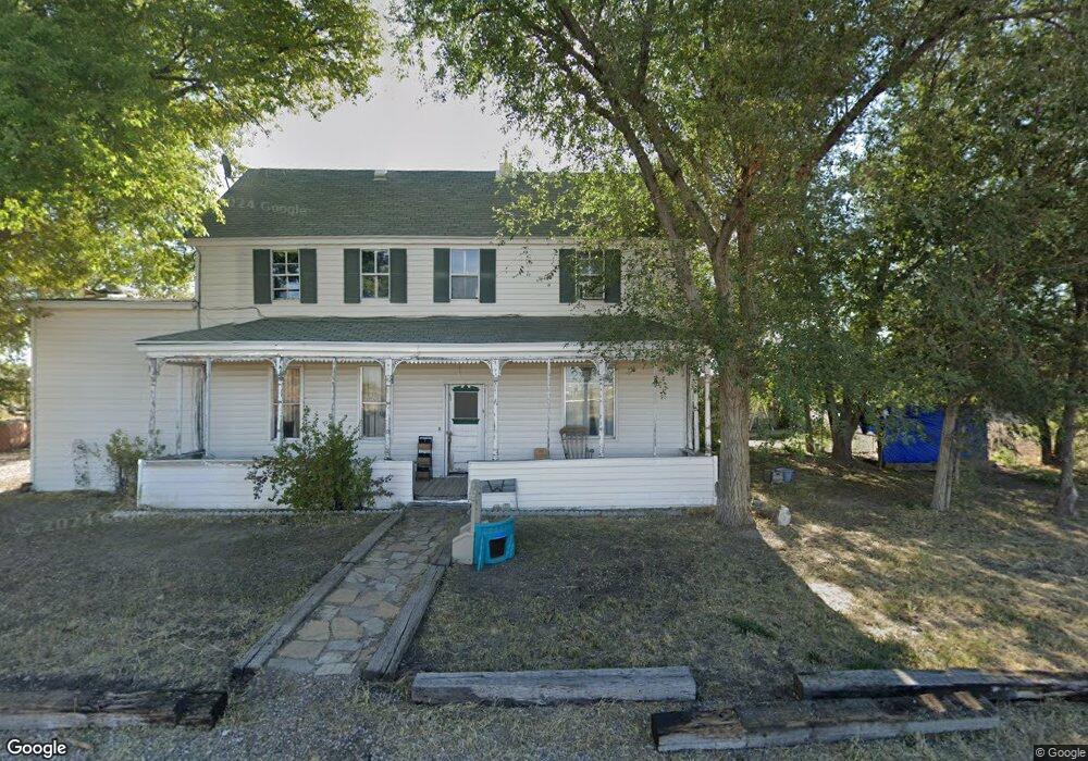
This home is located at 4015 S 2750 W, Oasis, UT 84624 and is currently estimated at $272,528, approximately $94 per square foot. 4015 S 2750 W is a home located in Millard County.
Ownership History
Date
Name
Owned For
Owner Type
Purchase Details
Closed on
Aug 18, 2008
Sold by
Lewis Jennifer M
Bought by
White Jerill
Current Estimated Value
Home Financials for this Owner
Home Financials are based on the most recent Mortgage that was taken out on this home.
Original Mortgage
$126,627
Outstanding Balance
$82,515
Interest Rate
6.27%
Mortgage Type
FHA
Estimated Equity
$190,013
Purchase Details
Closed on
Nov 21, 2007
Sold by
Klein Jennifer M and Lewis Jennifer M
Bought by
Lewis Jennifer M
Home Financials for this Owner
Home Financials are based on the most recent Mortgage that was taken out on this home.
Original Mortgage
$95,000
Interest Rate
6.3%
Mortgage Type
Purchase Money Mortgage
Purchase Details
Closed on
Nov 7, 2006
Sold by
Wells Fargo Bank Na
Bought by
Klein Jennifer M
Home Financials for this Owner
Home Financials are based on the most recent Mortgage that was taken out on this home.
Original Mortgage
$15,700
Interest Rate
6.38%
Mortgage Type
Purchase Money Mortgage
Create a Home Valuation Report for This Property
The Home Valuation Report is an in-depth analysis detailing your home's value as well as a comparison with similar homes in the area
Home Values in the Area
Average Home Value in this Area
Purchase History
| Date | Buyer | Sale Price | Title Company |
|---|---|---|---|
| White Jerill | -- | -- | |
| Lewis Jennifer M | -- | -- | |
| Klein Jennifer M | -- | -- |
Source: Public Records
Mortgage History
| Date | Status | Borrower | Loan Amount |
|---|---|---|---|
| Open | White Jerill | $126,627 | |
| Previous Owner | Lewis Jennifer M | $95,000 | |
| Previous Owner | Klein Jennifer M | $15,700 |
Source: Public Records
Tax History Compared to Growth
Tax History
| Year | Tax Paid | Tax Assessment Tax Assessment Total Assessment is a certain percentage of the fair market value that is determined by local assessors to be the total taxable value of land and additions on the property. | Land | Improvement |
|---|---|---|---|---|
| 2025 | $1,285 | $158,204 | $16,500 | $141,704 |
| 2024 | $1,285 | $9,750 | $9,750 | $0 |
| 2023 | $100 | $9,750 | $9,750 | $0 |
| 2022 | $249 | $22,000 | $22,000 | $0 |
| 2021 | $258 | $22,000 | $22,000 | $0 |
| 2020 | $257 | $22,000 | $22,000 | $0 |
| 2019 | $254 | $22,000 | $22,000 | $0 |
| 2018 | $248 | $22,000 | $22,000 | $0 |
| 2017 | $73 | $6,000 | $6,000 | $0 |
| 2016 | $70 | $6,000 | $6,000 | $0 |
| 2015 | $70 | $6,000 | $6,000 | $0 |
| 2014 | -- | $6,000 | $6,000 | $0 |
| 2013 | -- | $6,000 | $6,000 | $0 |
Source: Public Records
Map
Nearby Homes
- 470 S 2750 W Unit 6
- 460 S 2750 W Unit 7
- 490 S 2750 W Unit 5
- 465 S 2750 W Unit 4
- 6177 S 3000 Rd W
- 6500 S 3000 West Rd
- 0 Tbd 3000 Rd S Unit LotWP001
- 3885 W 4500 S
- 3770 S 4000 Rd W
- 3480 S 4000 W
- 17000 W 2500 Rd S
- 16700 W 2500 South Rd
- 16800 W 2500 South Rd
- 6500 W 2000 S
- 8000 S Highway 257
- 168 N 100 Rd W
- 289 W Center St S
- 1040 W Center St
- 700 Acres
- 1500 S 10000 W