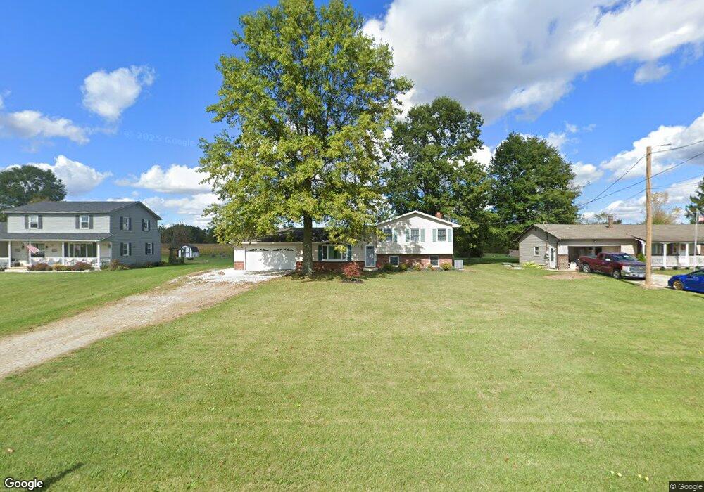
40162 Biggs Rd Lagrange, OH 44050
Estimated Value: $241,000 - $321,000
4
Beds
3
Baths
1,620
Sq Ft
$177/Sq Ft
Est. Value
About This Home
This home is located at 40162 Biggs Rd, Lagrange, OH 44050 and is currently estimated at $287,110, approximately $177 per square foot. 40162 Biggs Rd is a home located in Lorain County with nearby schools including Keystone Elementary School, Keystone Middle School, and Keystone High School.
Ownership History
Date
Name
Owned For
Owner Type
Purchase Details
Closed on
Sep 15, 2017
Sold by
Bledasoe Charles D
Bought by
Baliko Matthew S
Current Estimated Value
Home Financials for this Owner
Home Financials are based on the most recent Mortgage that was taken out on this home.
Original Mortgage
$161,000
Outstanding Balance
$134,555
Interest Rate
3.93%
Mortgage Type
New Conventional
Estimated Equity
$152,555
Create a Home Valuation Report for This Property
The Home Valuation Report is an in-depth analysis detailing your home's value as well as a comparison with similar homes in the area
Home Values in the Area
Average Home Value in this Area
Purchase History
| Date | Buyer | Sale Price | Title Company |
|---|---|---|---|
| Baliko Matthew S | $171,000 | Old Republic National Title |
Source: Public Records
Mortgage History
| Date | Status | Borrower | Loan Amount |
|---|---|---|---|
| Open | Baliko Matthew S | $161,000 |
Source: Public Records
Tax History
| Year | Tax Paid | Tax Assessment Tax Assessment Total Assessment is a certain percentage of the fair market value that is determined by local assessors to be the total taxable value of land and additions on the property. | Land | Improvement |
|---|---|---|---|---|
| 2024 | $3,093 | $75,250 | $12,936 | $62,314 |
| 2023 | $2,550 | $51,790 | $12,422 | $39,368 |
| 2022 | $2,531 | $51,790 | $12,422 | $39,368 |
| 2021 | $2,531 | $51,790 | $12,420 | $39,370 |
| 2020 | $2,240 | $40,810 | $9,790 | $31,020 |
| 2019 | $2,225 | $40,810 | $9,790 | $31,020 |
| 2018 | $2,206 | $40,810 | $9,790 | $31,020 |
| 2017 | $2,241 | $39,510 | $10,380 | $29,130 |
| 2016 | $2,224 | $39,510 | $10,380 | $29,130 |
| 2015 | $2,220 | $39,510 | $10,380 | $29,130 |
| 2014 | $1,824 | $37,270 | $9,790 | $27,480 |
| 2013 | $1,767 | $37,270 | $9,790 | $27,480 |
Source: Public Records
Map
Nearby Homes
- 801 Willich Ct
- 800 Buckingham Dr
- 808 Buckingham Dr
- 829 Robinson Dr
- 340 Granger Dr
- 548 William St
- 516 Appomattox Ct
- 567 Vicksburg Ct
- 0 Dill Ct Unit 5072837
- 317 Church St
- 305 W Main St
- 110 Railroad St
- 40175 Banks Rd
- 40260 Whitney Rd
- 40163 Banks Rd
- 1033 Parsons Rd Unit 11
- 697 Main St
- 551 N Main St
- 779 Huron St
- 1207 Fox Run
- 40182 Biggs Rd
- 40140 Biggs Rd
- 40202 Biggs Rd
- 40100 Biggs Rd
- 40222 Biggs Rd
- 40242 Biggs Rd
- 40262 Biggs Rd
- 40282 Biggs Rd
- 15974 Wheeler Rd
- 40302 Biggs Rd
- 641 U s Grant St
- 637 U s Grant St
- 637 U s Grant St Unit Lot 1
- 15922 Wheeler Rd
- 633 U s Grant St
- 633 U s Grant St Unit Lot 1
- 629 Us Grant St
- 40322 Biggs Rd
- 645 U s Grant St
- 0 Wheeler Rd
Your Personal Tour Guide
Ask me questions while you tour the home.