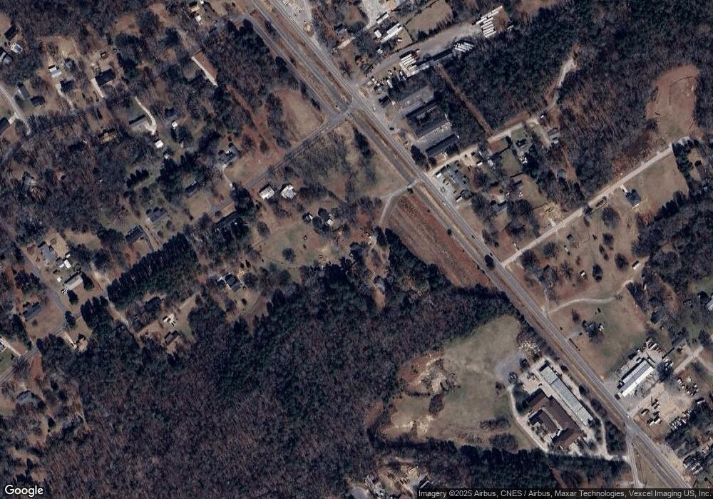
4017 Adkins Ridge Rd Rock Hill, SC 29730
Estimated Value: $121,000 - $221,000
--
Bed
--
Bath
1,032
Sq Ft
$178/Sq Ft
Est. Value
About This Home
This home is located at 4017 Adkins Ridge Rd, Rock Hill, SC 29730 and is currently estimated at $183,981, approximately $178 per square foot. 4017 Adkins Ridge Rd is a home located in York County with nearby schools including Independence Elementary School, Castle Heights Middle School, and Rock Hill High School.
Ownership History
Date
Name
Owned For
Owner Type
Purchase Details
Closed on
Sep 21, 2022
Sold by
Pamela Calhoun
Bought by
Postlewait Leonard
Current Estimated Value
Purchase Details
Closed on
Mar 9, 2022
Sold by
Edward Adkins Donald
Bought by
Calhoun Pamela and Postlewait Leonard
Purchase Details
Closed on
Jun 6, 2018
Sold by
Calhoun Pam and Postlewait Leonard
Bought by
Adkins Donald E
Purchase Details
Closed on
May 21, 2018
Sold by
Estate Of Lois Jane Adkins
Bought by
Adkins Donald E and Calhoun Pam
Create a Home Valuation Report for This Property
The Home Valuation Report is an in-depth analysis detailing your home's value as well as a comparison with similar homes in the area
Home Values in the Area
Average Home Value in this Area
Purchase History
| Date | Buyer | Sale Price | Title Company |
|---|---|---|---|
| Postlewait Leonard | -- | -- | |
| Calhoun Pamela | -- | None Listed On Document | |
| Adkins Donald E | -- | None Available | |
| Adkins Donald E | -- | None Available |
Source: Public Records
Tax History Compared to Growth
Tax History
| Year | Tax Paid | Tax Assessment Tax Assessment Total Assessment is a certain percentage of the fair market value that is determined by local assessors to be the total taxable value of land and additions on the property. | Land | Improvement |
|---|---|---|---|---|
| 2024 | $798 | $5,685 | $1,120 | $4,565 |
| 2023 | $818 | $5,685 | $1,120 | $4,565 |
| 2022 | $226 | $3,566 | $752 | $2,814 |
| 2021 | $0 | $3,566 | $752 | $2,814 |
| 2020 | $225 | $3,566 | $0 | $0 |
| 2019 | $166 | $3,100 | $0 | $0 |
| 2018 | $165 | $3,100 | $0 | $0 |
| 2017 | $155 | $3,100 | $0 | $0 |
| 2016 | $151 | $3,100 | $0 | $0 |
| 2014 | $50 | $3,100 | $560 | $2,540 |
| 2013 | $50 | $2,400 | $560 | $1,840 |
Source: Public Records
Map
Nearby Homes
- 161 Billy Claude Cir
- 141 Edenvale Rd
- 1580 Anderson Rd S
- 281 Schoolside Dr
- 2510 Firetower Rd
- 172 Neely Store Rd
- 2488 Catawba Church Rd
- 508 Bridgestone Ln
- 3339 Lesslie Hwy Unit 2
- 631 Anderson Rd S
- 611 Pondway Downs
- 623 Neelys Creek Rd
- 1903 Manning Place
- 356 Emma Wood Ln
- 1034 Neely Store Rd
- 2999 Starnes Dr
- 739 Springdale Rd
- 1104 Neely Store Rd
- Tract 4 Porter Rd
- Tract A Porter Rd
- 161 Billy Claude Cir
- 4023 Adkins Ridge Rd
- 127 Edenvale Rd
- 4035 Adkins Ridge Rd
- 2869 Lesslie Hwy
- 2867 Lesslie Hwy
- 111 Branham Rd Unit 6
- 111 Branham Rd Unit 5
- 111 Branham Rd Unit 3
- 111 Branham Rd Unit 2
- 111 Branham Rd Unit 1
- 2881 Lesslie Hwy
- 140 Edenvale Rd
- 2823 Lesslie Hwy
- 154 Edenvale Rd
- 2807 Lesslie Hwy
- 140 Mitchum Rd
- 164 Edenvale Rd
- 164 Edenvale Rd
- 4047 Adkins Ridge Rd
