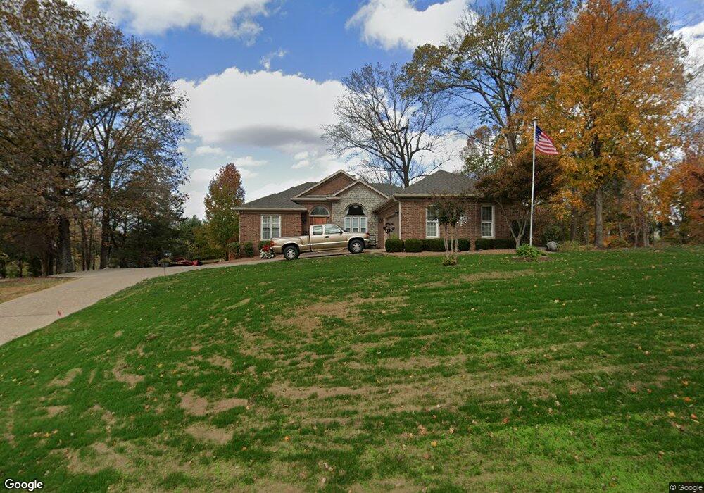
4017 Maple Hurst Dr Crestwood, KY 40014
Estimated Value: $495,000 - $642,000
4
Beds
4
Baths
3,015
Sq Ft
$187/Sq Ft
Est. Value
About This Home
This home is located at 4017 Maple Hurst Dr, Crestwood, KY 40014 and is currently estimated at $562,526, approximately $186 per square foot. 4017 Maple Hurst Dr is a home located in Oldham County with nearby schools including Camden Station Elementary School, South Oldham Middle School, and South Oldham High School.
Ownership History
Date
Name
Owned For
Owner Type
Purchase Details
Closed on
Dec 21, 2022
Sold by
Mathews William Michael and Mathews Linda B
Bought by
Young Ralph Lee and Young Marsha Jones
Current Estimated Value
Home Financials for this Owner
Home Financials are based on the most recent Mortgage that was taken out on this home.
Original Mortgage
$375,000
Outstanding Balance
$363,027
Interest Rate
6.61%
Mortgage Type
New Conventional
Estimated Equity
$199,499
Purchase Details
Closed on
Feb 22, 2007
Sold by
Mathews William Michael and Mathews Michael
Bought by
Mathews William Michael and Mathews Linda B
Home Financials for this Owner
Home Financials are based on the most recent Mortgage that was taken out on this home.
Original Mortgage
$155,000
Interest Rate
6.19%
Mortgage Type
New Conventional
Create a Home Valuation Report for This Property
The Home Valuation Report is an in-depth analysis detailing your home's value as well as a comparison with similar homes in the area
Home Values in the Area
Average Home Value in this Area
Purchase History
| Date | Buyer | Sale Price | Title Company |
|---|---|---|---|
| Young Ralph Lee | $500,000 | Bluegrass Land Title | |
| Mathews William Michael | -- | None Available | |
| Mathews William Michael | $347,500 | None Available |
Source: Public Records
Mortgage History
| Date | Status | Borrower | Loan Amount |
|---|---|---|---|
| Open | Young Ralph Lee | $375,000 | |
| Previous Owner | Mathews William Michael | $155,000 | |
| Previous Owner | Mathews William Michael | $113,000 |
Source: Public Records
Tax History Compared to Growth
Tax History
| Year | Tax Paid | Tax Assessment Tax Assessment Total Assessment is a certain percentage of the fair market value that is determined by local assessors to be the total taxable value of land and additions on the property. | Land | Improvement |
|---|---|---|---|---|
| 2024 | $6,222 | $500,000 | $70,000 | $430,000 |
| 2023 | $6,252 | $500,000 | $70,000 | $430,000 |
| 2022 | $4,483 | $360,000 | $60,000 | $300,000 |
| 2021 | $4,291 | $347,500 | $60,000 | $287,500 |
| 2020 | $4,301 | $347,500 | $60,000 | $287,500 |
| 2019 | $4,254 | $347,500 | $60,000 | $287,500 |
| 2018 | $4,256 | $347,500 | $0 | $0 |
| 2017 | $4,226 | $347,500 | $0 | $0 |
| 2013 | $3,782 | $347,500 | $60,000 | $287,500 |
Source: Public Records
Map
Nearby Homes
- 4700 Edds Ct
- 4610 Glenarm Rd
- 4612 Glenarm Rd
- 5208 Manor Dr
- 6205 Pebble Ct
- 6125 Park Rd
- 6401 Shelton Cir Unit 309
- 5901 Landers Ave Unit 311
- 6501 Matalin Place Unit 310
- 6500 Matalin Place Unit 310
- 5107 Clare Cove
- 5101 Clare Cove
- 7691 Celebration Way
- 6609 Clore Lake Rd
- 6611 Clore Lake Rd
- 7643 Celebration Way
- 6715 Hypoint Ridge Rd
- 6714 Hypoint Ridge Rd
- 6712 Hypoint Ridge Rd
- 7000 Walton Way
- 4015 Maple Hurst Dr
- 4019 Maple Hurst Dr
- 4016 Maple Hurst Dr
- 4810 Glenarm Rd
- 4013 Maple Hurst Dr
- 4812 Glenarm Rd
- 4012 Maple Hurst Dr
- 4808 Glenarm Rd
- 6003 Glen Maple Ct
- 6004 Glen Maple Ct
- 4010 Maple Hurst Dr
- 6001 Glen Maple Ct
- 4007 Maple Hurst Dr
- 4008 Maple Hurst Dr
- 4815 Glenarm Rd
- 6002 Glen Maple Ct
- 4005 Maple Hurst Dr
- 5921 Greensward Place
- 4006 Maple Hurst Dr
- 6000 Glen Maple Ct