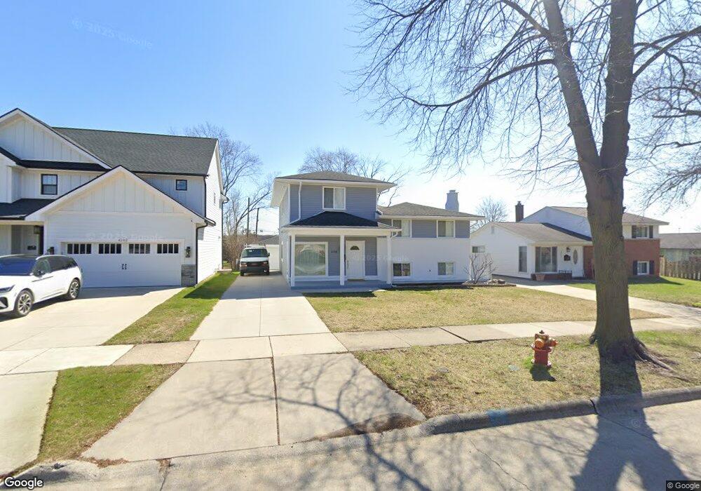
4018 Devon Rd Royal Oak, MI 48073
Estimated Value: $325,000 - $560,000
5
Beds
4
Baths
1,900
Sq Ft
$231/Sq Ft
Est. Value
About This Home
This home is located at 4018 Devon Rd, Royal Oak, MI 48073 and is currently estimated at $438,652, approximately $230 per square foot. 4018 Devon Rd is a home located in Oakland County with nearby schools including Alfred E. Upton Elementary School, Royal Oak Middle School, and Royal Oak High School.
Ownership History
Date
Name
Owned For
Owner Type
Purchase Details
Closed on
Apr 12, 2013
Sold by
Laho Besnik and Laho Etleva
Bought by
Laho Besnik and Laho Xhafer
Current Estimated Value
Home Financials for this Owner
Home Financials are based on the most recent Mortgage that was taken out on this home.
Original Mortgage
$65,000
Interest Rate
3.39%
Mortgage Type
New Conventional
Purchase Details
Closed on
Jan 23, 2009
Sold by
Laho Xhiafer
Bought by
Laho
Purchase Details
Closed on
Feb 24, 2003
Sold by
Bardha Ekrem and Bardha Lumteri
Bought by
Laho Xhafer
Purchase Details
Closed on
Feb 28, 2002
Sold by
Devito C
Bought by
Laho Xhafer
Home Financials for this Owner
Home Financials are based on the most recent Mortgage that was taken out on this home.
Original Mortgage
$141,085
Interest Rate
7.18%
Create a Home Valuation Report for This Property
The Home Valuation Report is an in-depth analysis detailing your home's value as well as a comparison with similar homes in the area
Home Values in the Area
Average Home Value in this Area
Purchase History
| Date | Buyer | Sale Price | Title Company |
|---|---|---|---|
| Laho Besnik | -- | First American Title Ins Co | |
| Laho | -- | None Available | |
| Laho Xhafer | -- | -- | |
| Laho Xhafer | -- | -- | |
| Laho Xhafer | $179,000 | -- |
Source: Public Records
Mortgage History
| Date | Status | Borrower | Loan Amount |
|---|---|---|---|
| Closed | Laho Besnik | $65,000 | |
| Previous Owner | Laho Xhafer | $141,085 |
Source: Public Records
Tax History
| Year | Tax Paid | Tax Assessment Tax Assessment Total Assessment is a certain percentage of the fair market value that is determined by local assessors to be the total taxable value of land and additions on the property. | Land | Improvement |
|---|---|---|---|---|
| 2025 | $5,441 | $181,350 | $0 | $0 |
| 2024 | $4,142 | $168,710 | $0 | $0 |
| 2022 | $4,894 | $153,950 | $0 | $0 |
| 2020 | $4,025 | $147,230 | $0 | $0 |
| 2018 | $4,894 | $132,590 | $0 | $0 |
| 2017 | $6,483 | $132,590 | $0 | $0 |
| 2015 | -- | $124,560 | $0 | $0 |
| 2014 | -- | $111,490 | $0 | $0 |
| 2011 | -- | $109,530 | $0 | $0 |
Source: Public Records
Map
Nearby Homes
- 4101 Devon Rd
- 4227 Crooks Rd
- 1723 Cresthill Ave
- 3915 Devon Rd
- 1512 Normandy Rd Unit 105
- 2129 Normandy Rd
- 4345 Crooks Rd Unit 36
- 3919 Woodland Ave
- 4401 Crooks Rd
- 3403 Crooks Rd Unit 10
- 3535 Woodland Ave
- 3804 Elmhurst Ave
- 542 S Manitou Ave
- 4510 Rosewold Ave
- 4201 Kent Rd
- 2419 Normandy Rd
- 3522 Elmhurst Ave
- 1418 W 13 Mile Rd
- 2471 Massoit Rd
- 1212 W Windemere Ave
- 4014 Devon Rd Unit Bldg-Unit
- 4014 Devon Rd
- 4104 Devon Rd
- 4102 Devon Rd
- 4108 Devon Rd
- 4112 Devon Rd
- 4118 Devon Rd
- 4021 Crooks Rd
- 4031 Crooks Rd
- 4071 Crooks Rd
- 4071 Crooks Rd
- 4107 Crooks Rd
- 4103 Crooks Rd
- 4079 Crooks Rd
- 4075 Crooks Rd
- 4109 Devon Rd
- 4013 Devon Rd
- 4122 Devon Rd
- 4115 Crooks Rd
- 4005 Devon Rd
Your Personal Tour Guide
Ask me questions while you tour the home.