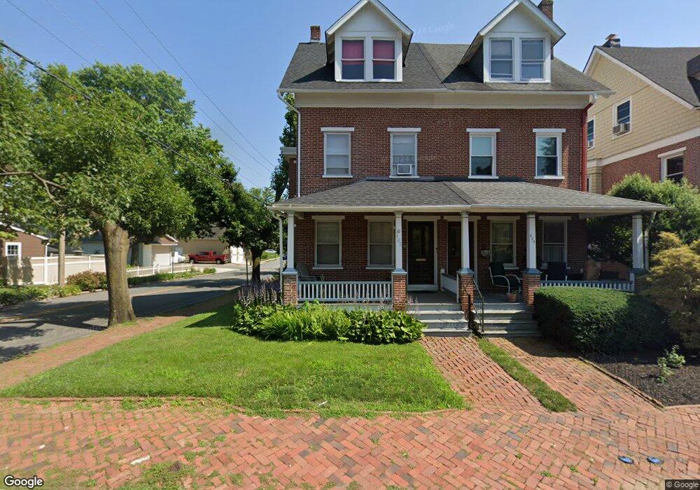
402 Dean St West Chester, PA 19382
Estimated Value: $504,096 - $588,000
5
Beds
2
Baths
1,923
Sq Ft
$277/Sq Ft
Est. Value
About This Home
This home is located at 402 Dean St, West Chester, PA 19382 and is currently estimated at $533,274, approximately $277 per square foot. 402 Dean St is a home located in Chester County with nearby schools including Hillsdale Elementary School, Stetson Middle School, and Bayard Rustin High School.
Ownership History
Date
Name
Owned For
Owner Type
Purchase Details
Closed on
Oct 23, 2024
Sold by
Hyatt Elizabeth
Bought by
402 Dean Llc
Current Estimated Value
Purchase Details
Closed on
Nov 19, 1998
Sold by
Obrien Elizabeth M and Hyatt Elizabeth
Bought by
Hyatt Elizabeth
Home Financials for this Owner
Home Financials are based on the most recent Mortgage that was taken out on this home.
Original Mortgage
$63,000
Interest Rate
6.7%
Mortgage Type
Commercial
Create a Home Valuation Report for This Property
The Home Valuation Report is an in-depth analysis detailing your home's value as well as a comparison with similar homes in the area
Home Values in the Area
Average Home Value in this Area
Purchase History
| Date | Buyer | Sale Price | Title Company |
|---|---|---|---|
| 402 Dean Llc | $480,000 | None Listed On Document | |
| Hyatt Elizabeth | -- | -- |
Source: Public Records
Mortgage History
| Date | Status | Borrower | Loan Amount |
|---|---|---|---|
| Previous Owner | Hyatt Elizabeth | $63,000 |
Source: Public Records
Tax History Compared to Growth
Tax History
| Year | Tax Paid | Tax Assessment Tax Assessment Total Assessment is a certain percentage of the fair market value that is determined by local assessors to be the total taxable value of land and additions on the property. | Land | Improvement |
|---|---|---|---|---|
| 2025 | $4,526 | $129,040 | $33,070 | $95,970 |
| 2024 | $4,526 | $129,040 | $33,070 | $95,970 |
| 2023 | $4,476 | $129,040 | $33,070 | $95,970 |
| 2022 | $4,428 | $129,040 | $33,070 | $95,970 |
| 2021 | $4,337 | $129,040 | $33,070 | $95,970 |
| 2020 | $4,257 | $129,040 | $33,070 | $95,970 |
| 2019 | $4,207 | $129,040 | $33,070 | $95,970 |
| 2018 | $4,131 | $129,040 | $33,070 | $95,970 |
| 2017 | $4,055 | $129,040 | $33,070 | $95,970 |
| 2016 | $2,881 | $129,040 | $33,070 | $95,970 |
| 2015 | $2,881 | $129,040 | $33,070 | $95,970 |
| 2014 | $2,881 | $129,040 | $33,070 | $95,970 |
Source: Public Records
Map
Nearby Homes
- 228 Dean St
- 401 W Barnard St
- 116 Price St
- 19 S New St
- 303 S Church St
- 433 W Gay St
- 443 W Gay St
- 110 S High St
- 525 Raymond Dr Unit 45
- 523 Raymond Dr Unit 46
- 333 Hannum Ave
- 724 W Nields St
- 418 Hannum Ave
- 616 W Chestnut St
- 305 S Walnut St
- 615-617 S Walnut St
- 303 W Washington St
- 112 S Matlack St
- 110 S Matlack St
- 615 S Walnut St