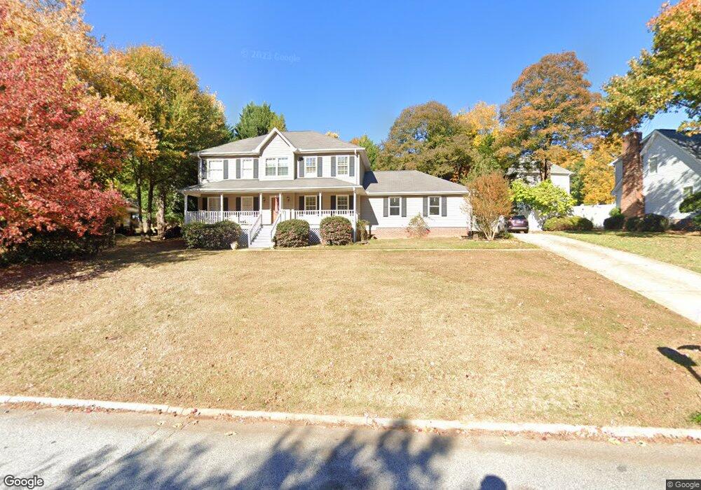
402 Foxhound Rd Simpsonville, SC 29680
Estimated Value: $328,532 - $386,000
--
Bed
--
Bath
2,334
Sq Ft
$152/Sq Ft
Est. Value
About This Home
This home is located at 402 Foxhound Rd, Simpsonville, SC 29680 and is currently estimated at $355,383, approximately $152 per square foot. 402 Foxhound Rd is a home located in Greenville County with nearby schools including Plain Elementary, Bryson Middle School, and Hillcrest High School.
Ownership History
Date
Name
Owned For
Owner Type
Purchase Details
Closed on
May 12, 2016
Sold by
Ford Dean E and Ford Carla M
Bought by
Jones Michael D and Jones Marie C
Current Estimated Value
Home Financials for this Owner
Home Financials are based on the most recent Mortgage that was taken out on this home.
Original Mortgage
$181,157
Outstanding Balance
$142,547
Interest Rate
3.31%
Mortgage Type
FHA
Estimated Equity
$212,836
Purchase Details
Closed on
Aug 16, 1999
Sold by
Hodges Emory E
Bought by
Ford Dean E
Create a Home Valuation Report for This Property
The Home Valuation Report is an in-depth analysis detailing your home's value as well as a comparison with similar homes in the area
Home Values in the Area
Average Home Value in this Area
Purchase History
| Date | Buyer | Sale Price | Title Company |
|---|---|---|---|
| Jones Michael D | $184,500 | None Available | |
| Ford Dean E | $138,500 | -- |
Source: Public Records
Mortgage History
| Date | Status | Borrower | Loan Amount |
|---|---|---|---|
| Open | Jones Michael D | $181,157 |
Source: Public Records
Tax History Compared to Growth
Tax History
| Year | Tax Paid | Tax Assessment Tax Assessment Total Assessment is a certain percentage of the fair market value that is determined by local assessors to be the total taxable value of land and additions on the property. | Land | Improvement |
|---|---|---|---|---|
| 2024 | $1,537 | $7,510 | $1,400 | $6,110 |
| 2023 | $1,537 | $7,510 | $1,400 | $6,110 |
| 2022 | $1,502 | $7,510 | $1,400 | $6,110 |
| 2021 | $1,503 | $7,510 | $1,400 | $6,110 |
| 2020 | $1,506 | $7,080 | $1,000 | $6,080 |
| 2019 | $1,507 | $7,080 | $1,000 | $6,080 |
| 2018 | $1,371 | $7,080 | $1,000 | $6,080 |
| 2017 | $1,371 | $7,080 | $1,000 | $6,080 |
| 2016 | $1,172 | $157,160 | $25,000 | $132,160 |
| 2015 | $1,172 | $157,160 | $25,000 | $132,160 |
| 2014 | $1,120 | $152,400 | $27,000 | $125,400 |
Source: Public Records
Map
Nearby Homes
- 501 Foxhound Rd
- 511 Foxhound Rd
- 6 W Fairgate Ct
- 138 Ashdown Dr
- 153 Border Ave
- 102 Hudders Creek Way
- 102 Spring Meadow Rd
- 167 Border Ave
- 606 Davenport Rd
- 126 Ashdown Dr
- 224 Scottish Ave
- 220 Scottish Ave
- 208 Orie Ct
- 58 Fair Village Ln
- 56 Fair Village Ln
- 54 Fair Village Ln
- 52 Fair Village Ln
- 61 Fair Village Ln
- 59 Fair Village Ln
- 411 Spring Meadow Rd
- 404 Foxhound Rd
- 400 Foxhound Rd
- 103 Ranger Ct
- 602 Foxhound Ct
- 405 Foxhound Rd
- 403 Foxhound Rd
- 604 Foxhound Ct
- 105 Ranger Ct
- 407 Foxhound Rd
- 310 Foxhound Rd
- 601 Foxhound Ct
- 603 Foxhound Ct
- 401 Fox Hound Rd
- 606 Foxhound Ct
- 106 Ranger Ct
- 313 Foxhound Rd
- 102 Ranger Ct
- 104 Ranger Ct
- 607 Foxhound Ct
- 607 Foxhound Ct