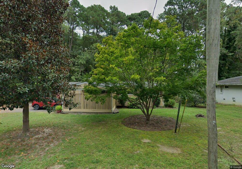
402 Lumpkin Blvd Louisburg, NC 27549
Estimated Value: $212,000 - $248,452
3
Beds
2
Baths
2,076
Sq Ft
$110/Sq Ft
Est. Value
About This Home
This home is located at 402 Lumpkin Blvd, Louisburg, NC 27549 and is currently estimated at $228,863, approximately $110 per square foot. 402 Lumpkin Blvd is a home located in Franklin County with nearby schools including Louisburg Elementary School, Terrell Lane Middle School, and Louisburg High School.
Ownership History
Date
Name
Owned For
Owner Type
Purchase Details
Closed on
Nov 18, 2014
Sold by
Fannie Mae
Bought by
Magee Ellen
Current Estimated Value
Home Financials for this Owner
Home Financials are based on the most recent Mortgage that was taken out on this home.
Original Mortgage
$2,592
Outstanding Balance
$1,981
Interest Rate
4.02%
Mortgage Type
Unknown
Estimated Equity
$226,882
Purchase Details
Closed on
May 27, 2014
Sold by
Semaske Gertrude C
Bought by
Federal National Mortgage Association
Create a Home Valuation Report for This Property
The Home Valuation Report is an in-depth analysis detailing your home's value as well as a comparison with similar homes in the area
Home Values in the Area
Average Home Value in this Area
Purchase History
| Date | Buyer | Sale Price | Title Company |
|---|---|---|---|
| Magee Ellen | -- | None Available | |
| Federal National Mortgage Association | $97,000 | None Available |
Source: Public Records
Mortgage History
| Date | Status | Borrower | Loan Amount |
|---|---|---|---|
| Open | Magee Ellen | $2,592 | |
| Open | Magee Ellen | $86,406 |
Source: Public Records
Tax History Compared to Growth
Tax History
| Year | Tax Paid | Tax Assessment Tax Assessment Total Assessment is a certain percentage of the fair market value that is determined by local assessors to be the total taxable value of land and additions on the property. | Land | Improvement |
|---|---|---|---|---|
| 2025 | $1,952 | $183,280 | $29,570 | $153,710 |
| 2024 | $1,952 | $183,280 | $29,570 | $153,710 |
| 2023 | $1,346 | $96,190 | $19,990 | $76,200 |
| 2022 | $1,288 | $96,190 | $19,990 | $76,200 |
| 2021 | $1,298 | $96,190 | $19,990 | $76,200 |
| 2020 | $1,301 | $96,190 | $19,990 | $76,200 |
| 2019 | $1,291 | $96,190 | $19,990 | $76,200 |
| 2018 | $1,286 | $96,190 | $19,990 | $76,200 |
| 2017 | $1,082 | $72,440 | $18,170 | $54,270 |
| 2016 | $1,123 | $72,440 | $18,170 | $54,270 |
| 2015 | $1,138 | $72,440 | $18,170 | $54,270 |
| 2014 | $1,075 | $72,440 | $18,170 | $54,270 |
Source: Public Records
Map
Nearby Homes
- 0-0 Halifax Rd
- 7.69 Acres N Carolina 561
- 23.20 Acre N Carolina 561
- 10.26 Acre N Carolina 561
- 126 Person St
- 101 Briarwood Ct
- 612 N Main St
- 109 Drew St
- 604 N Main St
- 125 Davis St
- 401 N Main St
- 321 W Noble St
- 301 W College St
- 313 W Noble St
- 305 N Elm St
- 414 W Noble St
- 191 Nc 56 Hwy E
- 615 Woodland Trail
- 205 Williamson St
- 101 S Elm St
- 306 Lumpkin Blvd
- 107 Dickens Ave
- 106 Dickens Ave
- 114 Cooke St
- 304 Lumpkin Blvd
- 126 Jeffress Dr
- 124 Jeffress Dr
- 105 Dickens Ave
- 302 Lumpkin Blvd
- 104 Dickens Ave
- 113 Cooke St
- 408 Lumpkin Blvd
- 103 Dickens Ave
- 120 Carol Cir
- 212 Lumpkin Blvd
- 130 Jeffress Dr
- 102 Dickens Ave
- 106 James Ave
- 1202 N Bickett Blvd
- 102 Cooke St