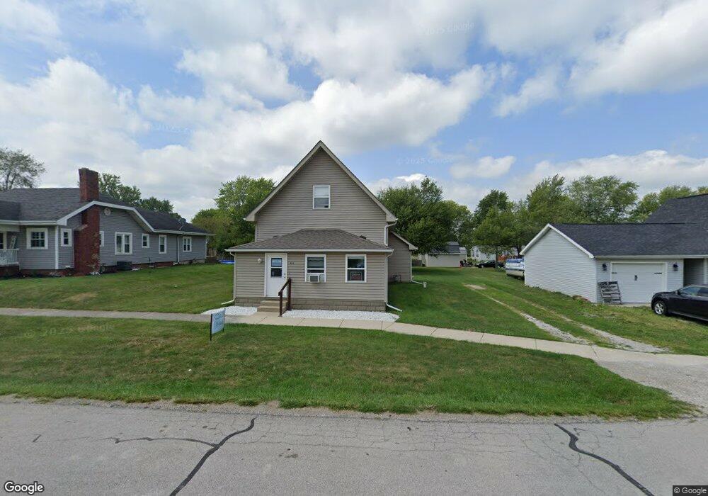
402 Main St Michigantown, IN 46057
Estimated Value: $151,000 - $181,000
3
Beds
1
Bath
1,956
Sq Ft
$83/Sq Ft
Est. Value
About This Home
This home is located at 402 Main St, Michigantown, IN 46057 and is currently estimated at $162,013, approximately $82 per square foot. 402 Main St is a home located in Clinton County with nearby schools including Clinton Central Elementary School and Clinton Central Junior/Senior High School.
Ownership History
Date
Name
Owned For
Owner Type
Purchase Details
Closed on
Sep 19, 2008
Sold by
Shoup Family Llc
Bought by
Brant Dane N and Brant Mandy E
Current Estimated Value
Home Financials for this Owner
Home Financials are based on the most recent Mortgage that was taken out on this home.
Original Mortgage
$75,510
Outstanding Balance
$50,225
Interest Rate
6.52%
Mortgage Type
New Conventional
Estimated Equity
$111,788
Purchase Details
Closed on
Jul 18, 2008
Sold by
Fannie Mae
Bought by
Shoup Family Llc
Purchase Details
Closed on
Jul 11, 2008
Sold by
Federal National Mortgage Association
Bought by
Shoup Family Llc
Purchase Details
Closed on
Oct 2, 2002
Sold by
Byrne Norman and Byrne Tracey
Bought by
Byrne Norman
Purchase Details
Closed on
Oct 15, 2001
Sold by
Allen Richard L and Allen Patrick Freda
Bought by
Byrne Norman and Byrne Tracey
Purchase Details
Closed on
Sep 17, 2001
Sold by
Allen Evaughn
Bought by
Allen Richard L and Allen Patrick Freda
Create a Home Valuation Report for This Property
The Home Valuation Report is an in-depth analysis detailing your home's value as well as a comparison with similar homes in the area
Home Values in the Area
Average Home Value in this Area
Purchase History
| Date | Buyer | Sale Price | Title Company |
|---|---|---|---|
| Brant Dane N | $78,000 | Landamerica/Lawyers Title | |
| Brant Dane N | -- | None Available | |
| Shoup Family Llc | -- | None Available | |
| Shoup Family Llc | $48,000 | Title Management Llc | |
| Byrne Norman | -- | -- | |
| Byrne Norman | $37,000 | -- | |
| Allen Richard L | -- | -- |
Source: Public Records
Mortgage History
| Date | Status | Borrower | Loan Amount |
|---|---|---|---|
| Open | Brant Dane N | $75,510 |
Source: Public Records
Tax History Compared to Growth
Tax History
| Year | Tax Paid | Tax Assessment Tax Assessment Total Assessment is a certain percentage of the fair market value that is determined by local assessors to be the total taxable value of land and additions on the property. | Land | Improvement |
|---|---|---|---|---|
| 2024 | $441 | $67,800 | $11,900 | $55,900 |
| 2023 | $510 | $72,100 | $11,900 | $60,200 |
| 2022 | $319 | $59,300 | $11,900 | $47,400 |
| 2021 | $293 | $55,600 | $11,900 | $43,700 |
| 2020 | $171 | $55,600 | $11,900 | $43,700 |
| 2019 | $281 | $55,800 | $11,900 | $43,900 |
| 2018 | $284 | $55,800 | $11,900 | $43,900 |
| 2017 | $281 | $55,500 | $11,900 | $43,600 |
| 2016 | $240 | $61,900 | $11,900 | $50,000 |
| 2014 | $146 | $57,000 | $10,200 | $46,800 |
Source: Public Records
Map
Nearby Homes
- 508 Ohio St
- 404 E 3rd St
- 102 Main St
- 5371 E 500 Rd N
- 5184 E County Road 100 N
- 5371 E County Road 500 N
- 1819 N County Road 830 E
- 2696 E Michigantown Rd
- 8994 E Hillis St
- 6953 N State Road 29
- 2775 E State Road 28
- 2174 Washington Ave
- 845 Makenna Cir
- 654 N Crescent Dr
- 1309 N County Road 30 E
- 1700 N Redbud Dr
- 1660 N Redbud Dr
- 359 Center Dr
- 759 Sunrise Dr Unit 111
- 837 Sunrise Dr Unit 119