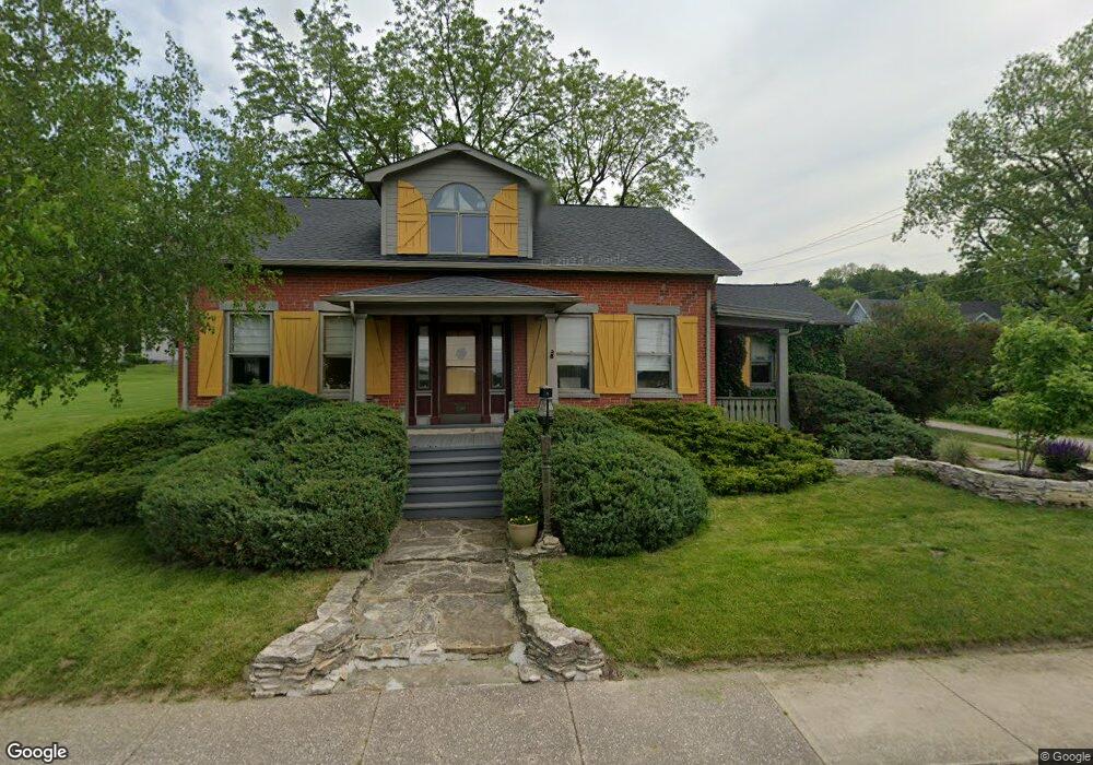
402 N Main St Port Byron, IL 61275
Estimated Value: $179,089 - $302,000
--
Bed
--
Bath
2,267
Sq Ft
$100/Sq Ft
Est. Value
About This Home
This home is located at 402 N Main St, Port Byron, IL 61275 and is currently estimated at $227,522, approximately $100 per square foot. 402 N Main St is a home located in Rock Island County with nearby schools including Riverdale Elementary School, Riverdale Middle School, and Riverdale Senior High School.
Create a Home Valuation Report for This Property
The Home Valuation Report is an in-depth analysis detailing your home's value as well as a comparison with similar homes in the area
Home Values in the Area
Average Home Value in this Area
Tax History Compared to Growth
Tax History
| Year | Tax Paid | Tax Assessment Tax Assessment Total Assessment is a certain percentage of the fair market value that is determined by local assessors to be the total taxable value of land and additions on the property. | Land | Improvement |
|---|---|---|---|---|
| 2024 | $1,483 | $62,285 | $12,237 | $50,048 |
| 2023 | $1,483 | $57,143 | $11,227 | $45,916 |
| 2022 | $1,539 | $53,390 | $10,708 | $42,682 |
| 2021 | $1,588 | $50,607 | $10,150 | $40,457 |
| 2020 | $1,587 | $49,859 | $10,000 | $39,859 |
| 2019 | $1,592 | $49,859 | $10,000 | $39,859 |
| 2018 | $1,565 | $45,424 | $10,815 | $34,609 |
| 2017 | $1,541 | $45,424 | $10,815 | $34,609 |
| 2016 | $1,549 | $44,797 | $10,666 | $34,131 |
| 2015 | $1,564 | $43,144 | $10,272 | $32,872 |
| 2014 | -- | $42,298 | $10,071 | $32,227 |
| 2013 | -- | $42,298 | $10,071 | $32,227 |
Source: Public Records
Map
Nearby Homes