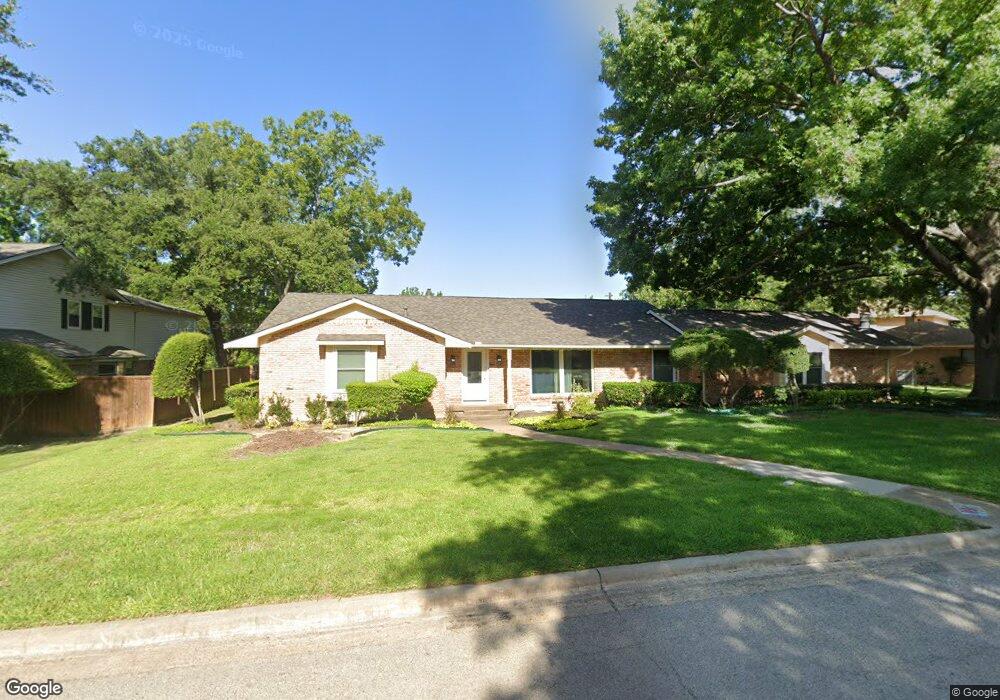
402 Riggs Cir Mesquite, TX 75149
Estimated Value: $341,000 - $426,000
3
Beds
4
Baths
2,422
Sq Ft
$154/Sq Ft
Est. Value
About This Home
This home is located at 402 Riggs Cir, Mesquite, TX 75149 and is currently estimated at $373,846, approximately $154 per square foot. 402 Riggs Cir is a home located in Dallas County with nearby schools including Moss Elementary School, Agnew Middle School, and Mesquite High School.
Ownership History
Date
Name
Owned For
Owner Type
Purchase Details
Closed on
Oct 11, 2017
Sold by
Tillery Terry Lynn
Bought by
Weed Kelly
Current Estimated Value
Home Financials for this Owner
Home Financials are based on the most recent Mortgage that was taken out on this home.
Original Mortgage
$140,250
Outstanding Balance
$117,148
Interest Rate
3.82%
Mortgage Type
Purchase Money Mortgage
Estimated Equity
$256,698
Purchase Details
Closed on
Jun 28, 2017
Sold by
Tillery Terry Lynn and Tillery Carlton Alan
Bought by
Tillery Terry Lynn
Purchase Details
Closed on
Nov 15, 1993
Sold by
Watt Eldred J and Watt Frances L
Bought by
Tillery Carlton Alan and Tillery Terry Lynn
Home Financials for this Owner
Home Financials are based on the most recent Mortgage that was taken out on this home.
Original Mortgage
$93,800
Interest Rate
6.86%
Create a Home Valuation Report for This Property
The Home Valuation Report is an in-depth analysis detailing your home's value as well as a comparison with similar homes in the area
Home Values in the Area
Average Home Value in this Area
Purchase History
| Date | Buyer | Sale Price | Title Company |
|---|---|---|---|
| Weed Kelly | -- | None Available | |
| Tillery Terry Lynn | -- | None Available | |
| Tillery Carlton Alan | -- | -- |
Source: Public Records
Mortgage History
| Date | Status | Borrower | Loan Amount |
|---|---|---|---|
| Open | Weed Kelly | $140,250 | |
| Previous Owner | Tillery Carlton Alan | $93,800 |
Source: Public Records
Tax History Compared to Growth
Tax History
| Year | Tax Paid | Tax Assessment Tax Assessment Total Assessment is a certain percentage of the fair market value that is determined by local assessors to be the total taxable value of land and additions on the property. | Land | Improvement |
|---|---|---|---|---|
| 2025 | $7,714 | $332,500 | $99,280 | $233,220 |
| 2024 | $7,714 | $332,500 | $99,280 | $233,220 |
| 2023 | $7,714 | $307,000 | $54,160 | $252,840 |
| 2022 | $7,713 | $307,000 | $54,160 | $252,840 |
| 2021 | $5,117 | $194,030 | $54,160 | $139,870 |
| 2020 | $5,171 | $185,000 | $45,130 | $139,870 |
| 2019 | $4,802 | $165,000 | $34,600 | $130,400 |
| 2018 | $6,610 | $235,740 | $34,600 | $201,140 |
| 2017 | $5,760 | $205,580 | $34,600 | $170,980 |
| 2016 | $5,760 | $205,580 | $34,600 | $170,980 |
| 2015 | $4,989 | $205,580 | $34,600 | $170,980 |
| 2014 | $4,989 | $201,500 | $57,750 | $143,750 |
Source: Public Records
Map
Nearby Homes
- 427 Riggs Cir
- 1137 Tosch Ln
- 1029 S Bryan St
- 218 New Market Rd
- 120 Running Brook Ln
- 1412 Paula Ln
- 206 Longshadow Ln
- 1429 Longshadow Ln
- 1136 Aragon Trail
- 1128 Aragon Trail
- 928 Tiffany Ln
- 1507 Creekwood Ln
- 1304 Doris Dr
- 205 Benwynd Dr
- 125 Benwynd Dr
- 1518 Creekwood Ln
- 12802 Park Hill Ct
- 12715 Bluffview Dr
- 830 Carver St
- 805 Norton Dr