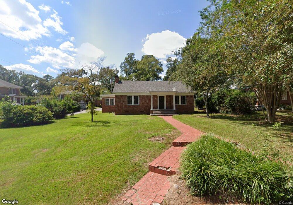
402 S Orange Ave Dothan, AL 36301
Estimated Value: $244,000 - $286,000
3
Beds
2
Baths
2,600
Sq Ft
$100/Sq Ft
Est. Value
About This Home
This home is located at 402 S Orange Ave, Dothan, AL 36301 and is currently estimated at $260,889, approximately $100 per square foot. 402 S Orange Ave is a home located in Houston County with nearby schools including Dothan City Early Education Center, Girard Elementary School, and Dothan 6th Grade Center.
Ownership History
Date
Name
Owned For
Owner Type
Purchase Details
Closed on
Sep 23, 2021
Sold by
Heersink John G
Bought by
Lehman Holdings Llc
Current Estimated Value
Home Financials for this Owner
Home Financials are based on the most recent Mortgage that was taken out on this home.
Original Mortgage
$172,000
Outstanding Balance
$155,823
Interest Rate
2.8%
Mortgage Type
Commercial
Estimated Equity
$105,066
Purchase Details
Closed on
Dec 15, 2011
Sold by
Jones Martha Jo and Embry Mary Rush
Bought by
Heersink John G
Create a Home Valuation Report for This Property
The Home Valuation Report is an in-depth analysis detailing your home's value as well as a comparison with similar homes in the area
Purchase History
| Date | Buyer | Sale Price | Title Company |
|---|---|---|---|
| Lehman Holdings Llc | $172,000 | None Available | |
| Heersink John G | -- | -- |
Source: Public Records
Mortgage History
| Date | Status | Borrower | Loan Amount |
|---|---|---|---|
| Open | Lehman Holdings Llc | $172,000 |
Source: Public Records
Tax History
| Year | Tax Paid | Tax Assessment Tax Assessment Total Assessment is a certain percentage of the fair market value that is determined by local assessors to be the total taxable value of land and additions on the property. | Land | Improvement |
|---|---|---|---|---|
| 2025 | $2,045 | $56,800 | $0 | $0 |
| 2024 | $2,045 | $55,640 | $0 | $0 |
| 2023 | $2,003 | $40,620 | $0 | $0 |
| 2022 | $1,250 | $36,220 | $0 | $0 |
| 2021 | $1,081 | $36,220 | $0 | $0 |
| 2020 | $1,081 | $31,340 | $0 | $0 |
| 2019 | $1,081 | $31,340 | $0 | $0 |
| 2018 | $1,081 | $31,340 | $0 | $0 |
| 2017 | $1,165 | $33,760 | $0 | $0 |
| 2016 | $1,165 | $0 | $0 | $0 |
| 2015 | $1,156 | $0 | $0 | $0 |
| 2014 | $1,156 | $0 | $0 | $0 |
Source: Public Records
Map
Nearby Homes
- 433 Woodland Dr
- 1107 Woodlawn Dr
- 268 S Park Ave
- 400 Winding Rd
- 1301 Sassar St
- 104 N Herring St
- 203 N Herring St
- 711 Westmead St
- 709 Westmead St
- 24 Parkplace Ct
- 2 Parkplace Ct
- 706 Westmead St
- 1709 Haisten Dr
- 305 N Herring St
- 607 Arlington Ave
- 1001 S Edgewood Dr
- 200 N Cherokee Ave
- 114 Westmont Dr
- 1110 W Powell St
- 1006 Martin St
- 400 S Orange Ave
- 1203 Laurel Ave
- 404 S Orange Ave
- 1109 Laurel Ave
- 1205 Laurel Ave
- 405 S Orange Ave
- 306 S Orange Ave
- 1110 Woodlawn Dr
- 467 Woodland Dr
- 304 S Orange Ave
- 417 Woodland Dr
- 449 Woodland Dr
- 1106 Woodlawn Dr
- 1107 Laurel Ave
- 1204 Laurel Ave
- 1110 Laurel Ave
- 1201 Woodlawn Dr
- 1203 Woodlawn Dr
- 365 Woodland Dr
- 1104 Woodlawn Dr
Your Personal Tour Guide
Ask me questions while you tour the home.