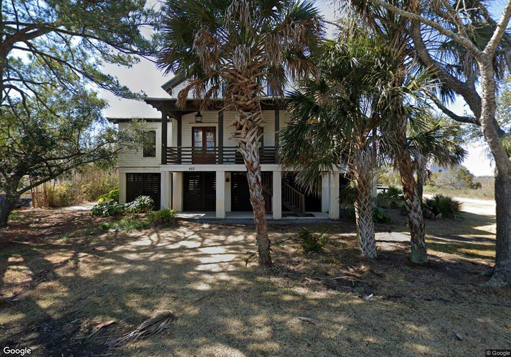
402 Station 18 1/2 St Sullivans Island, SC 29482
Sullivan's Island NeighborhoodEstimated Value: $2,841,000 - $7,594,812
3
Beds
1
Bath
1,422
Sq Ft
$3,767/Sq Ft
Est. Value
About This Home
This home is located at 402 Station 18 1/2 St, Sullivans Island, SC 29482 and is currently estimated at $5,357,271, approximately $3,767 per square foot. 402 Station 18 1/2 St is a home located in Charleston County with nearby schools including Sullivans Island Elementary School, Moultrie Middle School, and Wando High School.
Ownership History
Date
Name
Owned For
Owner Type
Purchase Details
Closed on
Aug 17, 2015
Sold by
Hassell Sara N
Bought by
Hassell Patrick B
Current Estimated Value
Home Financials for this Owner
Home Financials are based on the most recent Mortgage that was taken out on this home.
Original Mortgage
$1,369,000
Outstanding Balance
$1,047,313
Interest Rate
3.25%
Mortgage Type
Adjustable Rate Mortgage/ARM
Estimated Equity
$4,309,958
Purchase Details
Closed on
Feb 28, 2012
Sold by
Jones Brent A and Edwards Jones Lucretia T
Bought by
Hassell Patrick B and Hassell Sara N
Home Financials for this Owner
Home Financials are based on the most recent Mortgage that was taken out on this home.
Original Mortgage
$620,000
Interest Rate
3.87%
Mortgage Type
Construction
Purchase Details
Closed on
Mar 21, 2000
Sold by
Jones Arthur U
Bought by
Jones Brent A and Edwards Jones Lucretia T
Create a Home Valuation Report for This Property
The Home Valuation Report is an in-depth analysis detailing your home's value as well as a comparison with similar homes in the area
Home Values in the Area
Average Home Value in this Area
Purchase History
| Date | Buyer | Sale Price | Title Company |
|---|---|---|---|
| Hassell Patrick B | -- | -- | |
| Hassell Patrick B | $775,000 | -- | |
| Jones Brent A | -- | -- |
Source: Public Records
Mortgage History
| Date | Status | Borrower | Loan Amount |
|---|---|---|---|
| Open | Hassell Patrick B | $1,369,000 | |
| Closed | Hassell Patrick B | $620,000 |
Source: Public Records
Tax History Compared to Growth
Tax History
| Year | Tax Paid | Tax Assessment Tax Assessment Total Assessment is a certain percentage of the fair market value that is determined by local assessors to be the total taxable value of land and additions on the property. | Land | Improvement |
|---|---|---|---|---|
| 2024 | $12,236 | $107,270 | $0 | $0 |
| 2023 | $12,236 | $107,270 | $0 | $0 |
| 2022 | $12,067 | $107,270 | $0 | $0 |
| 2021 | $12,507 | $107,270 | $0 | $0 |
| 2020 | $12,764 | $107,270 | $0 | $0 |
| 2019 | $10,662 | $93,290 | $0 | $0 |
| 2017 | $9,398 | $93,290 | $0 | $0 |
| 2016 | $30,776 | $93,290 | $0 | $0 |
| 2015 | $9,362 | $93,290 | $0 | $0 |
| 2014 | $7,493 | $0 | $0 | $0 |
| 2011 | -- | $0 | $0 | $0 |
Source: Public Records
Map
Nearby Homes
- 1750 Ion Ave
- 1773 Atlantic Ave
- 1714 Middle St
- 1727 Atlantic Ave
- 409 Station 22 1 2 St
- 1651 Atlantic Ave
- 2307 Ion Ave
- 2414 Goldbug Ave
- 2424 Middle St
- 2524 Goldbug Ave
- 1602 Marsh Harbor Ln Unit A
- 2524 Middle St
- 1647 Marsh Harbor Ln
- 1608 Marsh Harbor Ln Unit C
- 2629 Goldbug Ave
- 0 Middle St
- 2630 Bayonne Ave
- 932 Middle St
- 904 Middle St
- 2820 Ion Ave
- 402 Station 18 1 2 St
- 321 Station 19 St
- 1850 Central Ave
- 1850 Back St
- 1856 Central Ave
- 1817 Back St
- 1903 Back St
- 322 Station 19 St Unit B
- 1820 Central Ave
- 1902 Central Ave Unit A
- 1907 Back St
- 1816 Back St
- 1813 Back St
- 1908 Central Ave
- 1814 Central Ave
- 401 Station 20 St
- 1850 Middle St
- 1808 Central Ave
- 1820 Middle St
- 1801 Back St