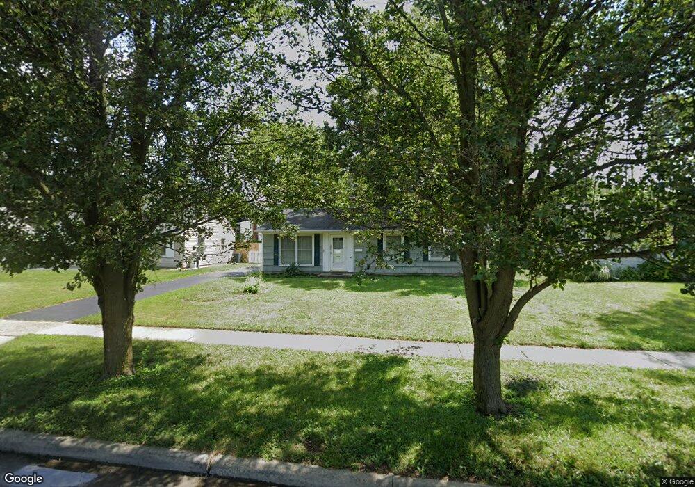
402 Sturbridge Rd Columbus, OH 43228
Estimated Value: $217,996 - $251,000
3
Beds
2
Baths
1,107
Sq Ft
$210/Sq Ft
Est. Value
About This Home
This home is located at 402 Sturbridge Rd, Columbus, OH 43228 and is currently estimated at $232,499, approximately $210 per square foot. 402 Sturbridge Rd is a home located in Franklin County with nearby schools including Prairie Lincoln Elementary School, Galloway Ridge Intermediate School, and Norton Middle School.
Ownership History
Date
Name
Owned For
Owner Type
Purchase Details
Closed on
Feb 15, 2005
Sold by
Tdm Properties Ltd
Bought by
Turner Brian R
Current Estimated Value
Home Financials for this Owner
Home Financials are based on the most recent Mortgage that was taken out on this home.
Original Mortgage
$95,900
Outstanding Balance
$47,303
Interest Rate
5.71%
Mortgage Type
Purchase Money Mortgage
Estimated Equity
$185,196
Purchase Details
Closed on
May 1, 2001
Sold by
Repik Clyde P
Bought by
Tdm Properties Ltd
Purchase Details
Closed on
Mar 9, 2000
Sold by
Estate Of Jessie L Repik
Bought by
Repik Clyde P
Purchase Details
Closed on
May 28, 1963
Bought by
Repik Clyde P and Repik Jessie
Create a Home Valuation Report for This Property
The Home Valuation Report is an in-depth analysis detailing your home's value as well as a comparison with similar homes in the area
Home Values in the Area
Average Home Value in this Area
Purchase History
| Date | Buyer | Sale Price | Title Company |
|---|---|---|---|
| Turner Brian R | $112,900 | Chicago Tit | |
| Tdm Properties Ltd | $84,500 | Chicago Title | |
| Repik Clyde P | -- | -- | |
| Repik Clyde P | -- | -- |
Source: Public Records
Mortgage History
| Date | Status | Borrower | Loan Amount |
|---|---|---|---|
| Open | Turner Brian R | $95,900 |
Source: Public Records
Tax History
| Year | Tax Paid | Tax Assessment Tax Assessment Total Assessment is a certain percentage of the fair market value that is determined by local assessors to be the total taxable value of land and additions on the property. | Land | Improvement |
|---|---|---|---|---|
| 2025 | $2,643 | $54,920 | $18,030 | $36,890 |
| 2024 | $2,643 | $54,920 | $18,030 | $36,890 |
| 2023 | $2,537 | $54,915 | $18,025 | $36,890 |
| 2022 | $2,034 | $30,350 | $4,170 | $26,180 |
| 2021 | $2,064 | $30,350 | $4,170 | $26,180 |
| 2020 | $2,044 | $30,350 | $4,170 | $26,180 |
| 2019 | $2,017 | $26,120 | $3,470 | $22,650 |
| 2018 | $1,006 | $26,120 | $3,470 | $22,650 |
| 2017 | $1,778 | $26,120 | $3,470 | $22,650 |
| 2016 | $1,888 | $25,350 | $6,830 | $18,520 |
| 2015 | $944 | $25,350 | $6,830 | $18,520 |
| 2014 | $1,853 | $25,350 | $6,830 | $18,520 |
| 2013 | $1,090 | $29,785 | $8,015 | $21,770 |
Source: Public Records
Map
Nearby Homes
- 381 Pasadena Ave
- 399 Carilla Ln
- 480 Yarmouth Ln
- 329 Weymouth Ln
- 129 Beacon Run W Unit 21C
- 87 Tarryton Ct W Unit 18D
- 218 Darbyhurst Rd
- 4723 Tarryton Ct S Unit 14-E
- 404 Old Village Rd
- 89 Postle Blvd
- 110 Inah Ave
- 104 Oxley Rd
- 69 Lawrence Ave
- 5409 Longworth Dr
- 4637 Hilton Ave
- 4682 Arnold Ave
- 5648 Larksdale Dr
- 4647 Henley Ave
- 5713 Larksdale Dr
- 257 S Murray Hill Rd
- 394 Sturbridge Rd
- 385 Topsfield Rd
- 420 Sturbridge Rd
- 386 Sturbridge Rd
- 419 Powder Mill Ln
- 377 Topsfield Rd
- 409 Powder Mill Ln
- 403 Sturbridge Rd
- 378 Sturbridge Rd
- 411 Sturbridge Rd
- 395 Sturbridge Rd
- 433 Powder Mill Ln
- 371 Topsfield Rd
- 419 Sturbridge Rd
- 387 Sturbridge Rd
- 363 Topsfield Rd
- 379 Sturbridge Rd
- 425 Sturbridge Rd
- 390 Topsfield Rd
- 420 Deerfield Rd
Your Personal Tour Guide
Ask me questions while you tour the home.