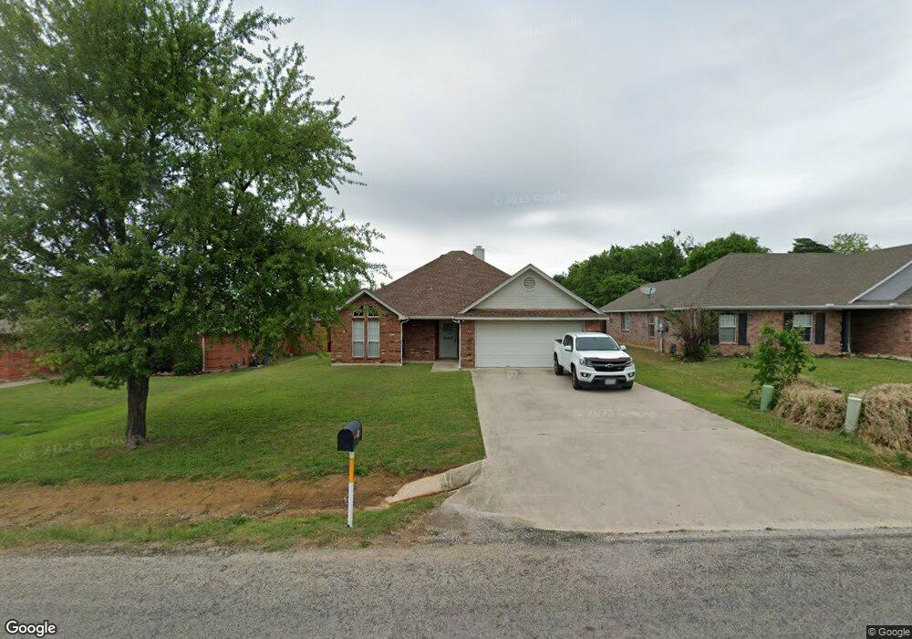
402 W Sherman Dr Aubrey, TX 76227
Estimated Value: $284,562 - $305,000
3
Beds
2
Baths
1,372
Sq Ft
$213/Sq Ft
Est. Value
About This Home
This home is located at 402 W Sherman Dr, Aubrey, TX 76227 and is currently estimated at $292,891, approximately $213 per square foot. 402 W Sherman Dr is a home located in Denton County with nearby schools including HL Brockett Elementary School, Aubrey Middle School, and Aubrey High School.
Ownership History
Date
Name
Owned For
Owner Type
Purchase Details
Closed on
Jun 15, 2020
Sold by
Cooper Linda
Bought by
Stell Steven
Current Estimated Value
Home Financials for this Owner
Home Financials are based on the most recent Mortgage that was taken out on this home.
Original Mortgage
$207,200
Outstanding Balance
$182,853
Interest Rate
3.2%
Mortgage Type
VA
Estimated Equity
$110,038
Purchase Details
Closed on
May 23, 2000
Sold by
Fisher Dyan M
Bought by
Cooper Linda
Home Financials for this Owner
Home Financials are based on the most recent Mortgage that was taken out on this home.
Original Mortgage
$79,499
Interest Rate
8.14%
Mortgage Type
FHA
Purchase Details
Closed on
Jun 18, 1999
Sold by
H & N Jv Inc
Bought by
Fisher Dyan M
Home Financials for this Owner
Home Financials are based on the most recent Mortgage that was taken out on this home.
Original Mortgage
$79,450
Interest Rate
10.37%
Mortgage Type
Purchase Money Mortgage
Create a Home Valuation Report for This Property
The Home Valuation Report is an in-depth analysis detailing your home's value as well as a comparison with similar homes in the area
Home Values in the Area
Average Home Value in this Area
Purchase History
| Date | Buyer | Sale Price | Title Company |
|---|---|---|---|
| Stell Steven | -- | Chicago Title | |
| Cooper Linda | -- | -- | |
| Fisher Dyan M | -- | Title Resources | |
| Fisher Dyan M | -- | Title Resources |
Source: Public Records
Mortgage History
| Date | Status | Borrower | Loan Amount |
|---|---|---|---|
| Open | Stell Steven | $207,200 | |
| Previous Owner | Cooper Linda | $79,499 | |
| Previous Owner | Fisher Dyan M | $79,450 |
Source: Public Records
Tax History Compared to Growth
Tax History
| Year | Tax Paid | Tax Assessment Tax Assessment Total Assessment is a certain percentage of the fair market value that is determined by local assessors to be the total taxable value of land and additions on the property. | Land | Improvement |
|---|---|---|---|---|
| 2025 | $3,912 | $258,530 | $65,066 | $193,464 |
| 2024 | $5,200 | $272,649 | $0 | $0 |
| 2023 | $3,446 | $247,863 | $72,296 | $228,199 |
| 2022 | $4,789 | $225,330 | $60,881 | $187,422 |
| 2021 | $4,660 | $204,845 | $45,661 | $159,184 |
| 2020 | $4,588 | $196,465 | $45,661 | $150,804 |
| 2019 | $4,277 | $181,412 | $45,661 | $148,264 |
| 2018 | $3,776 | $164,920 | $45,661 | $138,683 |
| 2017 | $3,479 | $149,927 | $45,661 | $116,107 |
| 2016 | $2,181 | $136,297 | $45,661 | $103,672 |
| 2015 | $2,176 | $123,906 | $30,440 | $93,466 |
| 2014 | $2,176 | $120,458 | $30,440 | $90,018 |
| 2013 | -- | $114,764 | $22,830 | $91,934 |
Source: Public Records
Map
Nearby Homes
- 7521 Bird Cherry Ln
- 7313 Bird Cherry Ln
- 732 Dressage Ln
- 728 Dressage Ln
- 712 Dressage Ln
- 509 Amy jo Cir
- 506 N Main St
- 3529 Maple St
- 105 E North St
- 3616 Barrel Ln
- 3612 Barrel Ln
- 3617 Barrel Ln
- 604 N Cherry St
- 309 W Sherman Dr
- 506 Caddell St
- 10100 Breezeway Dr
- 4004 Horsemint Rd
- TBD De Moye Ln
- TBD Rock Hill Rd
- TBD Farm To Market Road 428
- 404 W Sherman Dr
- 200 Linda St
- 202 Linda St
- 500 W Sherman Dr
- 204 Linda St
- 501 Amy jo Cir
- 206 Linda St
- 7525 Bird Cherry Ln
- 7312 Snapdragon Ct
- 1105 Ginger Rd
- 949 Burnet Ln
- 604 Presidio St
- 633 Presidio St
- 7325 Carnation St
- 1109 Ginger Rd
- 7517 Bird Cherry Ln
- 7313 Snapdragon Ct
- 646 Presidio St
- 7312 Allium Ct
- 7337 Carnation St