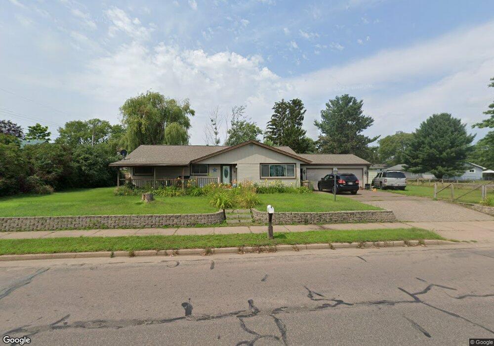
4020 Robin Rd Eau Claire, WI 54703
Estimated Value: $260,000 - $279,000
3
Beds
2
Baths
1,605
Sq Ft
$167/Sq Ft
Est. Value
About This Home
This home is located at 4020 Robin Rd, Eau Claire, WI 54703 and is currently estimated at $267,666, approximately $166 per square foot. 4020 Robin Rd is a home located in Chippewa County with nearby schools including Locust Lane Elementary School, Northstar Middle School, and North High School.
Ownership History
Date
Name
Owned For
Owner Type
Purchase Details
Closed on
Aug 27, 2010
Sold by
Citimortgage Inc
Bought by
Hinke Larry and Hinke Diane
Current Estimated Value
Home Financials for this Owner
Home Financials are based on the most recent Mortgage that was taken out on this home.
Original Mortgage
$63,000
Outstanding Balance
$40,737
Interest Rate
4.42%
Mortgage Type
Purchase Money Mortgage
Estimated Equity
$226,929
Purchase Details
Closed on
Aug 4, 2010
Sold by
Walkner Robert J and Walkner Maren C
Bought by
Citimortgage Inc
Home Financials for this Owner
Home Financials are based on the most recent Mortgage that was taken out on this home.
Original Mortgage
$63,000
Outstanding Balance
$40,737
Interest Rate
4.42%
Mortgage Type
Purchase Money Mortgage
Estimated Equity
$226,929
Purchase Details
Closed on
Jun 4, 2010
Sold by
Walkner
Bought by
Crmsi Remic Series 2006 01 Ea
Create a Home Valuation Report for This Property
The Home Valuation Report is an in-depth analysis detailing your home's value as well as a comparison with similar homes in the area
Purchase History
| Date | Buyer | Sale Price | Title Company |
|---|---|---|---|
| Hinke Larry | $83,900 | None Available | |
| Citimortgage Inc | $72,505 | None Available | |
| Crmsi Remic Series 2006 01 Ea | $72,600 | -- |
Source: Public Records
Mortgage History
| Date | Status | Borrower | Loan Amount |
|---|---|---|---|
| Open | Hinke Larry | $63,000 |
Source: Public Records
Tax History
| Year | Tax Paid | Tax Assessment Tax Assessment Total Assessment is a certain percentage of the fair market value that is determined by local assessors to be the total taxable value of land and additions on the property. | Land | Improvement |
|---|---|---|---|---|
| 2025 | $3,918 | $201,400 | $24,000 | $177,400 |
| 2024 | $3,331 | $201,400 | $24,000 | $177,400 |
| 2023 | $3,974 | $201,400 | $24,000 | $177,400 |
| 2022 | $3,421 | $201,400 | $24,000 | $177,400 |
| 2021 | $3,130 | $201,400 | $24,000 | $177,400 |
| 2020 | $2,800 | $148,200 | $24,000 | $124,200 |
| 2019 | $2,719 | $148,200 | $24,000 | $124,200 |
| 2018 | $2,880 | $148,200 | $24,000 | $124,200 |
| 2017 | $2,641 | $120,300 | $20,600 | $99,700 |
| 2016 | $2,643 | $120,300 | $20,600 | $99,700 |
| 2015 | $2,530 | $120,300 | $20,600 | $99,700 |
| 2014 | $2,627 | $120,300 | $20,600 | $99,700 |
Source: Public Records
Map
Nearby Homes
- 3232 Lotus St
- 3231 Oakland St
- 3233 Potter Rd
- 3210 Midway St
- 3145 Fern Ct
- 3650 114th St
- 11510 E Melby St
- 4947 Woodlands Dr
- 4919 Woodlands Dr
- 2935 Boston Dr
- 3521 Leslie Ln
- 4226 Bennington Ct
- 2300 113th St
- 2915 E Princeton Ave
- Lot 5 27th Ct
- Lot 4 27th Ct
- 4232 Bennington Ct
- 2903 E Princeton Ave
- 2827 E Princeton Ave
- 2833 E Princeton Ave
- 3350 Melby St
- 3346 Melby St
- 3340 Melby St
- 3350 Davey St
- 3344 Davey St
- 3332 Melby St
- 3333 Davey St
- 3406 Melby St
- 3332 Davey St
- 3318 Melby St
- 4120 Robin Rd Unit 4122
- 3403 Melby St
- 3920 Robin Rd
- 3349 Peterson St Unit 3351
- 4122 Robin Rd
- 3326 Davey St
- 3319 Davey St
- 3341 Peterson St Unit 3343
- 3312 Melby St
- 3325 Melby St
Your Personal Tour Guide
Ask me questions while you tour the home.