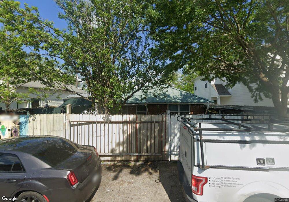
4020 Rutland St Houston, TX 77018
Independence Heights NeighborhoodEstimated Value: $329,437 - $494,000
4
Beds
2
Baths
2,240
Sq Ft
$190/Sq Ft
Est. Value
About This Home
This home is located at 4020 Rutland St, Houston, TX 77018 and is currently estimated at $426,359, approximately $190 per square foot. 4020 Rutland St is a home located in Harris County with nearby schools including Kennedy Elementary School, Williams Middle, and Booker T Washington Sr High.
Ownership History
Date
Name
Owned For
Owner Type
Purchase Details
Closed on
Jan 25, 2007
Sold by
Oddo Ben J and Oddo Bernice
Bought by
Diaz Manuel and Diaz Jorge
Current Estimated Value
Purchase Details
Closed on
Dec 13, 1996
Sold by
Oddo Ben J
Bought by
Diaz Manuel
Home Financials for this Owner
Home Financials are based on the most recent Mortgage that was taken out on this home.
Original Mortgage
$31,000
Interest Rate
7.77%
Mortgage Type
Seller Take Back
Create a Home Valuation Report for This Property
The Home Valuation Report is an in-depth analysis detailing your home's value as well as a comparison with similar homes in the area
Home Values in the Area
Average Home Value in this Area
Purchase History
| Date | Buyer | Sale Price | Title Company |
|---|---|---|---|
| Diaz Manuel | -- | None Available | |
| Diaz Manuel | -- | -- |
Source: Public Records
Mortgage History
| Date | Status | Borrower | Loan Amount |
|---|---|---|---|
| Previous Owner | Diaz Manuel | $31,000 |
Source: Public Records
Tax History Compared to Growth
Tax History
| Year | Tax Paid | Tax Assessment Tax Assessment Total Assessment is a certain percentage of the fair market value that is determined by local assessors to be the total taxable value of land and additions on the property. | Land | Improvement |
|---|---|---|---|---|
| 2025 | $39 | $305,815 | $131,544 | $174,271 |
| 2024 | $39 | $319,884 | $131,544 | $188,340 |
| 2023 | $39 | $288,047 | $116,928 | $171,119 |
| 2022 | $2,365 | $273,580 | $116,928 | $156,652 |
| 2021 | $2,276 | $233,750 | $92,568 | $141,182 |
| 2020 | $2,149 | $219,752 | $87,696 | $132,056 |
| 2019 | $2,042 | $89,653 | $43,848 | $45,805 |
| 2018 | $200 | $76,053 | $43,848 | $32,205 |
| 2017 | $1,686 | $66,689 | $34,104 | $32,585 |
| 2016 | $1,686 | $66,689 | $34,104 | $32,585 |
| 2015 | $352 | $73,932 | $24,360 | $49,572 |
| 2014 | $352 | $63,886 | $17,052 | $46,834 |
Source: Public Records
Map
Nearby Homes
- 204 Blueberry St
- 4022 Rutland St
- 4123 Yale St
- 4115 Yale St
- 4210 Allston St
- 4213 Yale St
- 212 Pheasant St
- 4010 Rutland St
- 225 Hyta St
- 226 Hyta St
- 230 Hyta St
- 219 Pheasant St Unit B
- 223 Cockerel St
- 3914 Tulane St
- 121B E 43rd St
- 121A E 43rd St
- 104 E 44th St Unit A
- 119A E 43rd St
- 119B E 43rd St
- 3939 Tulane St
- 4018 Rutland St
- 205 Oriole St
- 4016 Rutland St
- 203 Oriole St
- 215 Oriole St
- 4014 Rutland St
- 204 Pheasant St
- 4102 Allston St
- 4012 Rutland St
- 201 Oriole St
- 208 Pheasant St
- 4104 Allston St
- 212 Oriole St
- 217 Oriole St Unit 2
- 216 Oriole St
- 216 Oriole St Unit B
- 216 Oriole St Unit D
- 216 Oriole St Unit A
- 216 Oriole St Unit C
- 4006 Rutland St