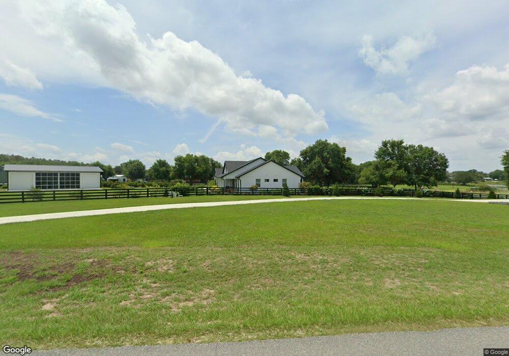
40213 Babb Rd Umatilla, FL 32784
Estimated Value: $499,000 - $639,529
3
Beds
3
Baths
2,598
Sq Ft
$214/Sq Ft
Est. Value
About This Home
This home is located at 40213 Babb Rd, Umatilla, FL 32784 and is currently estimated at $557,132, approximately $214 per square foot. 40213 Babb Rd is a home with nearby schools including Umatilla Elementary School, Umatilla Middle School, and Umatilla High School.
Ownership History
Date
Name
Owned For
Owner Type
Purchase Details
Closed on
Dec 16, 2020
Sold by
Sangster Robert
Bought by
Spurling Tracy L and Spurling Blaine C
Current Estimated Value
Purchase Details
Closed on
Nov 12, 2020
Sold by
Vossberg Carl A
Bought by
Sangster Robert
Purchase Details
Closed on
Apr 30, 2001
Sold by
United Southern Bk
Bought by
Vossberg Carl A
Home Financials for this Owner
Home Financials are based on the most recent Mortgage that was taken out on this home.
Original Mortgage
$92,500
Interest Rate
6.98%
Create a Home Valuation Report for This Property
The Home Valuation Report is an in-depth analysis detailing your home's value as well as a comparison with similar homes in the area
Home Values in the Area
Average Home Value in this Area
Purchase History
| Date | Buyer | Sale Price | Title Company |
|---|---|---|---|
| Spurling Tracy L | $85,000 | Seaplane Title Llc | |
| Sangster Robert | $180,000 | Seaplane Title Llc | |
| Vossberg Carl A | $92,500 | -- |
Source: Public Records
Mortgage History
| Date | Status | Borrower | Loan Amount |
|---|---|---|---|
| Previous Owner | Vossberg Carl A | $92,500 |
Source: Public Records
Tax History
| Year | Tax Paid | Tax Assessment Tax Assessment Total Assessment is a certain percentage of the fair market value that is determined by local assessors to be the total taxable value of land and additions on the property. | Land | Improvement |
|---|---|---|---|---|
| 2026 | $5,563 | $415,680 | -- | -- |
| 2025 | $4,976 | $404,360 | -- | -- |
| 2024 | $4,976 | $404,360 | -- | -- |
| 2023 | $4,976 | $366,489 | $0 | $0 |
| 2022 | $1,685 | $92,500 | $92,500 | $0 |
| 2021 | $991 | $72,058 | $0 | $0 |
| 2020 | $24 | $1,620 | $0 | $0 |
| 2019 | $24 | $1,620 | $0 | $0 |
| 2018 | $24 | $1,620 | $0 | $0 |
| 2017 | $31 | $2,106 | $0 | $0 |
| 2016 | $32 | $2,106 | $0 | $0 |
| 2015 | $33 | $2,106 | $0 | $0 |
| 2014 | $33 | $2,106 | $0 | $0 |
Source: Public Records
Map
Nearby Homes
- 0 Cr 450 Unit MFRV4946420
- 0 County Road 450 Unit MFRV4946435
- 0 County Road 450 Unit MFRO6235694
- 16635 County Road 450
- 40610 Babb Rd
- 592 Crescent St
- 40700 Long Island Dr
- 590 Crescent St
- 0 Wilson Parrish Rd Unit MFRG5108654
- 548 Owens Ln
- 552 Owens Ln
- 114 Wingfield Dr
- 15820 Wilson Parrish Rd
- 0 Guerrant St Unit MFRG5094082
- 15836 Wilson Parrish Rd
- 0 Peru Rd Unit MFRO6170333
- 372 W Collins St Unit 109
- 475 Guerrant St
- 15401 County Road 450
- 51 Cayman Cir
Your Personal Tour Guide
Ask me questions while you tour the home.