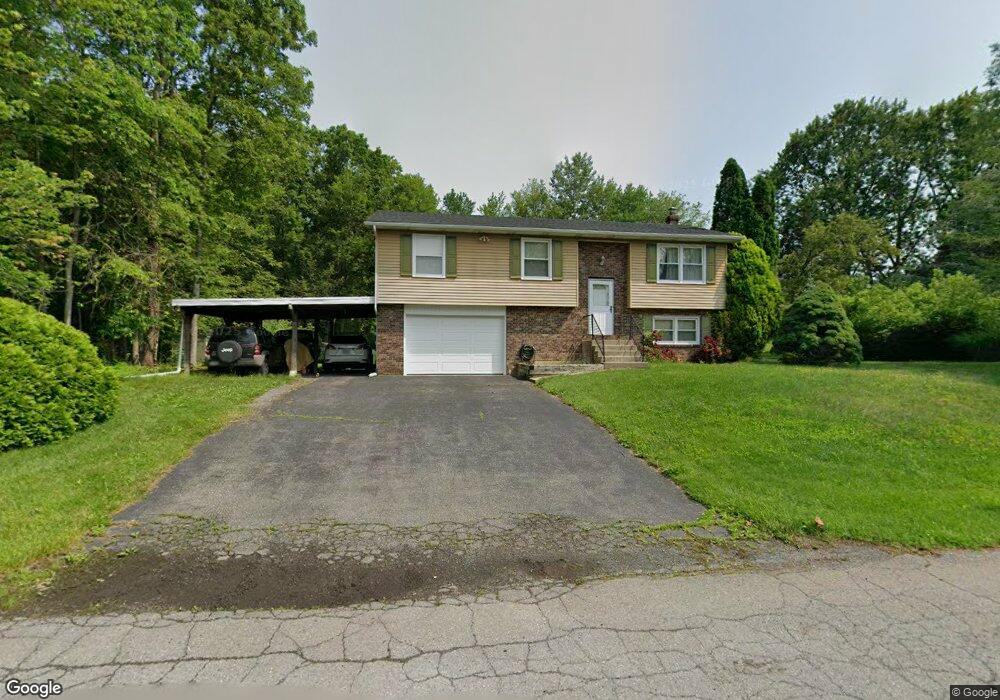
4022 Perry Ct W Danielsville, PA 18038
Estimated Value: $294,000 - $361,000
3
Beds
2
Baths
1,422
Sq Ft
$231/Sq Ft
Est. Value
About This Home
This home is located at 4022 Perry Ct W, Danielsville, PA 18038 and is currently estimated at $327,899, approximately $230 per square foot. 4022 Perry Ct W is a home located in Northampton County with nearby schools including Lehigh Elementary School, Northampton Area Middle School, and Northampton Area High School.
Ownership History
Date
Name
Owned For
Owner Type
Purchase Details
Closed on
Jan 10, 2008
Sold by
Schwartz Daniel R and Schwartz Jan L
Bought by
Osburn Gregory T and Carte Kathy J
Current Estimated Value
Home Financials for this Owner
Home Financials are based on the most recent Mortgage that was taken out on this home.
Original Mortgage
$206,150
Outstanding Balance
$130,194
Interest Rate
6.17%
Mortgage Type
Purchase Money Mortgage
Estimated Equity
$197,705
Purchase Details
Closed on
Oct 1, 1998
Bought by
Schwartz Daniel R and Schwartz Jan L
Create a Home Valuation Report for This Property
The Home Valuation Report is an in-depth analysis detailing your home's value as well as a comparison with similar homes in the area
Home Values in the Area
Average Home Value in this Area
Purchase History
| Date | Buyer | Sale Price | Title Company |
|---|---|---|---|
| Osburn Gregory T | $217,000 | None Available | |
| Schwartz Daniel R | $119,500 | -- |
Source: Public Records
Mortgage History
| Date | Status | Borrower | Loan Amount |
|---|---|---|---|
| Open | Osburn Gregory T | $206,150 |
Source: Public Records
Tax History Compared to Growth
Tax History
| Year | Tax Paid | Tax Assessment Tax Assessment Total Assessment is a certain percentage of the fair market value that is determined by local assessors to be the total taxable value of land and additions on the property. | Land | Improvement |
|---|---|---|---|---|
| 2025 | $542 | $50,200 | $20,200 | $30,000 |
| 2024 | $3,690 | $50,200 | $20,200 | $30,000 |
| 2023 | $3,625 | $50,200 | $20,200 | $30,000 |
| 2022 | $3,625 | $50,200 | $20,200 | $30,000 |
| 2021 | $3,634 | $50,200 | $20,200 | $30,000 |
| 2020 | $3,634 | $50,200 | $20,200 | $30,000 |
| 2019 | $3,581 | $50,200 | $20,200 | $30,000 |
| 2018 | $3,528 | $50,200 | $20,200 | $30,000 |
| 2017 | $3,451 | $50,200 | $20,200 | $30,000 |
| 2016 | -- | $50,200 | $20,200 | $30,000 |
| 2015 | -- | $50,200 | $20,200 | $30,000 |
| 2014 | -- | $50,200 | $20,200 | $30,000 |
Source: Public Records
Map
Nearby Homes
- 4083 W Mountain View Dr
- 4196 Independence Ln
- 0 Olive Rd
- 0 Walnut Dr
- 4237 Independence Ln
- 1015 Honeysuckle Rd
- 1437 Nectarine Rd
- 1150 E Stateside Dr
- 0 Mountain View Dr Unit 747924
- 1225 Meyer Dr
- 137 E Zimmer Dr
- 12 E Zimmer Dr
- 79 De Rose St
- 93 Nashua St
- 3829 Dogwood Rd
- 38 De Rose St
- 95 Nashua St
- 32 De Rose St
- 54 Zimmer Dr W Unit 54
- 4390 Woodland Cir
- 4014 Perry Ct W
- 1295 Mary Ct
- 4030 Perry Ct W
- 4023 Perry Ct W
- 1297 Mary Ct
- 4054 Perry Ct W
- 4031 Perry Ct W
- 1296 Mary Ct
- 4026 Charles Dr
- 4016 Charles Dr
- 4002 Perry Ct E
- 1294 Mary Ct
- 1278 Mary Dr
- 1298 Mary Ct
- 4032 Charles Dr
- 1274 Mary Dr
- 3998 Perry Ct E
- 1263 Mary Dr
- 1293 Blue Mountain Dr
- 4027 Charles Dr