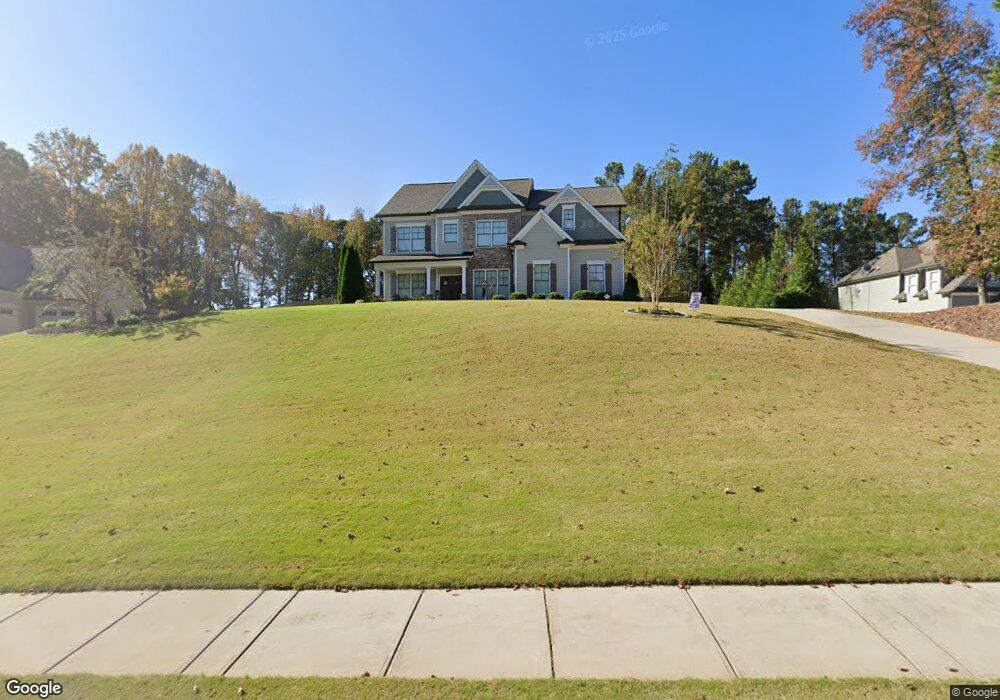
4022 Silverstone Dr Braselton, GA 30517
Estimated Value: $604,000 - $677,000
4
Beds
3
Baths
2,980
Sq Ft
$218/Sq Ft
Est. Value
About This Home
This home is located at 4022 Silverstone Dr, Braselton, GA 30517 and is currently estimated at $648,443, approximately $217 per square foot. 4022 Silverstone Dr is a home located in Hall County with nearby schools including Chestnut Mountain Elementary School, Cherokee Bluff Middle School, and Cherokee Bluff High School.
Ownership History
Date
Name
Owned For
Owner Type
Purchase Details
Closed on
Jul 1, 2016
Sold by
Atkinson Trust Llc
Bought by
Romero Jose Manuel and Romero Heather Marie
Current Estimated Value
Home Financials for this Owner
Home Financials are based on the most recent Mortgage that was taken out on this home.
Original Mortgage
$309,000
Outstanding Balance
$248,691
Interest Rate
3.66%
Mortgage Type
VA
Estimated Equity
$399,752
Purchase Details
Closed on
Dec 21, 2010
Sold by
Mf Georgia Ii Llc
Bought by
The Atkinson Trust Llc
Purchase Details
Closed on
Jun 25, 2010
Sold by
Bank Of North Georgia
Bought by
Mf Georgia Ii Llc
Purchase Details
Closed on
Oct 6, 2009
Sold by
Garen Homes Inc
Bought by
Bank Of North Georgia
Purchase Details
Closed on
Jun 25, 2007
Sold by
Ruby Forrest Inc
Bought by
Garen Homes Inc
Create a Home Valuation Report for This Property
The Home Valuation Report is an in-depth analysis detailing your home's value as well as a comparison with similar homes in the area
Home Values in the Area
Average Home Value in this Area
Purchase History
| Date | Buyer | Sale Price | Title Company |
|---|---|---|---|
| Romero Jose Manuel | -- | -- | |
| Romero Jose Manuel | $60,000 | -- | |
| The Atkinson Trust Llc | $11,100 | -- | |
| Mf Georgia Ii Llc | $11,900 | -- | |
| Bank Of North Georgia | -- | -- | |
| Garen Homes Inc | $450,000 | -- |
Source: Public Records
Mortgage History
| Date | Status | Borrower | Loan Amount |
|---|---|---|---|
| Open | Romero Jose Manuel | $309,000 | |
| Closed | Romero Jose Manuel | $309,000 |
Source: Public Records
Tax History
| Year | Tax Paid | Tax Assessment Tax Assessment Total Assessment is a certain percentage of the fair market value that is determined by local assessors to be the total taxable value of land and additions on the property. | Land | Improvement |
|---|---|---|---|---|
| 2025 | $5,985 | $261,520 | $67,480 | $194,040 |
| 2024 | $6,898 | $273,960 | $60,720 | $213,240 |
| 2023 | $5,823 | $246,120 | $49,480 | $196,640 |
| 2022 | $5,088 | $192,520 | $41,680 | $150,840 |
| 2021 | $4,304 | $159,160 | $19,800 | $139,360 |
| 2020 | $4,300 | $152,520 | $19,800 | $132,720 |
| 2019 | $4,325 | $152,080 | $19,800 | $132,280 |
| 2018 | $4,207 | $145,640 | $19,800 | $125,840 |
| 2017 | $3,768 | $131,520 | $19,800 | $111,720 |
| 2016 | $188 | $4,360 | $4,360 | $0 |
| 2015 | $185 | $4,360 | $4,360 | $0 |
| 2014 | $185 | $4,360 | $4,360 | $0 |
Source: Public Records
Map
Nearby Homes
- 4070 Silverstone Dr
- 1305 Overland Park Dr
- 3792 Tanners Mill Rd
- 5447 Winder Hwy
- 4528 White Horse Dr
- 3917 Kilgore Falls Dr
- 5465 Winder Hwy
- 4326 Caney Fork Cir
- 5255 Red Hawk Dr
- 4420 Benefield Rd
- 4126 Tanners Mill Rd
- 5007 Chastain Way
- 67 Pointer Ln
- 4719 Shady Lake Cir
- 5503 Tulis Dr
- 5322 Windridge Pkwy Unit 18A
- 5322 Windridge Pkwy
- 5326 Windridge Pkwy
- 5516 Tullis Dr
- 5516 Tullis Dr Unit 127A
- 4026 Silverstone Dr Unit 6
- 4026 Silverstone Dr
- 4018 Silverstone Dr Unit 4
- 4018 Silverstone Dr
- 4012 Silverstone Dr
- 4102 Brands Ct
- 4103 Brands Ct Unit 52
- 4103 Brands Ct
- 4017 Silverstone Dr
- 4008 Silverstone Dr
- 4008 Silverstone Dr Unit 2
- 4075 Ellison Farm Rd
- 4106 Brands Ct
- 4204 Norton Ln
- 4107 Brands Ct
- 4210 Norton Ln
- 4214 Norton Ln
- 4004 Silverstone Dr
- 4005 Silverstone Dr
- 4031 Silverstone Dr
Your Personal Tour Guide
Ask me questions while you tour the home.