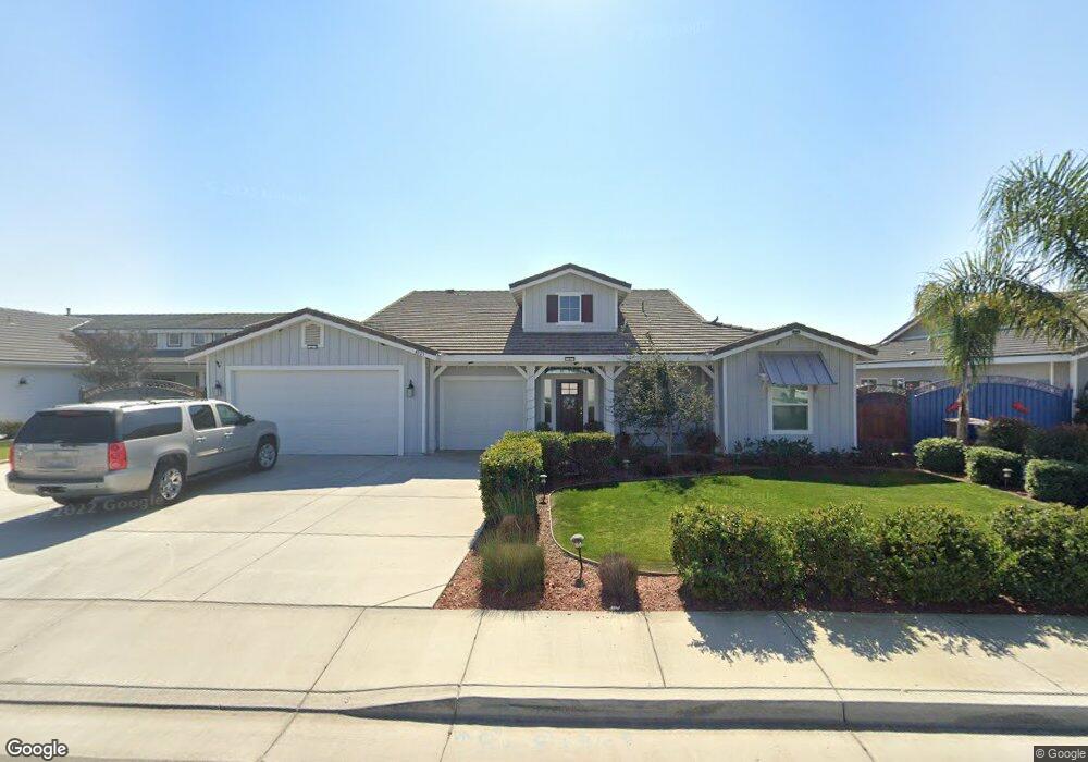
4023 Rolling Rock Ave Bakersfield, CA 93313
Stonegate NeighborhoodEstimated Value: $413,000 - $632,000
4
Beds
3
Baths
2,711
Sq Ft
$205/Sq Ft
Est. Value
About This Home
This home is located at 4023 Rolling Rock Ave, Bakersfield, CA 93313 and is currently estimated at $554,961, approximately $204 per square foot. 4023 Rolling Rock Ave is a home with nearby schools including Panama Elementary School, Stonecreek Junior High School, and Ridgeview High School.
Ownership History
Date
Name
Owned For
Owner Type
Purchase Details
Closed on
Feb 1, 2018
Sold by
D & A Premier Properties Llc
Bought by
Aralar Rhoderick
Current Estimated Value
Home Financials for this Owner
Home Financials are based on the most recent Mortgage that was taken out on this home.
Original Mortgage
$358,615
Outstanding Balance
$304,095
Interest Rate
4.04%
Mortgage Type
New Conventional
Estimated Equity
$250,866
Create a Home Valuation Report for This Property
The Home Valuation Report is an in-depth analysis detailing your home's value as well as a comparison with similar homes in the area
Home Values in the Area
Average Home Value in this Area
Purchase History
| Date | Buyer | Sale Price | Title Company |
|---|---|---|---|
| Aralar Rhoderick | $422,000 | Chicago Title Bakersfield |
Source: Public Records
Mortgage History
| Date | Status | Borrower | Loan Amount |
|---|---|---|---|
| Open | Aralar Rhoderick | $358,615 |
Source: Public Records
Tax History
| Year | Tax Paid | Tax Assessment Tax Assessment Total Assessment is a certain percentage of the fair market value that is determined by local assessors to be the total taxable value of land and additions on the property. | Land | Improvement |
|---|---|---|---|---|
| 2025 | $6,608 | $508,043 | $68,267 | $439,776 |
| 2024 | $6,506 | $498,083 | $66,929 | $431,154 |
| 2023 | $6,506 | $488,318 | $65,617 | $422,701 |
| 2022 | $6,249 | $478,745 | $64,331 | $414,414 |
| 2021 | $6,111 | $469,359 | $63,070 | $406,289 |
| 2020 | $6,042 | $464,548 | $62,424 | $402,124 |
| 2019 | $5,930 | $464,548 | $62,424 | $402,124 |
| 2018 | $3,974 | $296,664 | $33,664 | $263,000 |
| 2017 | $181 | $13,397 | $13,397 | $0 |
| 2016 | $204 | $13,135 | $13,135 | $0 |
Source: Public Records
Map
Nearby Homes
- 4403 Oceanrock Ave
- 8711 Dalby Ct
- 3305 Kimmie Rachelle Ct
- 8606 Rockhampton Dr
- 4401 Whitegate Ave
- 9506 Orchard Grass Ct
- 3006 Giovanetti Ave Unit 2
- 8119 Willoughby Ct
- 5414 Red Wheat Ave
- 2914 Tar Springs Ave
- 8201 Capitan Dr
- 2901 Flint Hills Dr
- 4307 Walker Lake Dr Unit 2
- 2310 Taft Hwy
- 2612 Trentino Ave
- 5808 Esmerelda Ave
- 5612 Mckee Rd
- 5918 Esmerelda Ave
- 4504 Basque St
- 5831 Mardal Ave
- 4029 Rolling Rock Ave
- 4024 Smoky Rock Ct
- 4030 Smoky Rock Ct
- 4018 Smoky Rock Ct
- 4011 Rolling Rock Ave
- 4030 Rolling Rock Ave
- 4024 Rolling Rock Ave
- 4012 Smoky Rock Ct
- 4018 Rolling Rock Ave
- 4005 Rolling Rock Ave
- 4012 Rolling Rock Ave
- 4101 Rolling Rock Ave
- 4006 Smoky Rock Ct
- 4100 Aquastone Ct
- 4025 Smoky Rock Ct
- 4006 Rolling Rock Ave
- 4019 Smoky Rock Ct
- 4031 Smoky Rock Ct
- 4100 Rolling Rock Ave
- 4013 Smoky Rock Ct
Your Personal Tour Guide
Ask me questions while you tour the home.