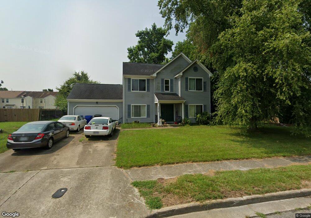
4024 Ebbtide Ln Portsmouth, VA 23703
Churchland NeighborhoodEstimated Value: $390,997 - $425,000
4
Beds
3
Baths
2,174
Sq Ft
$187/Sq Ft
Est. Value
About This Home
This home is located at 4024 Ebbtide Ln, Portsmouth, VA 23703 and is currently estimated at $406,999, approximately $187 per square foot. 4024 Ebbtide Ln is a home located in Portsmouth City with nearby schools including Churchland Primary/Intermediate School, Churchland Middle School, and Churchland High School.
Ownership History
Date
Name
Owned For
Owner Type
Purchase Details
Closed on
Jan 23, 2001
Sold by
Stewart Nancy A
Bought by
Conner James P
Current Estimated Value
Home Financials for this Owner
Home Financials are based on the most recent Mortgage that was taken out on this home.
Original Mortgage
$60,000
Outstanding Balance
$21,617
Interest Rate
7.39%
Estimated Equity
$385,382
Create a Home Valuation Report for This Property
The Home Valuation Report is an in-depth analysis detailing your home's value as well as a comparison with similar homes in the area
Home Values in the Area
Average Home Value in this Area
Purchase History
| Date | Buyer | Sale Price | Title Company |
|---|---|---|---|
| Conner James P | $154,500 | -- |
Source: Public Records
Mortgage History
| Date | Status | Borrower | Loan Amount |
|---|---|---|---|
| Open | Conner James P | $60,000 |
Source: Public Records
Tax History Compared to Growth
Tax History
| Year | Tax Paid | Tax Assessment Tax Assessment Total Assessment is a certain percentage of the fair market value that is determined by local assessors to be the total taxable value of land and additions on the property. | Land | Improvement |
|---|---|---|---|---|
| 2025 | $4,332 | $359,120 | $86,220 | $272,900 |
| 2024 | $4,332 | $338,280 | $86,220 | $252,060 |
| 2023 | $3,864 | $309,120 | $86,220 | $222,900 |
| 2022 | $3,964 | $304,950 | $86,220 | $218,730 |
| 2021 | $3,371 | $259,340 | $71,850 | $187,490 |
| 2020 | $3,246 | $249,670 | $68,430 | $181,240 |
| 2019 | $3,219 | $247,580 | $68,430 | $179,150 |
| 2018 | $3,219 | $247,580 | $68,430 | $179,150 |
| 2017 | $3,219 | $247,580 | $68,430 | $179,150 |
| 2016 | $3,110 | $239,250 | $68,430 | $170,820 |
| 2015 | $3,110 | $239,250 | $68,430 | $170,820 |
| 2014 | $3,028 | $238,460 | $68,430 | $170,030 |
Source: Public Records
Map
Nearby Homes
- 17 Shoal Ct
- 4071 Long Point Blvd
- 8 Compass Ct
- 3877 Peachtree Ln W
- 3818 Peach Orchard Cir
- 3913 Stateflower Ct
- 3866 Augustine Cir
- 3860 Sugar Creek Cir
- 6446 Olde Bullocks Cir
- 4100 Mayfair Way
- 3817 Harvest Ct
- 6417 Pelican Crescent N
- 3660B Towne Point Rd Unit A
- 5807 Dunkin St
- 3791 Towne Point Rd
- 3433 Willow Breeze Dr
- 3715 Magnolia Dr
- 3705 Bamboo Rd
- 21 Windy Pines Crescent
- 4200 Quince Rd
- 4108 Long Point Blvd
- 4020 Ebbtide Ln
- 4028 Ebbtide Ln
- 4112 Long Point Blvd
- 4116 Long Point Blvd
- 4120 Long Point Blvd
- 4003 Ketch Dr
- 4005 Ketch Dr
- 4025 Ebbtide Ln
- 4124 Long Point Blvd
- 4007 Ketch Dr
- 4016 Ebbtide Ln
- 4009 Ketch Dr
- 4128 Long Point Blvd
- 4029 Ebbtide Ln
- 4011 Ketch Dr
- 4017 Ebbtide Ln
- 4013 Ketch Dr
- 4109 Long Point Blvd
- 4015 Ketch Dr