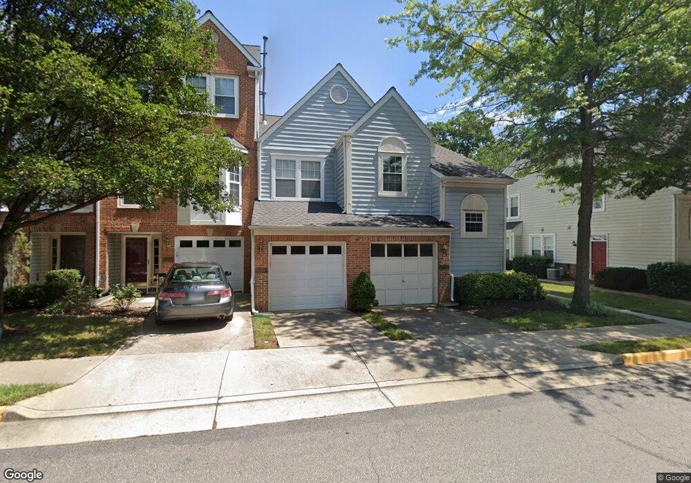
4027 Cressida Place Unit 63 Woodbridge, VA 22192
Old Bridge NeighborhoodEstimated Value: $420,578 - $461,000
2
Beds
2
Baths
1,494
Sq Ft
$291/Sq Ft
Est. Value
About This Home
This home is located at 4027 Cressida Place Unit 63, Woodbridge, VA 22192 and is currently estimated at $434,895, approximately $291 per square foot. 4027 Cressida Place Unit 63 is a home located in Prince William County with nearby schools including Gar-Field High School, Westridge Elementary School, and Woodbridge Middle School.
Ownership History
Date
Name
Owned For
Owner Type
Purchase Details
Closed on
Nov 26, 2007
Sold by
Young Kay B
Bought by
Givens Deborah E
Current Estimated Value
Home Financials for this Owner
Home Financials are based on the most recent Mortgage that was taken out on this home.
Original Mortgage
$265,828
Outstanding Balance
$169,817
Interest Rate
6.48%
Mortgage Type
FHA
Estimated Equity
$265,078
Purchase Details
Closed on
Apr 16, 2002
Sold by
Olson Rachel Roberts
Bought by
Young Kay B
Purchase Details
Closed on
Dec 2, 1997
Sold by
Pw Ll
Bought by
Roberts Rachel
Home Financials for this Owner
Home Financials are based on the most recent Mortgage that was taken out on this home.
Original Mortgage
$145,900
Interest Rate
7.26%
Mortgage Type
VA
Create a Home Valuation Report for This Property
The Home Valuation Report is an in-depth analysis detailing your home's value as well as a comparison with similar homes in the area
Home Values in the Area
Average Home Value in this Area
Purchase History
| Date | Buyer | Sale Price | Title Company |
|---|---|---|---|
| Givens Deborah E | $270,000 | -- | |
| Young Kay B | $178,000 | -- | |
| Roberts Rachel | $143,080 | -- |
Source: Public Records
Mortgage History
| Date | Status | Borrower | Loan Amount |
|---|---|---|---|
| Open | Givens Deborah E | $265,828 | |
| Previous Owner | Roberts Rachel | $145,900 |
Source: Public Records
Tax History Compared to Growth
Tax History
| Year | Tax Paid | Tax Assessment Tax Assessment Total Assessment is a certain percentage of the fair market value that is determined by local assessors to be the total taxable value of land and additions on the property. | Land | Improvement |
|---|---|---|---|---|
| 2025 | $3,505 | $372,500 | $98,500 | $274,000 |
| 2024 | $3,505 | $352,400 | $92,900 | $259,500 |
| 2023 | $3,414 | $328,100 | $86,000 | $242,100 |
| 2022 | $3,448 | $311,300 | $81,100 | $230,200 |
| 2021 | $3,275 | $267,100 | $69,300 | $197,800 |
| 2020 | $3,860 | $249,000 | $64,200 | $184,800 |
| 2019 | $3,591 | $231,700 | $58,200 | $173,500 |
| 2018 | $2,760 | $228,600 | $67,900 | $160,700 |
| 2017 | $2,731 | $220,000 | $63,200 | $156,800 |
| 2016 | $2,542 | $206,300 | $59,000 | $147,300 |
| 2015 | $2,032 | $192,100 | $49,200 | $142,900 |
| 2014 | $2,032 | $160,200 | $49,200 | $111,000 |
Source: Public Records
Map
Nearby Homes
- 4030 Cressida Place
- 3988 Cressida Place
- 12804 Evansport Place
- 12899 Bjork Ln
- 4140 Hummel Way
- 12687 Perchance Terrace
- 4104 Churchman Way
- 13203 Haddock Rd
- 12608 Kempston Ln
- 13203 Hampshire Ct
- 12551 Kempston Ln
- 13002 Kingswell Dr
- 13002 Kimbrough Ln
- 12608 Aubrey Glen Terrace
- 4550 Kendall Dr
- 4716 Kentwood Ln
- 13010 Kerrydale Rd
- 13014 Kerrydale Rd
- 12658 Stone Lined Cir
- 12289 Arabian Place
- 4025 Cressida Place
- 4021 Cressida Place
- 4021 Cressida Place Unit 61
- 4019 Cressida Place Unit 60
- 4031 Cressida Place
- 4029 Cressida Place Unit 66
- 4017 Cressida Place Unit 59
- 4033 Cressida Place
- 4035 Cressida Place Unit 68
- 4015 Cressida Place
- 4037 Cressida Place
- 4024 Cressida Place
- 4026 Cressida Place
- 4028 Cressida Place
- 4022 Cressida Place Unit 22
- 4020 Cressida Place
- 4039 Cressida Place Unit 70
- 4039 Cressida Place
- 4032 Cressida Place
- 4009 Cressida Place