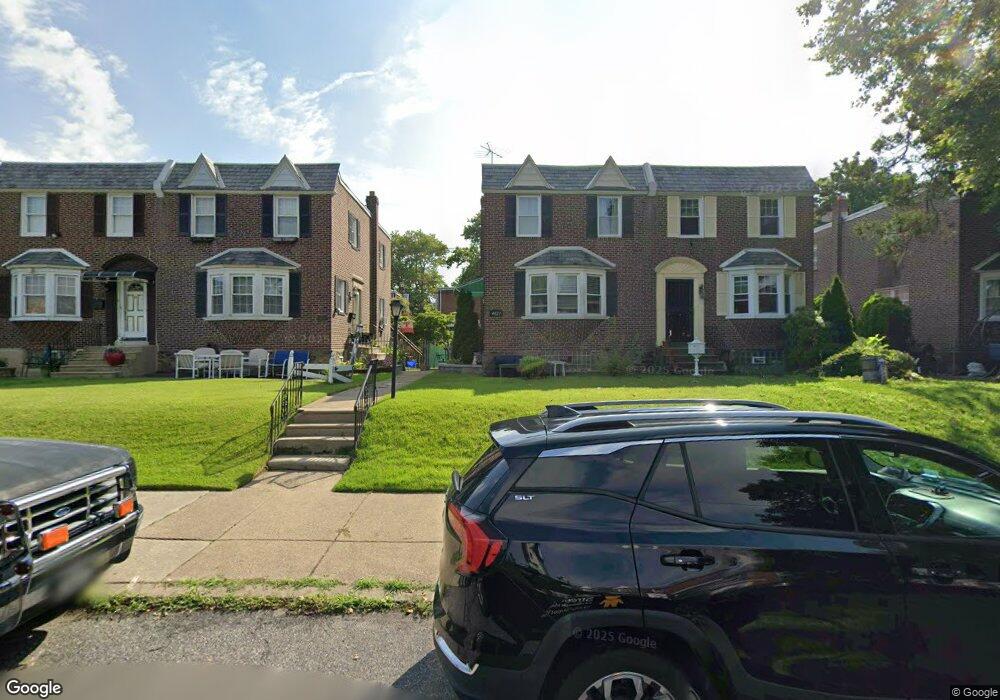
4027 Lansing St Philadelphia, PA 19136
Holmesburg NeighborhoodEstimated Value: $254,000 - $270,000
3
Beds
2
Baths
1,234
Sq Ft
$212/Sq Ft
Est. Value
About This Home
This home is located at 4027 Lansing St, Philadelphia, PA 19136 and is currently estimated at $262,166, approximately $212 per square foot. 4027 Lansing St is a home located in Philadelphia County with nearby schools including Edwin Forrest Elementary School, Lincoln High School, and Meehan Austin Middle School.
Ownership History
Date
Name
Owned For
Owner Type
Purchase Details
Closed on
Aug 27, 2002
Sold by
Costello Mary E
Bought by
Keller Joseph W
Current Estimated Value
Home Financials for this Owner
Home Financials are based on the most recent Mortgage that was taken out on this home.
Original Mortgage
$95,941
Outstanding Balance
$39,341
Interest Rate
6.25%
Mortgage Type
FHA
Estimated Equity
$222,825
Create a Home Valuation Report for This Property
The Home Valuation Report is an in-depth analysis detailing your home's value as well as a comparison with similar homes in the area
Home Values in the Area
Average Home Value in this Area
Purchase History
| Date | Buyer | Sale Price | Title Company |
|---|---|---|---|
| Keller Joseph W | $96,700 | Lawyers Title Insurance Corp |
Source: Public Records
Mortgage History
| Date | Status | Borrower | Loan Amount |
|---|---|---|---|
| Open | Keller Joseph W | $95,941 |
Source: Public Records
Tax History Compared to Growth
Tax History
| Year | Tax Paid | Tax Assessment Tax Assessment Total Assessment is a certain percentage of the fair market value that is determined by local assessors to be the total taxable value of land and additions on the property. | Land | Improvement |
|---|---|---|---|---|
| 2025 | $2,923 | $262,200 | $52,440 | $209,760 |
| 2024 | $2,923 | $262,200 | $52,440 | $209,760 |
| 2023 | $2,923 | $208,800 | $41,760 | $167,040 |
| 2022 | $1,140 | $208,800 | $41,760 | $167,040 |
| 2021 | $2,450 | $0 | $0 | $0 |
| 2020 | $2,450 | $0 | $0 | $0 |
| 2019 | $2,230 | $0 | $0 | $0 |
| 2018 | $2,045 | $0 | $0 | $0 |
| 2017 | $2,045 | $0 | $0 | $0 |
| 2016 | $2,045 | $0 | $0 | $0 |
| 2015 | $1,958 | $0 | $0 | $0 |
| 2014 | -- | $146,100 | $39,090 | $107,010 |
| 2012 | -- | $20,480 | $3,122 | $17,358 |
Source: Public Records
Map
Nearby Homes
- 4203 Hartel Ave
- 4016 Decatur St
- 4228 Hartel Ave
- 3556 Meridian St
- 4243 Chippendale St
- 4228 Rhawn St
- 4224 Chippendale Ave
- 4313 Sheffield Ave
- 3520 Ashville St
- 8053 Charles St
- 4317 Sheffield Ave
- 4011 Marple St
- 4214 Marple St
- 3515 Ashville St
- 4312 Rhawn St
- 4314 Rhawn St
- 3557 Oakmont St
- 4415 Mcmenamy St
- 3528 Chippendale Ave
- 4304 Oakmont St
- 4029 Lansing St
- 4025 Lansing St
- 4031 Lansing St
- 4023 Lansing St
- 4033 Lansing St
- 4021 Lansing St
- 4019 Lansing St
- 4028 Hartel Ave
- 4024 Hartel Ave
- 4022 Hartel Ave
- 4017 Lansing St
- 4030 Hartel Ave
- 4032 Hartel Ave
- 4026 Lansing St
- 4024 Lansing St
- 4028 Lansing St
- 4022 Lansing St
- 4020 Hartel Ave
- 4018 Hartel Ave
- 4030 Lansing St