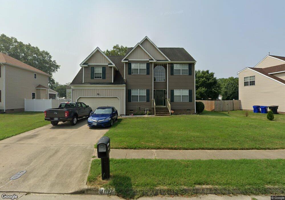
4027 Stowaway Ln Portsmouth, VA 23703
Churchland NeighborhoodEstimated Value: $407,422 - $424,000
4
Beds
3
Baths
2,529
Sq Ft
$164/Sq Ft
Est. Value
About This Home
This home is located at 4027 Stowaway Ln, Portsmouth, VA 23703 and is currently estimated at $414,856, approximately $164 per square foot. 4027 Stowaway Ln is a home located in Portsmouth City with nearby schools including Churchland Primary/Intermediate School, Churchland Middle School, and Churchland High School.
Ownership History
Date
Name
Owned For
Owner Type
Purchase Details
Closed on
Feb 19, 2013
Sold by
Armistead Sylvia L
Bought by
Armistead Ronald L and Armistead Sylvia L
Current Estimated Value
Home Financials for this Owner
Home Financials are based on the most recent Mortgage that was taken out on this home.
Original Mortgage
$176,017
Outstanding Balance
$123,126
Interest Rate
3.5%
Mortgage Type
FHA
Estimated Equity
$291,730
Create a Home Valuation Report for This Property
The Home Valuation Report is an in-depth analysis detailing your home's value as well as a comparison with similar homes in the area
Home Values in the Area
Average Home Value in this Area
Purchase History
| Date | Buyer | Sale Price | Title Company |
|---|---|---|---|
| Armistead Ronald L | -- | -- |
Source: Public Records
Mortgage History
| Date | Status | Borrower | Loan Amount |
|---|---|---|---|
| Open | Armistead Ronald L | $176,017 |
Source: Public Records
Tax History Compared to Growth
Tax History
| Year | Tax Paid | Tax Assessment Tax Assessment Total Assessment is a certain percentage of the fair market value that is determined by local assessors to be the total taxable value of land and additions on the property. | Land | Improvement |
|---|---|---|---|---|
| 2025 | $4,593 | $382,040 | $86,220 | $295,820 |
| 2024 | $4,593 | $359,490 | $86,220 | $273,270 |
| 2023 | $4,099 | $327,930 | $86,220 | $241,710 |
| 2022 | $4,205 | $323,430 | $86,220 | $237,210 |
| 2021 | $3,578 | $275,240 | $71,850 | $203,390 |
| 2020 | $3,446 | $265,060 | $68,430 | $196,630 |
| 2019 | $3,416 | $262,800 | $68,430 | $194,370 |
| 2018 | $3,416 | $262,800 | $68,430 | $194,370 |
| 2017 | $3,416 | $262,800 | $68,430 | $194,370 |
| 2016 | $3,299 | $253,790 | $68,430 | $185,360 |
| 2015 | $3,293 | $253,280 | $68,430 | $184,850 |
| 2014 | $3,217 | $253,280 | $68,430 | $184,850 |
Source: Public Records
Map
Nearby Homes
- 4071 Long Point Blvd
- 8 Compass Ct
- 17 Shoal Ct
- 6446 Olde Bullocks Cir
- 6417 Pelican Crescent N
- 4100 Mayfair Way
- 21 Windy Pines Crescent
- 3913 Stateflower Ct
- 3877 Peachtree Ln W
- 3818 Peach Orchard Cir
- 6750 Burbage Landing Cir
- 3866 Augustine Cir
- 6832 Ivanhoe Ct
- 3860 Sugar Creek Cir
- 5833 Hawthorne Ln
- 4726 River Shore Rd
- 6602 James Point Ct
- 3817 Harvest Ct
- 5807 Dunkin St
- 4200 Quince Rd