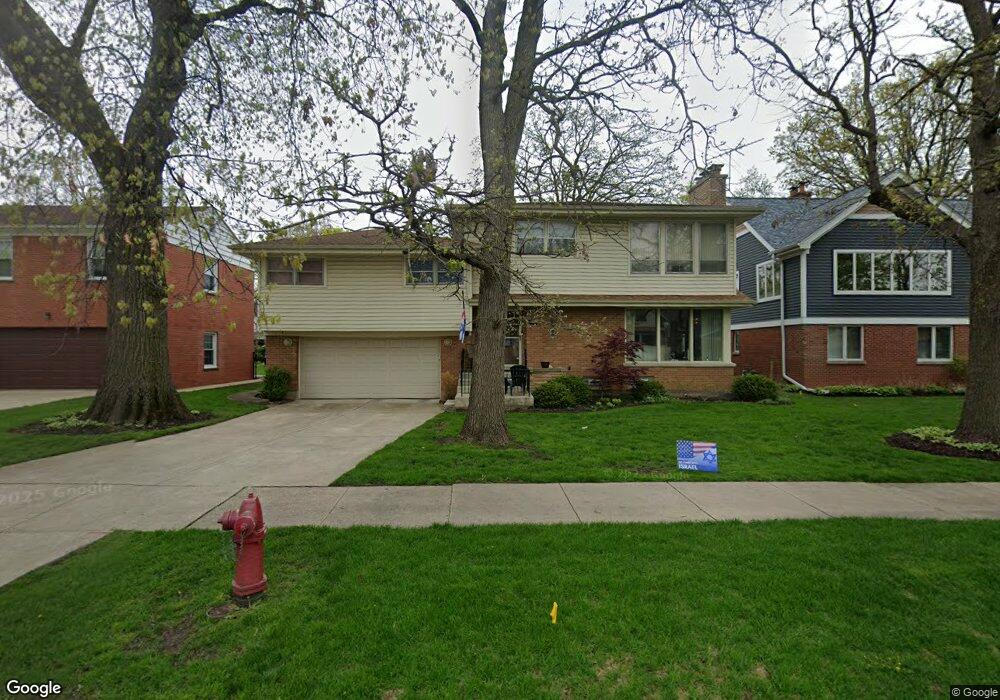
4028 Suffield Ct Skokie, IL 60076
North Skokie NeighborhoodEstimated Value: $925,488 - $1,016,000
5
Beds
6
Baths
3,490
Sq Ft
$278/Sq Ft
Est. Value
About This Home
This home is located at 4028 Suffield Ct, Skokie, IL 60076 and is currently estimated at $971,872, approximately $278 per square foot. 4028 Suffield Ct is a home located in Cook County with nearby schools including Old Orchard Jr High School, Devonshire Elementary School, and Niles North High School.
Ownership History
Date
Name
Owned For
Owner Type
Purchase Details
Closed on
Jan 12, 1994
Sold by
Polin Kenneth S and Polin Debra A
Bought by
Polin Kenneth S and Polin Debra A
Current Estimated Value
Purchase Details
Closed on
Oct 28, 1993
Sold by
Levin Julian D
Bought by
Polin Kenneth S and Polin Debra A
Home Financials for this Owner
Home Financials are based on the most recent Mortgage that was taken out on this home.
Original Mortgage
$200,000
Interest Rate
6.96%
Create a Home Valuation Report for This Property
The Home Valuation Report is an in-depth analysis detailing your home's value as well as a comparison with similar homes in the area
Home Values in the Area
Average Home Value in this Area
Purchase History
| Date | Buyer | Sale Price | Title Company |
|---|---|---|---|
| Polin Kenneth S | -- | -- | |
| Polin Kenneth S | $216,666 | -- |
Source: Public Records
Mortgage History
| Date | Status | Borrower | Loan Amount |
|---|---|---|---|
| Previous Owner | Polin Kenneth S | $200,000 |
Source: Public Records
Tax History Compared to Growth
Tax History
| Year | Tax Paid | Tax Assessment Tax Assessment Total Assessment is a certain percentage of the fair market value that is determined by local assessors to be the total taxable value of land and additions on the property. | Land | Improvement |
|---|---|---|---|---|
| 2024 | $14,701 | $64,810 | $10,296 | $54,514 |
| 2023 | $14,262 | $64,810 | $10,296 | $54,514 |
| 2022 | $14,262 | $64,810 | $10,296 | $54,514 |
| 2021 | $11,998 | $49,831 | $7,078 | $42,753 |
| 2020 | $12,663 | $49,831 | $7,078 | $42,753 |
| 2019 | $13,386 | $57,763 | $7,078 | $50,685 |
| 2018 | $13,408 | $53,205 | $6,220 | $46,985 |
| 2017 | $13,521 | $53,205 | $6,220 | $46,985 |
| 2016 | $13,155 | $53,205 | $6,220 | $46,985 |
| 2015 | $12,823 | $48,564 | $5,362 | $43,202 |
| 2014 | $13,006 | $50,276 | $5,362 | $44,914 |
| 2013 | $12,961 | $50,276 | $5,362 | $44,914 |
Source: Public Records
Map
Nearby Homes
- 3358 Dempster St
- 9010 Keeler Ave
- 9101 Sleeping Bear Rd
- 8720 Karlov Ave
- 4310 Church St
- 9249 Kildare Ave
- 9246 Kildare Ave
- 8600 E Prairie Rd
- 8521 Springfield Ave
- 9333 Kildare Ave
- 3639 Crain St
- 8822 Central Park Ave
- 4354 Lyons St
- 8607 Lawndale Ave
- 8449 Kedvale Ave
- 9349 N Lowell Ave
- 8414 Crawford Ave
- 8713 Drake Ave
- 9100 Kenton Ave
- 9234 Kolmar Ave
- 4032 Suffield Ct
- 4024 Suffield Ct
- 4024 Suffield Ct
- 4040 Suffield Ct
- 4029 Grove St
- 4019 Grove St Unit 1
- 4035 Grove St
- 4017 Grove St
- 4000 Suffield Ct
- 4000 Suffield Ct
- 4000 Suffield Ct
- 4000 Suffield Ct
- 4025 Suffield Ct
- 4029 Suffield Ct
- 8942 Crawford Ave
- 4041 Grove St
- 4035 Suffield Ct
- 4044 Suffield Ct
- 4044 Suffield Ct
- 8948 Crawford Ave