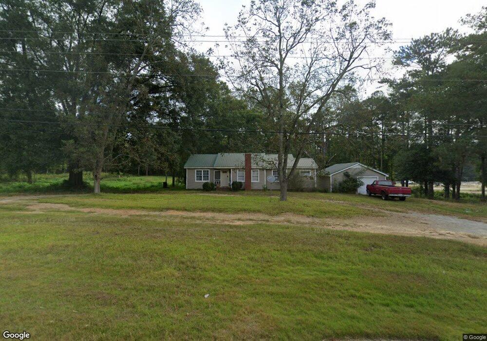
4029 N Highway 27 Carrollton, GA 30117
Estimated Value: $201,845 - $243,000
3
Beds
2
Baths
1,256
Sq Ft
$174/Sq Ft
Est. Value
About This Home
This home is located at 4029 N Highway 27, Carrollton, GA 30117 and is currently estimated at $218,211, approximately $173 per square foot. 4029 N Highway 27 is a home located in Carroll County with nearby schools including Mt. Zion Elementary School, Mt. Zion Middle School, and Mt. Zion High School.
Ownership History
Date
Name
Owned For
Owner Type
Purchase Details
Closed on
Dec 31, 2013
Sold by
West Metro Investors Of Ga Llc
Bought by
Dyer Timothy D and Dyer Karen M
Current Estimated Value
Purchase Details
Closed on
Sep 1, 2004
Sold by
West Georgia Flea
Bought by
Dyer Timothy D and Dyer Karen M
Purchase Details
Closed on
Jan 16, 1998
Sold by
Hammock
Bought by
West Georgia Flea
Purchase Details
Closed on
Oct 3, 1986
Bought by
Hammock
Create a Home Valuation Report for This Property
The Home Valuation Report is an in-depth analysis detailing your home's value as well as a comparison with similar homes in the area
Home Values in the Area
Average Home Value in this Area
Purchase History
| Date | Buyer | Sale Price | Title Company |
|---|---|---|---|
| Dyer Timothy D | -- | -- | |
| Dyer Timothy D | $250,000 | -- | |
| West Georgia Flea | $45,000 | -- | |
| Hammock | -- | -- |
Source: Public Records
Tax History Compared to Growth
Tax History
| Year | Tax Paid | Tax Assessment Tax Assessment Total Assessment is a certain percentage of the fair market value that is determined by local assessors to be the total taxable value of land and additions on the property. | Land | Improvement |
|---|---|---|---|---|
| 2024 | $1,386 | $61,280 | $6,344 | $54,936 |
| 2023 | $1,386 | $55,380 | $5,076 | $50,304 |
| 2022 | $1,062 | $42,355 | $1,925 | $40,430 |
| 2021 | $944 | $36,810 | $1,540 | $35,270 |
| 2020 | $835 | $32,513 | $1,400 | $31,113 |
| 2019 | $782 | $30,214 | $1,400 | $28,814 |
| 2018 | $612 | $23,312 | $1,400 | $21,912 |
| 2017 | $614 | $23,312 | $1,400 | $21,912 |
| 2016 | $614 | $23,312 | $1,400 | $21,912 |
| 2015 | $980 | $35,048 | $14,000 | $21,049 |
| 2014 | $984 | $35,049 | $14,000 | $21,049 |
Source: Public Records
Map
Nearby Homes
- 14 Cole Lake Rd
- 174 Katie Ln
- 676 Hog Liver Rd
- 68 Tyler Ln
- 405 Adler Point
- 00 Hog Liver Rd Unit 346
- 0 Hog Liver Rd Unit 148331
- 0 Hog Liver Rd Unit 10630257
- 0 Hog Liver Rd Unit 7671087
- 0 Hog Liver Rd Unit 10614601
- 0 Hog Liver Rd Unit 10630818
- 142 Tyler Ln
- 112 Turkey Creek Trail
- 469 Lee Williams Rd
- 406 Holly Springs Rd
- 898 Bowdon Junction Rd
- The Thomas 2 Plan at Lambert Overlook
- The Thomas Plan at Lambert Overlook
- The Brook Plan at Lambert Overlook
- 4748 Us Highway 27
- 4016 N Highway 27
- 4048 N Highway 27
- 3990 N Highway 27
- 4095 Us Highway 27
- 4095 N Highway 27
- 0 Coles Lake Rd Unit 7028649
- 0 Coles Lake Rd
- 4098 N Highway 27
- 465 Mandeville Ln
- 3972 U S 27
- 3972 N Highway 27
- 4119 N Highway 27
- 105 Bethlehem Church Rd
- 125 Bethlehem Church Rd
- 51 Bethlehem Church Rd
- 101 Bethlehem Church Rd
- 37 Cole Lake Rd
- 37 Bethlehem Church Rd
- 000 Bethlehem Church Rd
- 0 Bethlehem Church Rd Unit 8647945