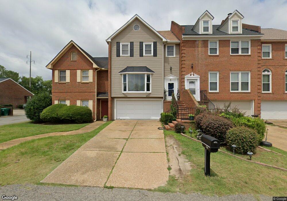
403 Bennington Ln Albany, GA 31707
Westover NeighborhoodEstimated Value: $146,000 - $178,370
2
Beds
3
Baths
1,394
Sq Ft
$115/Sq Ft
Est. Value
About This Home
This home is located at 403 Bennington Ln, Albany, GA 31707 and is currently estimated at $160,093, approximately $114 per square foot. 403 Bennington Ln is a home located in Dougherty County with nearby schools including Lake Park Elementary School, Merry Acres Middle School, and Westover High School.
Ownership History
Date
Name
Owned For
Owner Type
Purchase Details
Closed on
Dec 22, 2004
Sold by
Wale Robert E
Bought by
Wale Loria
Current Estimated Value
Purchase Details
Closed on
Aug 11, 1999
Sold by
Wale Robert E
Bought by
Wale Loria
Purchase Details
Closed on
Feb 23, 1999
Sold by
Miller Charles C
Bought by
Wale Robert E
Purchase Details
Closed on
Feb 19, 1999
Sold by
Street Ann Brim
Bought by
Miller Charles C
Purchase Details
Closed on
Jul 10, 1987
Sold by
Gardner B C
Bought by
Streat Ann Brim
Create a Home Valuation Report for This Property
The Home Valuation Report is an in-depth analysis detailing your home's value as well as a comparison with similar homes in the area
Home Values in the Area
Average Home Value in this Area
Purchase History
| Date | Buyer | Sale Price | Title Company |
|---|---|---|---|
| Wale Loria | -- | -- | |
| Wale Loria | -- | -- | |
| Wale Robert E | $92,000 | -- | |
| Miller Charles C | $92,000 | -- | |
| Streat Ann Brim | -- | -- |
Source: Public Records
Tax History Compared to Growth
Tax History
| Year | Tax Paid | Tax Assessment Tax Assessment Total Assessment is a certain percentage of the fair market value that is determined by local assessors to be the total taxable value of land and additions on the property. | Land | Improvement |
|---|---|---|---|---|
| 2024 | $2,227 | $48,680 | $4,800 | $43,880 |
| 2023 | $1,336 | $48,680 | $4,800 | $43,880 |
| 2022 | $2,183 | $48,680 | $4,800 | $43,880 |
| 2021 | $2,024 | $48,680 | $4,800 | $43,880 |
| 2020 | $2,029 | $48,680 | $4,800 | $43,880 |
| 2019 | $2,036 | $48,680 | $4,800 | $43,880 |
| 2018 | $2,045 | $48,680 | $4,800 | $43,880 |
| 2017 | $1,905 | $48,680 | $4,800 | $43,880 |
| 2016 | $1,906 | $48,680 | $4,800 | $43,880 |
| 2015 | -- | $48,680 | $4,800 | $43,880 |
| 2014 | $1,887 | $48,680 | $4,800 | $43,880 |
Source: Public Records
Map
Nearby Homes
- 1813 Gillionville Rd
- 415 Forest Glen Dr
- 427 S Audubon Dr
- 2613 Partridge Dr
- 418 Meadowlark Dr
- 2807 Stonewater Dr
- 607 Summit Dr
- 2508 Pheasant Dr
- 2802 Stonewater Dr
- 2814 Reeves Ln
- 1826 Green Valley Ln
- 1814 Green Valley Ln
- 120 Mossydale Ln
- 00 Gillionville Rd
- 2506 Ridgewood Ln
- 2200 Gillionville Rd
- 3108 Cane Mill Ct
- 1812 Robinhood Rd
- 2205 Star Ln
- 1800 Regalwood Dr
- 405 Bennington Ln
- 401 Bennington Ln
- 409 Bennington Ln
- 410 Kingswood Dr
- 2531 Gillionville Rd
- 2529 Gillionville Rd
- 405 Clarendon Ct
- 2527 Gillionville Rd
- 407 Clarendon Ct
- 412 Kingswood Dr
- 409 Clarendon Ct
- 409 Kingswood Dr
- 414 Kingswood Dr
- 411 Kingswood Dr
- 413 Kingswood Dr
- 415 Kingswood Dr
- 416 Kingswood Dr
- 417 Kingswood Dr
- 419 Kingswood Dr
- 410 Clarendon Ct