
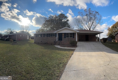

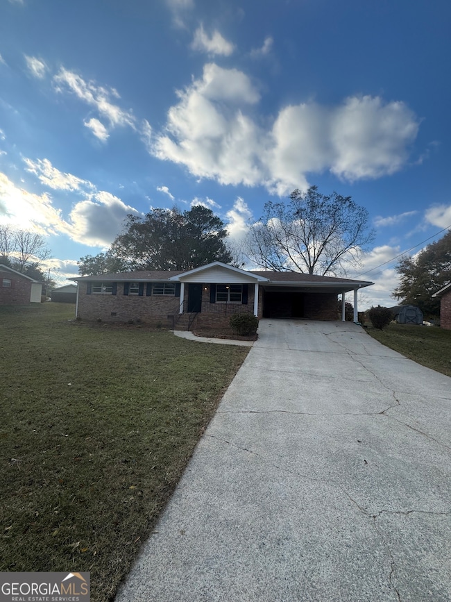


403 Burns Rd Carrollton, GA 30117
Estimated payment $1,455/month
Highlights
- Ranch Style House
- No HOA
- Four Sided Brick Exterior Elevation
- Carrollton Elementary School Rated A-
- Den
- Central Air
About This Home
Charming 3-Bedroom Brick Ranch Home! This beautifully updated four-sided brick ranch is ready for its new owners. Ideal for first-time homebuyers, this low-maintenance residence is situated in a prime location, just moments away from the vibrant offerings of downtown Carrollton, including shopping, dining, and the Greenbelt. This is an excellent opportunity to acquire an affordable home in a highly desirable area. Additionally, the property holds great potential as a rental investment. FHA Eligible after 12/15
Home Details
Home Type
- Single Family
Est. Annual Taxes
- $1,657
Year Built
- Built in 1970
Lot Details
- Level Lot
- Open Lot
Parking
- Carport
Home Design
- Ranch Style House
- Composition Roof
- Four Sided Brick Exterior Elevation
Interior Spaces
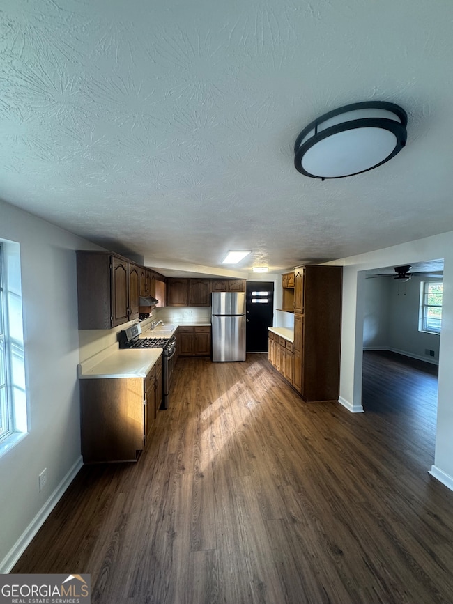
- 1,128 Sq Ft Home
- Family Room
- Den
- Crawl Space
- Oven or Range
- Laundry in Garage
Flooring
- Carpet
- Laminate
Bedrooms and Bathrooms
- 3 Main Level Bedrooms
- Bathtub Includes Tile Surround
Location
- City Lot
Schools
- Carrollton Elementary And Middle School
- Carrollton High School
Utilities
- Central Air
- Heating System Uses Natural Gas
- Gas Water Heater
Community Details
- No Home Owners Association
- Carroll Estates Subdivision
Map
Home Values in the Area
Average Home Value in this Area
Tax History
| Year | Tax Paid | Tax Assessment Tax Assessment Total Assessment is a certain percentage of the fair market value that is determined by local assessors to be the total taxable value of land and additions on the property. | Land | Improvement |
|---|---|---|---|---|
| 2024 | $1,522 | $60,654 | $6,000 | $54,654 |
| 2023 | $1,522 | $55,892 | $6,000 | $49,892 |
| 2022 | $1,342 | $45,989 | $6,000 | $39,989 |
| 2021 | $1,183 | $40,533 | $6,000 | $34,533 |
| 2020 | $1,073 | $36,738 | $6,000 | $30,738 |
| 2019 | $1,014 | $34,390 | $6,000 | $28,390 |
| 2018 | $932 | $31,140 | $6,000 | $25,140 |
| 2017 | $248 | $30,075 | $6,000 | $24,075 |
| 2016 | $197 | $30,267 | $6,000 | $24,267 |
| 2015 | $214 | $24,726 | $6,000 | $18,726 |
| 2014 | $216 | $24,726 | $6,000 | $18,726 |
Property History
| Date | Event | Price | List to Sale | Price per Sq Ft |
|---|---|---|---|---|
| 11/10/2025 11/10/25 | For Sale | $249,900 | -- | $222 / Sq Ft |
Purchase History
| Date | Type | Sale Price | Title Company |
|---|---|---|---|
| Warranty Deed | -- | -- | |
| Deed | -- | -- | |
| Deed | -- | -- | |
| Deed | -- | -- | |
| Deed | -- | -- | |
| Deed | -- | -- | |
| Deed | $18,900 | -- |
Source: Georgia MLS
MLS Number: 10640982
APN: C04-0090035
Disclaimer: Certain information contained herein is derived from information provided by parties other than Homes.com. All information provided is deemed reliable, but is not guaranteed to be accurate and should be independently verified.
![]() The data relating to real estate for sale on this web site comes in part from the Broker Reciprocity Program of Georgia MLS. Real estate listings held by brokerage firms other than Redfin are marked with the Broker Reciprocity logo and detailed information about them includes the name of the listing brokers. Information deemed reliable but not guaranteed. Copyright 2025 Georgia MLS. All rights reserved.
The data relating to real estate for sale on this web site comes in part from the Broker Reciprocity Program of Georgia MLS. Real estate listings held by brokerage firms other than Redfin are marked with the Broker Reciprocity logo and detailed information about them includes the name of the listing brokers. Information deemed reliable but not guaranteed. Copyright 2025 Georgia MLS. All rights reserved.
- 0 Carroll Cir Unit LOTS 4-8 10571562
- 150 Cedar Park Way
- 204 Burns Rd
- 0 Burns Rd Unit LOT 2 10571612
- 0 Burns Rd Unit LOT 3 10571635
- 0 Burns Rd Unit LOT 1 10571595
- 0 Burns Rd Unit 148013
- 0 Carroll Cir- Lots 4-8 Unit 148012
- 3 Burns Rd
- 2 Burns Rd
- 314 Belva St
- 223 N Lakeshore Dr
- 231 N Lakeshore Dr
- 8 Horsley Mill Rd
- 114 Green Point Way
- 9 Horsley Mill Rd
- 1711B Bankhead Hwy
- 103 Oxford Square
- 325 Almon Rd
- 208 Lane Dr
- 717 Burns Rd
- 200 Bledsoe St
- 300 Bledsoe St
- 107 Robinson Ave
- 205 Mara St
- 341 Clifton Terrace
- 124-125 Williams St
- 162 Poplar Point Dr
- 250 Northwinds Blvd
- 130 Waverly Way
- 1126 Maple St
- 333 Foster St
- 1205 Maple St
- 201 Hays Mill Rd
- 25 Quail Trail Unit 29
- 233 Hays Mill Rd
- 2325 Shady Grove Rd Unit B
- 2325 Shady Grove Rd Unit A
- 460 Hays Mill Rd
- 102 University Dr
