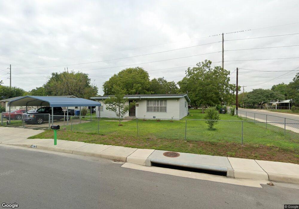
403 Flora Mae Dr San Antonio, TX 78220
Southeast Side NeighborhoodEstimated Value: $138,000 - $162,000
3
Beds
2
Baths
1,080
Sq Ft
$140/Sq Ft
Est. Value
About This Home
This home is located at 403 Flora Mae Dr, San Antonio, TX 78220 and is currently estimated at $150,862, approximately $139 per square foot. 403 Flora Mae Dr is a home located in Bexar County with nearby schools including Hirsch Elementary School, Sam Houston High School, and Southwest Preparatory School.
Ownership History
Date
Name
Owned For
Owner Type
Purchase Details
Closed on
Jul 27, 2006
Sold by
Deskin Stella and Umphers Stella Louise
Bought by
Robles Robert W and Robles Emelia G
Current Estimated Value
Home Financials for this Owner
Home Financials are based on the most recent Mortgage that was taken out on this home.
Original Mortgage
$62,406
Outstanding Balance
$37,508
Interest Rate
6.78%
Mortgage Type
FHA
Estimated Equity
$113,354
Purchase Details
Closed on
May 4, 2005
Sold by
Umphers Olen and Estate Of Lenard Lee Umphers
Bought by
Umphers Stella Louise
Create a Home Valuation Report for This Property
The Home Valuation Report is an in-depth analysis detailing your home's value as well as a comparison with similar homes in the area
Home Values in the Area
Average Home Value in this Area
Purchase History
| Date | Buyer | Sale Price | Title Company |
|---|---|---|---|
| Robles Robert W | -- | Lalt | |
| Umphers Stella Louise | -- | -- |
Source: Public Records
Mortgage History
| Date | Status | Borrower | Loan Amount |
|---|---|---|---|
| Open | Robles Robert W | $62,406 |
Source: Public Records
Tax History Compared to Growth
Tax History
| Year | Tax Paid | Tax Assessment Tax Assessment Total Assessment is a certain percentage of the fair market value that is determined by local assessors to be the total taxable value of land and additions on the property. | Land | Improvement |
|---|---|---|---|---|
| 2025 | $242 | $111,860 | $57,370 | $74,690 |
| 2024 | $242 | $101,691 | $57,370 | $74,690 |
| 2023 | $242 | $92,446 | $57,370 | $74,690 |
| 2022 | $2,277 | $84,042 | $45,520 | $69,270 |
| 2021 | $2,135 | $76,402 | $27,290 | $52,140 |
| 2020 | $1,969 | $69,456 | $19,870 | $50,040 |
| 2019 | $1,810 | $63,142 | $18,530 | $48,110 |
| 2018 | $1,629 | $57,402 | $16,060 | $48,860 |
| 2017 | $1,473 | $52,184 | $16,060 | $43,800 |
| 2016 | $1,339 | $47,440 | $10,090 | $37,350 |
| 2015 | $1,179 | $46,980 | $10,090 | $36,890 |
| 2014 | $1,179 | $51,310 | $0 | $0 |
Source: Public Records
Map
Nearby Homes
- 4851 Alfred Dr
- 203 Lynhaven Dr
- 4810 John Victor Dr
- 4906 Frostwood Dr
- 510 Carol Crest St
- 4823 John Victor Dr
- 302 Glenbrook
- 8532 Frostwood Dr
- 4631 Kay Ann Dr
- 4614 Belinda Lee St
- 4610 Belinda Lee St
- 4607 Belinda Lee St
- 4603 Lavender Ln
- 4534 Kay Ann Dr
- 4842 Lord Rd
- 257 Glenoak Dr
- 111 Zerrcliff Ln
- 126 Highway Dr
- 215 Midland Dr
- 4442 Lord Rd
- 411 Flora Mae Dr
- 4834 Billy Dr
- 415 Flora Mae Dr
- 4851 Billy Dr
- 4902 Huntsmoor Ct
- 4901 Waycross Ln
- 4835 Billy Dr
- 4830 Billy Dr
- 4900 Huntsmoor Ct
- 4905 Waycross Ln
- 4847 Alfred Dr
- 4826 Billy Dr
- 4904 Huntsmoor Ct
- 4900 Waycross Ln
- 4907 Waycross Ln
- 4831 Billy Dr
- 4901 Huntsmoor Ct
- 4822 Billy Dr
- 4906 Huntsmoor Ct
- 4902 Waycross Ln