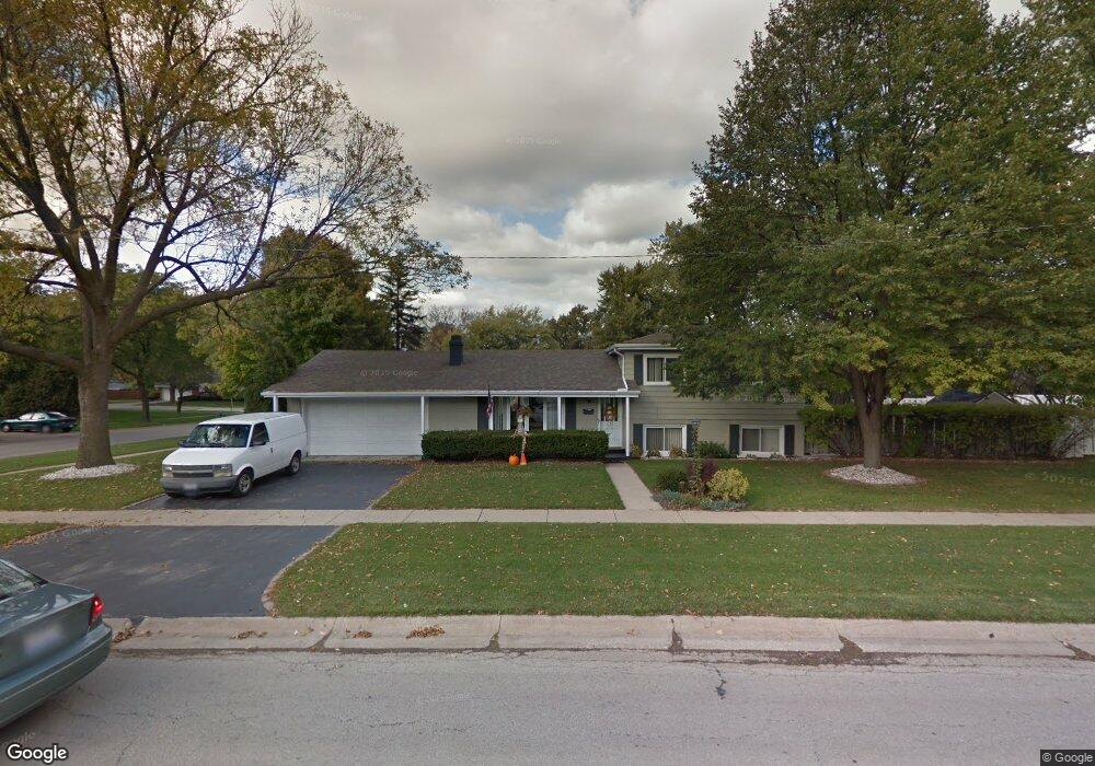
403 Keepataw Dr Lemont, IL 60439
Southeast Lemont NeighborhoodEstimated Value: $356,000 - $380,000
3
Beds
1
Bath
1,160
Sq Ft
$315/Sq Ft
Est. Value
About This Home
This home is located at 403 Keepataw Dr, Lemont, IL 60439 and is currently estimated at $365,376, approximately $314 per square foot. 403 Keepataw Dr is a home located in Cook County with nearby schools including Oakwood School, River Valley School, and Old Quarry Middle School.
Ownership History
Date
Name
Owned For
Owner Type
Purchase Details
Closed on
Jun 9, 2005
Sold by
Moravek Richard A and Moravek Elizabeth Ann
Bought by
Hebda Joseph M and Hebda Janice M
Current Estimated Value
Home Financials for this Owner
Home Financials are based on the most recent Mortgage that was taken out on this home.
Original Mortgage
$100,000
Outstanding Balance
$52,407
Interest Rate
5.82%
Mortgage Type
Fannie Mae Freddie Mac
Estimated Equity
$312,969
Create a Home Valuation Report for This Property
The Home Valuation Report is an in-depth analysis detailing your home's value as well as a comparison with similar homes in the area
Home Values in the Area
Average Home Value in this Area
Purchase History
| Date | Buyer | Sale Price | Title Company |
|---|---|---|---|
| Hebda Joseph M | $284,000 | Git |
Source: Public Records
Mortgage History
| Date | Status | Borrower | Loan Amount |
|---|---|---|---|
| Open | Hebda Joseph M | $100,000 |
Source: Public Records
Tax History Compared to Growth
Tax History
| Year | Tax Paid | Tax Assessment Tax Assessment Total Assessment is a certain percentage of the fair market value that is determined by local assessors to be the total taxable value of land and additions on the property. | Land | Improvement |
|---|---|---|---|---|
| 2024 | $4,787 | $29,000 | $5,850 | $23,150 |
| 2023 | $3,744 | $29,000 | $5,850 | $23,150 |
| 2022 | $3,744 | $21,578 | $5,175 | $16,403 |
| 2021 | $3,667 | $21,577 | $5,175 | $16,402 |
| 2020 | $3,803 | $21,577 | $5,175 | $16,402 |
| 2019 | $3,509 | $21,342 | $5,175 | $16,167 |
| 2018 | $3,448 | $21,342 | $5,175 | $16,167 |
| 2017 | $3,421 | $21,342 | $5,175 | $16,167 |
| 2016 | $3,281 | $16,394 | $4,275 | $12,119 |
| 2015 | $3,300 | $16,394 | $4,275 | $12,119 |
| 2014 | $3,345 | $16,394 | $4,275 | $12,119 |
| 2013 | $3,732 | $19,049 | $4,275 | $14,774 |
Source: Public Records
Map
Nearby Homes
- 417 Glenys Dr
- 1200 Prairie Ln Unit 1-A
- 1213 Prairie Ln
- 1224 Prairie Ln
- 1341 Ashbury Cir
- Fremont Plan at Covington Knolls
- Briarcliffe Plan at Covington Knolls
- Eden Plan at Covington Knolls
- Amberwood Plan at Covington Knolls
- Calysta Plan at Covington Knolls
- Danbury Plan at Covington Knolls
- 1228 Prairie Ln Unit 4B
- 1228 Prairie Ln
- 1232 Prairie Ln Unit 5-A
- 1382 Overton Dr
- 15500 E 127th St
- 1236 Prairie Ln Unit 5-B
- 905 State St
- 906 State St
- 1408 Ashbury Dr
- 1035 Hillview Dr
- 407 Keepataw Dr
- 1036 Crestview Dr
- 1033 Hillview Dr
- 1111 Hillview Dr
- 406 Keepataw Dr
- 1104 Hillview Dr
- 1106 Hillview Dr
- 358 Keepataw Dr
- 1108 Hillview Dr
- 1034 Crestview Dr
- 408 Keepataw Dr
- 1110 Hillview Dr
- 1031 Hillview Dr Unit 1
- 1112 Hillview Dr
- 410 Keepataw Dr
- 1037 Crestview Dr
- 359 Keepataw Dr
- 1115 Hillview Dr
- 405 Glenys Dr