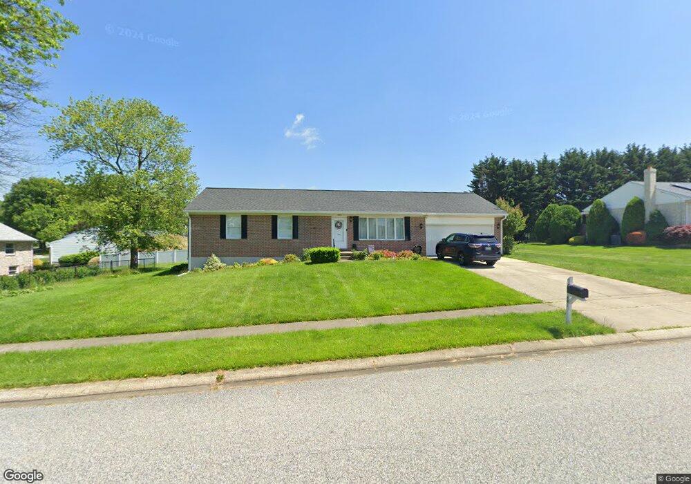
403 Mauser Dr Bel Air, MD 21015
Estimated Value: $456,275 - $524,000
3
Beds
3
Baths
1,620
Sq Ft
$298/Sq Ft
Est. Value
About This Home
This home is located at 403 Mauser Dr, Bel Air, MD 21015 and is currently estimated at $482,069, approximately $297 per square foot. 403 Mauser Dr is a home located in Harford County with nearby schools including Fountain Green Elementary School, Southampton Middle School, and C. Milton Wright High School.
Ownership History
Date
Name
Owned For
Owner Type
Purchase Details
Closed on
Dec 8, 2011
Sold by
Caron Arlene B
Bought by
Roberts Richard A and Roberts Colleen H
Current Estimated Value
Home Financials for this Owner
Home Financials are based on the most recent Mortgage that was taken out on this home.
Original Mortgage
$197,000
Interest Rate
3.99%
Mortgage Type
New Conventional
Purchase Details
Closed on
Mar 30, 1994
Sold by
Stephen Homes Inc
Bought by
Caron John R
Home Financials for this Owner
Home Financials are based on the most recent Mortgage that was taken out on this home.
Original Mortgage
$97,400
Interest Rate
7.07%
Create a Home Valuation Report for This Property
The Home Valuation Report is an in-depth analysis detailing your home's value as well as a comparison with similar homes in the area
Home Values in the Area
Average Home Value in this Area
Purchase History
| Date | Buyer | Sale Price | Title Company |
|---|---|---|---|
| Roberts Richard A | $283,000 | Sage Title Group Llc | |
| Caron John R | $190,250 | -- |
Source: Public Records
Mortgage History
| Date | Status | Borrower | Loan Amount |
|---|---|---|---|
| Previous Owner | Roberts Richard A | $197,000 | |
| Previous Owner | Caron John R | $97,400 |
Source: Public Records
Tax History
| Year | Tax Paid | Tax Assessment Tax Assessment Total Assessment is a certain percentage of the fair market value that is determined by local assessors to be the total taxable value of land and additions on the property. | Land | Improvement |
|---|---|---|---|---|
| 2025 | -- | $365,000 | $98,900 | $266,100 |
| 2024 | -- | $347,067 | $0 | $0 |
| 2023 | -- | $329,133 | $0 | $0 |
| 2022 | $3,392 | $311,200 | $98,900 | $212,300 |
| 2020 | $3,174 | $291,733 | $0 | $0 |
| 2019 | $3,174 | $282,000 | $113,200 | $168,800 |
| 2018 | $70 | $275,033 | $0 | $0 |
| 2017 | $70 | $282,000 | $0 | $0 |
| 2016 | $70 | $261,100 | $0 | $0 |
| 2015 | $3,046 | $260,800 | $0 | $0 |
| 2014 | $3,046 | $260,500 | $0 | $0 |
Source: Public Records
Map
Nearby Homes
- 503 Mauser Dr
- 1723 E Churchville Rd
- 1522 Southview Rd
- 113 Crescent Dr
- 1612 Ruger Dr
- 1837 E Churchville Rd
- 1601 Redfield Rd
- 1204 Athens Ct
- 718 Beretta Way
- 1224 Marston Ct
- 1838 Braavos Ct
- 1245 Athens Ct
- 1402 Bonnett Place Unit 131
- 1406 Bonnett Place Unit 201
- 1622 Shady Tree Ct
- 1307 Sheridan Place Unit 80
- 1619 Shady Tree Ct
- 1617 Shady Tree Ct
- 1310 Sheridan Place Unit 208
- 1309 Sheridan Place Unit 99
- 405 Mauser Dr
- 1801 Prindle Dr
- 503 Barnside Place
- 1803 Prindle Dr
- 402 Forehand Ct
- 404 Mauser Dr
- 402 Mauser Dr
- 404 Forehand Ct
- 406 Mauser Dr
- 1709 Prindle Dr
- 505 Barnside Place
- 1800 Prindle Dr
- 408 Mauser Dr
- 501 Mauser Dr
- 406 Forehand Ct
- 1802 Prindle Dr
- 1811 Prindle Dr
- 403 Forehand Ct
- 1708 Prindle Dr
- 401 Winslow Dr
Your Personal Tour Guide
Ask me questions while you tour the home.