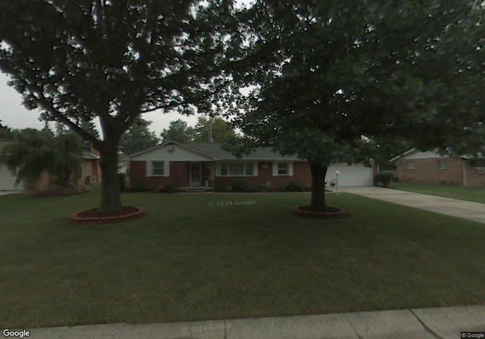
403 Meadow Ln Walbridge, OH 43465
Estimated Value: $224,000 - $263,000
3
Beds
2
Baths
1,637
Sq Ft
$149/Sq Ft
Est. Value
About This Home
This home is located at 403 Meadow Ln, Walbridge, OH 43465 and is currently estimated at $243,481, approximately $148 per square foot. 403 Meadow Ln is a home located in Wood County with nearby schools including Lake Elementary School, Lake Middle School, and Lake High School.
Ownership History
Date
Name
Owned For
Owner Type
Purchase Details
Closed on
May 4, 2017
Sold by
Rupley James W
Bought by
Swartzmiller Riley J
Current Estimated Value
Home Financials for this Owner
Home Financials are based on the most recent Mortgage that was taken out on this home.
Original Mortgage
$115,000
Outstanding Balance
$94,593
Interest Rate
4.14%
Mortgage Type
New Conventional
Estimated Equity
$148,888
Purchase Details
Closed on
Jul 2, 1996
Sold by
Miller William F
Bought by
Rupley James W and Rupley Katherine R
Purchase Details
Closed on
Nov 9, 1990
Bought by
Miller William F
Create a Home Valuation Report for This Property
The Home Valuation Report is an in-depth analysis detailing your home's value as well as a comparison with similar homes in the area
Home Values in the Area
Average Home Value in this Area
Purchase History
| Date | Buyer | Sale Price | Title Company |
|---|---|---|---|
| Swartzmiller Riley J | $145,000 | None Available | |
| Rupley James W | -- | None Available | |
| Rupley James W | $119,000 | -- | |
| Miller William F | $95,000 | -- |
Source: Public Records
Mortgage History
| Date | Status | Borrower | Loan Amount |
|---|---|---|---|
| Open | Swartzmiller Riley J | $115,000 |
Source: Public Records
Tax History
| Year | Tax Paid | Tax Assessment Tax Assessment Total Assessment is a certain percentage of the fair market value that is determined by local assessors to be the total taxable value of land and additions on the property. | Land | Improvement |
|---|---|---|---|---|
| 2025 | $2,827 | $63,525 | $14,385 | $49,140 |
| 2024 | $2,814 | $63,525 | $14,385 | $49,140 |
| 2023 | $2,814 | $63,530 | $14,390 | $49,140 |
| 2021 | $2,806 | $53,970 | $14,210 | $39,760 |
| 2020 | $2,695 | $53,970 | $14,210 | $39,760 |
| 2019 | $2,505 | $46,240 | $14,210 | $32,030 |
| 2018 | $2,567 | $46,240 | $14,210 | $32,030 |
| 2017 | $1,954 | $46,240 | $14,210 | $32,030 |
| 2016 | $1,824 | $43,300 | $14,210 | $29,090 |
| 2015 | $1,824 | $43,300 | $14,210 | $29,090 |
| 2014 | $1,928 | $43,300 | $14,210 | $29,090 |
| 2013 | $1,005 | $43,300 | $14,210 | $29,090 |
Source: Public Records
Map
Nearby Homes
- 238 S Bridge Rd
- 236 S Bridge Rd
- 224 S Bridge Rd
- 232 S Bridge Rd
- 241 S Bridge Rd
- 237 S Bridge Rd
- 504 N Main St
- 225 E Union St
- 30643 Drouillard Rd
- Integrity 1750 Plan at Meadowgate
- Integrity 1530 Plan at Meadowgate
- Integrity 1605 Plan at Meadowgate
- integrity 2280 Plan at Meadowgate
- Integrity 2061 V8.1a Plan at Meadowgate
- Integrity 2080 Plan at Meadowgate
- Integrity 1830 Plan at Meadowgate
- Integrity 1910 Plan at Meadowgate
- Integrity 2060 Plan at Meadowgate
- Integrity 2000 Plan at Meadowgate
- Integrity 1880 Plan at Meadowgate
Your Personal Tour Guide
Ask me questions while you tour the home.