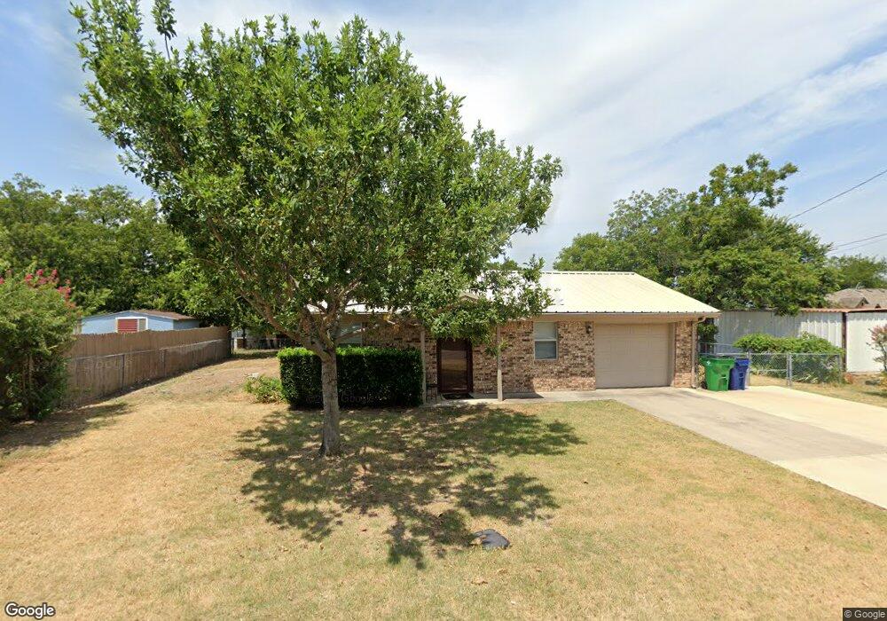
403 N Trenchard St Decatur, TX 76234
Estimated Value: $203,000 - $251,000
2
Beds
1
Bath
999
Sq Ft
$217/Sq Ft
Est. Value
About This Home
This home is located at 403 N Trenchard St, Decatur, TX 76234 and is currently estimated at $216,742, approximately $216 per square foot. 403 N Trenchard St is a home located in Wise County with nearby schools including Decatur High School and Victory Christian Academy.
Ownership History
Date
Name
Owned For
Owner Type
Purchase Details
Closed on
Jan 17, 2023
Sold by
Griggs Tyler W
Bought by
Hachtel Dustin
Current Estimated Value
Home Financials for this Owner
Home Financials are based on the most recent Mortgage that was taken out on this home.
Original Mortgage
$200,000
Outstanding Balance
$158,333
Interest Rate
6.33%
Mortgage Type
Seller Take Back
Estimated Equity
$58,409
Purchase Details
Closed on
Dec 4, 2014
Sold by
Waylett Leisa G and Waylett Lillis
Bought by
Hachtel Robert
Purchase Details
Closed on
Jan 23, 2004
Sold by
Waylett Leisa G
Bought by
Hachtel Robert
Purchase Details
Closed on
Dec 17, 2003
Sold by
Ashworth Annie L
Bought by
Hachtel Robert
Create a Home Valuation Report for This Property
The Home Valuation Report is an in-depth analysis detailing your home's value as well as a comparison with similar homes in the area
Home Values in the Area
Average Home Value in this Area
Purchase History
| Date | Buyer | Sale Price | Title Company |
|---|---|---|---|
| Hachtel Dustin | -- | Texas Title | |
| Hachtel Robert | -- | None Available | |
| Hachtel Robert | -- | -- | |
| Hachtel Robert | -- | -- |
Source: Public Records
Mortgage History
| Date | Status | Borrower | Loan Amount |
|---|---|---|---|
| Open | Hachtel Dustin | $200,000 |
Source: Public Records
Tax History Compared to Growth
Tax History
| Year | Tax Paid | Tax Assessment Tax Assessment Total Assessment is a certain percentage of the fair market value that is determined by local assessors to be the total taxable value of land and additions on the property. | Land | Improvement |
|---|---|---|---|---|
| 2025 | $1,048 | $182,079 | -- | -- |
| 2024 | $1,048 | $165,526 | $0 | $0 |
| 2023 | $2,730 | $150,478 | $0 | $0 |
| 2022 | $2,996 | $136,798 | $0 | $0 |
| 2021 | $2,838 | $129,220 | $34,760 | $94,460 |
| 2020 | $2,652 | $122,510 | $32,590 | $89,920 |
| 2019 | $2,547 | $120,430 | $32,590 | $87,840 |
| 2018 | $2,416 | $106,380 | $13,040 | $93,340 |
| 2017 | $2,205 | $84,940 | $13,040 | $71,900 |
| 2016 | $2,095 | $85,020 | $13,040 | $71,980 |
| 2015 | -- | $73,370 | $10,860 | $62,510 |
| 2014 | -- | $71,940 | $8,690 | $63,250 |
Source: Public Records
Map
Nearby Homes
- 407 N Lane St
- 606 W Mulberry St
- 0 N Hwy 287 Unit 25379920
- 304 Cyndilu Ln
- 1 S Martin Extension
- 601 W Brady St
- 101 E Mulberry St
- 401 S Holman St
- 700 N Church St
- 802 N Church St
- 903 N Miller St
- 4112 U S 380
- 50+/- acres U S 380
- 305 E Shoemaker St
- 114 Sondra Lin Blvd
- TBD Farm To Market 51
- 602 N Cates St
- W W Rose Ave
- 204 W Collins St
- 307 E Vernon St
- 404 N Cowan St
- 402 N Trenchard St
- 406 N Cowan St
- 404 N Trenchard St
- 405 N Trenchard St
- 600 W Oak St
- 406 N Trenchard St
- 400 N Trenchard St
- 602 W Oak St
- 414 W Oak St
- 505 W Ash St
- 405 N Cowan St
- 407 N Cowan St
- 409 N Cowan St
- 553 W Oak St
- 503 W Ash St
- 602 W Mill St
- 303 N Cowan St
- 501 W Oak St
- 501 N Cowan St