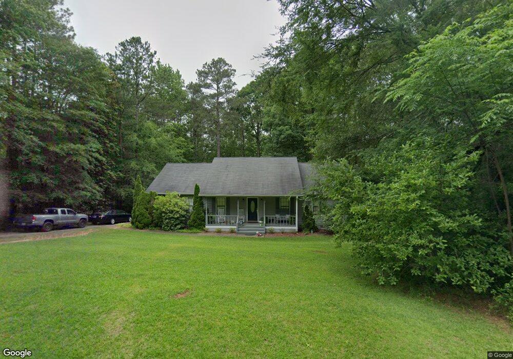
403 Taylor Dr Forsyth, GA 31029
Estimated Value: $245,406 - $311,000
Studio
2
Baths
1,830
Sq Ft
$149/Sq Ft
Est. Value
About This Home
This home is located at 403 Taylor Dr, Forsyth, GA 31029 and is currently estimated at $272,469, approximately $148 per square foot. 403 Taylor Dr is a home located in Monroe County with nearby schools including T.G. Scott Elementary School, Mary Persons High School, and Lighthouse Academy.
Ownership History
Date
Name
Owned For
Owner Type
Purchase Details
Closed on
Jun 20, 2007
Sold by
Not Provided
Bought by
Callahan Rodney O and Callahan Caroline C
Current Estimated Value
Home Financials for this Owner
Home Financials are based on the most recent Mortgage that was taken out on this home.
Original Mortgage
$161,025
Outstanding Balance
$97,945
Interest Rate
6.35%
Mortgage Type
New Conventional
Estimated Equity
$174,524
Purchase Details
Closed on
Apr 15, 1999
Purchase Details
Closed on
Jul 17, 1996
Purchase Details
Closed on
Dec 30, 1991
Create a Home Valuation Report for This Property
The Home Valuation Report is an in-depth analysis detailing your home's value as well as a comparison with similar homes in the area
Home Values in the Area
Average Home Value in this Area
Purchase History
| Date | Buyer | Sale Price | Title Company |
|---|---|---|---|
| Callahan Rodney O | $169,500 | -- | |
| -- | $15,000 | -- | |
| -- | $649,400 | -- | |
| -- | -- | -- |
Source: Public Records
Mortgage History
| Date | Status | Borrower | Loan Amount |
|---|---|---|---|
| Open | Callahan Rodney O | $161,025 |
Source: Public Records
Tax History
| Year | Tax Paid | Tax Assessment Tax Assessment Total Assessment is a certain percentage of the fair market value that is determined by local assessors to be the total taxable value of land and additions on the property. | Land | Improvement |
|---|---|---|---|---|
| 2025 | $1,240 | $71,280 | $11,520 | $59,760 |
| 2024 | $1,240 | $71,280 | $11,520 | $59,760 |
| 2023 | $1,196 | $61,320 | $11,520 | $49,800 |
| 2022 | $937 | $61,320 | $11,520 | $49,800 |
| 2021 | $965 | $61,320 | $11,520 | $49,800 |
| 2020 | $1,014 | $61,320 | $11,520 | $49,800 |
| 2019 | $1,021 | $61,320 | $11,520 | $49,800 |
| 2018 | $1,611 | $61,320 | $11,520 | $49,800 |
| 2017 | $1,966 | $61,320 | $11,520 | $49,800 |
| 2016 | $1,541 | $61,320 | $11,520 | $49,800 |
| 2015 | $1,471 | $61,320 | $11,520 | $49,800 |
| 2014 | $1,455 | $61,320 | $11,520 | $49,800 |
Source: Public Records
Map
Nearby Homes
- 0 Loraine Forest Courts Unit 10706300
- 285 E Main St
- 243 Copper Crossing
- 0 Patrol Rd Unit 10711373
- 101 E Chambers St
- S S Lee St
- 0 S Lee St Unit 10646818
- 311 Clover Pass
- 131 Hawthorne Ln
- 125 Hawthorne Ln
- 155 Hawthorne Ln
- 0 Benson Ham Rd Unit OUTPARCEL 1 10551782
- 0 Benson Ham Rd Unit OUTPARCEL 2 10558340
- 0 Georgia 42 Unit 260376
- 4580 Capulet Ct
- 33 Mitchell Rd
- 436 Magnolia Ct
- 155 W Johnston St
- 62 Dew Place
- 60 Dew Place
- 365 Taylor Dr
- 405 Taylor Dr
- 406 Taylor Dr
- 102 Oglethorpe St
- 402 Taylor Dr
- 107 Oglethorpe St Unit 178
- 107 Oglethorpe St
- 404 Taylor Dr
- Lot 258 Taylor Dr
- 0 Taylor Dr Unit LOT258 2624957
- 0 Taylor Dr Unit LOT 258 7068729
- 0 Taylor Dr Unit 7415374
- 0 Taylor Dr Unit M129731
- 105 Oglethorpe St
- 211 Newton Dr
- 409 Taylor Dr
- 101 Oglethorpe St
- 215 Newton Dr
- 207 Newton Dr
- 411 Taylor Dr
Your Personal Tour Guide
Ask me questions while you tour the home.