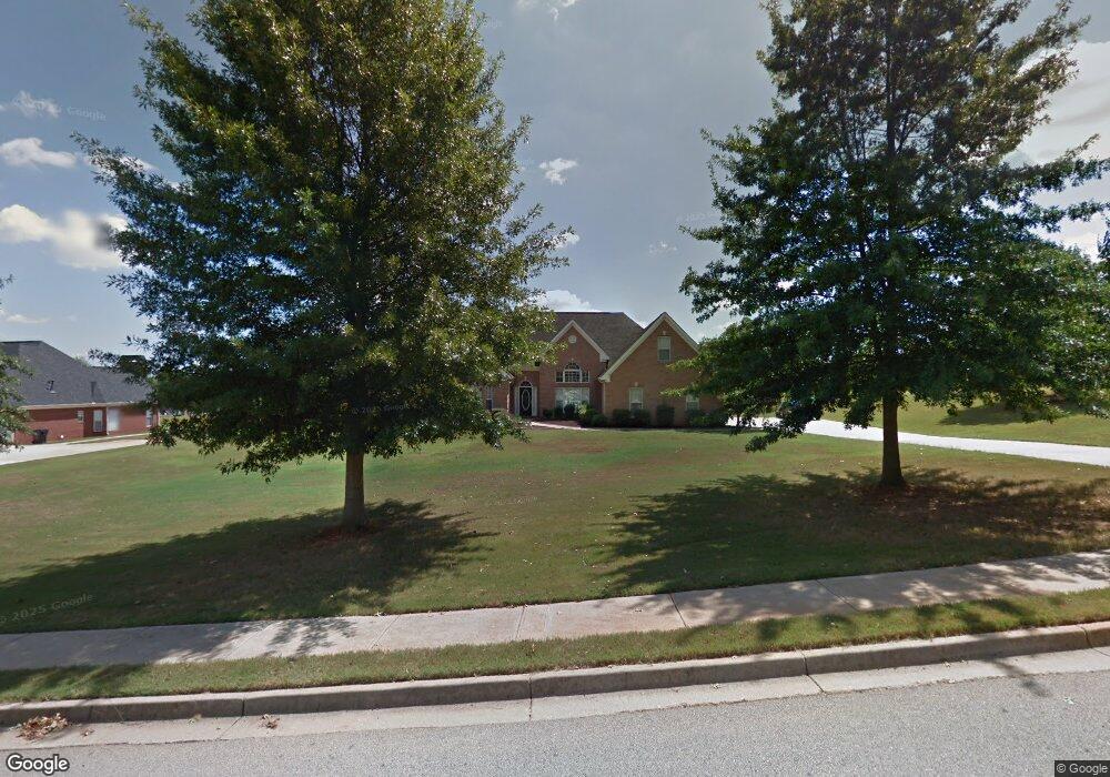
403 Tomahawk Trail McDonough, GA 30252
Estimated Value: $394,968 - $534,000
3
Beds
3
Baths
2,954
Sq Ft
$152/Sq Ft
Est. Value
About This Home
This home is located at 403 Tomahawk Trail, McDonough, GA 30252 and is currently estimated at $449,992, approximately $152 per square foot. 403 Tomahawk Trail is a home located in Henry County with nearby schools including Timber Ridge Elementary School, Union Grove Middle School, and Union Grove High School.
Ownership History
Date
Name
Owned For
Owner Type
Purchase Details
Closed on
Oct 28, 2010
Sold by
Deats William D and Deats Sandra B
Bought by
Deats William D and Deats Sandra B
Current Estimated Value
Home Financials for this Owner
Home Financials are based on the most recent Mortgage that was taken out on this home.
Original Mortgage
$120,000
Outstanding Balance
$78,334
Interest Rate
4.37%
Mortgage Type
New Conventional
Estimated Equity
$371,658
Purchase Details
Closed on
Oct 15, 2007
Sold by
Hsbc Mtg Svcs Inc
Bought by
Deats William D and Deats Sandra B
Home Financials for this Owner
Home Financials are based on the most recent Mortgage that was taken out on this home.
Original Mortgage
$165,600
Interest Rate
6.44%
Mortgage Type
New Conventional
Purchase Details
Closed on
Nov 7, 2006
Sold by
Lounnarath Bounlieng S and Lounnarath Noy K
Bought by
Hsbc Mtg Svcs Inc
Purchase Details
Closed on
May 18, 2001
Sold by
Atha Eugene and Atha Allen
Bought by
Lounnarath Bounlieng S and Lounnarath Kongkeo
Home Financials for this Owner
Home Financials are based on the most recent Mortgage that was taken out on this home.
Original Mortgage
$214,800
Interest Rate
7.11%
Mortgage Type
New Conventional
Create a Home Valuation Report for This Property
The Home Valuation Report is an in-depth analysis detailing your home's value as well as a comparison with similar homes in the area
Home Values in the Area
Average Home Value in this Area
Purchase History
| Date | Buyer | Sale Price | Title Company |
|---|---|---|---|
| Deats William D | -- | -- | |
| Deats William D | $207,000 | -- | |
| Hsbc Mtg Svcs Inc | $250,355 | -- | |
| Lounnarath Bounlieng S | $231,000 | -- |
Source: Public Records
Mortgage History
| Date | Status | Borrower | Loan Amount |
|---|---|---|---|
| Open | Deats William D | $120,000 | |
| Previous Owner | Deats William D | $165,600 | |
| Previous Owner | Lounnarath Bounlieng S | $214,800 |
Source: Public Records
Tax History
| Year | Tax Paid | Tax Assessment Tax Assessment Total Assessment is a certain percentage of the fair market value that is determined by local assessors to be the total taxable value of land and additions on the property. | Land | Improvement |
|---|---|---|---|---|
| 2025 | $1,855 | $183,880 | $24,000 | $159,880 |
| 2024 | $1,855 | $167,040 | $24,000 | $143,040 |
| 2023 | $2,160 | $166,880 | $20,000 | $146,880 |
| 2022 | $2,243 | $149,000 | $16,000 | $133,000 |
| 2021 | $2,804 | $132,760 | $16,000 | $116,760 |
| 2020 | $2,557 | $122,320 | $12,000 | $110,320 |
| 2019 | $4,295 | $117,960 | $12,000 | $105,960 |
| 2018 | $4,356 | $120,560 | $12,000 | $108,560 |
| 2016 | $3,443 | $94,360 | $12,000 | $82,360 |
| 2015 | -- | $84,800 | $10,000 | $74,800 |
| 2014 | $2,974 | $79,320 | $10,000 | $69,320 |
Source: Public Records
Map
Nearby Homes
- 1305 Chester Place
- 170 Alexander Dr
- 1064 Crown River Pkwy
- 1230 Edythe Ct
- 1129 River Green Ct
- 1108 the By Way
- 1523 Bent River Cir
- 2587 Kelleytown Rd
- 2610 Kelleytown Rd
- 205 Stanley Ct
- 210 Stanley Ct
- 1100 River Green Ct Unit 2
- 110 Riverbend Ct
- 114 Riveredge Dr
- 129 Limbaugh Valley Dr
- 1081 Crown River Pkwy
- 123 Riveredge Dr Unit 1
- 1085 Crown River Pkwy
- 110 Riverbend Dr
- 2086 Fontainbleau Dr
- 405 Tomahawk Trail
- 401 Tomahawk Trail
- 405 Tomahawk Tr
- 302 Tribe Way
- 402 Tomahawk Trail
- 404 Tomahawk Trail
- 107 Big Cotton Trail
- 400 Tomahawk Tr
- 400 Tomahawk Trail
- 407 Tomahawk Trail
- 406 Tomahawk Trail
- 304 Tribe Way
- 110 Big Cotton Trail
- 112 Big Cotton Trail
- 108 Big Cotton Trail
- 119 Big Cotton Trail
- 125 Big Cotton Trail
- 114 Big Cotton Trail
- 409 Tomahawk Trail
- 301 Tribe Way
Your Personal Tour Guide
Ask me questions while you tour the home.