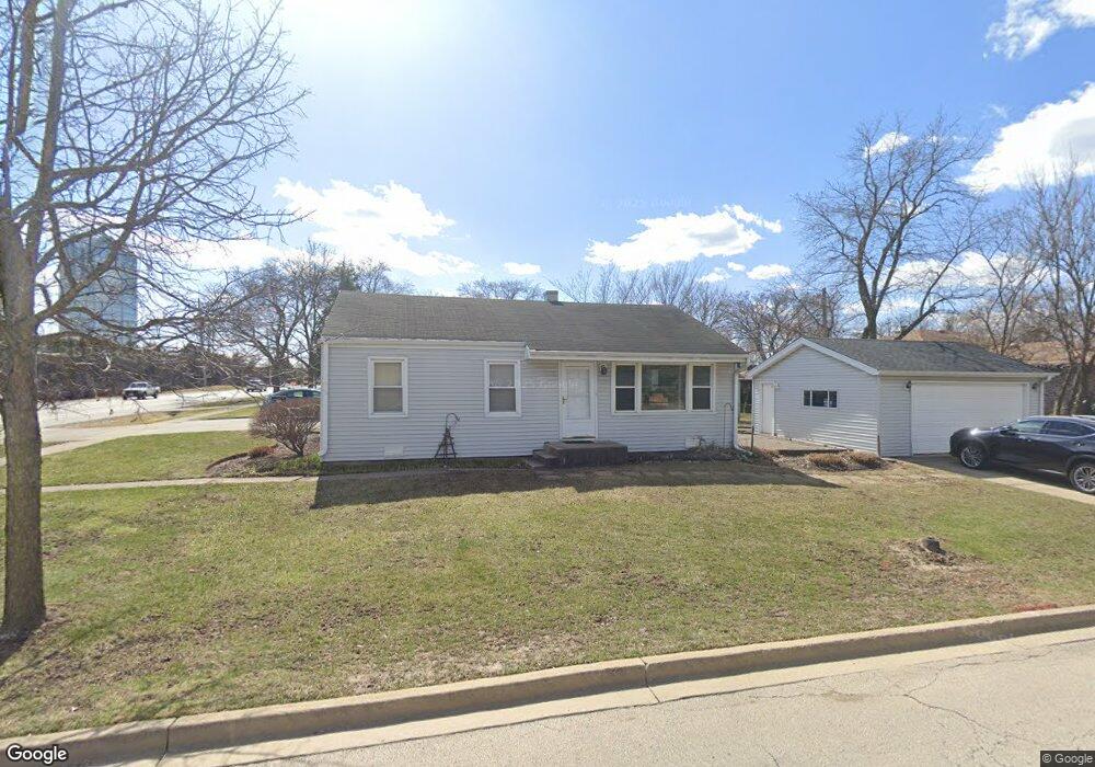
403 W Butterfield Rd Elmhurst, IL 60126
Estimated Value: $273,203 - $337,000
--
Bed
--
Bath
936
Sq Ft
$337/Sq Ft
Est. Value
About This Home
This home is located at 403 W Butterfield Rd, Elmhurst, IL 60126 and is currently estimated at $315,801, approximately $337 per square foot. 403 W Butterfield Rd is a home located in DuPage County with nearby schools including Salt Creek Elementary School, Stella May Swartz Elementary School, and John E Albright Middle School.
Ownership History
Date
Name
Owned For
Owner Type
Purchase Details
Closed on
May 22, 2015
Sold by
Nelson Joseph A
Bought by
Declaratio Nelson Ii Joseph A and Joseph A Nelson Iii Declaration Of Trust
Current Estimated Value
Purchase Details
Closed on
Oct 3, 2003
Sold by
Allen Terrence W and Armetta Sharon R
Bought by
Nelson Joseph A
Home Financials for this Owner
Home Financials are based on the most recent Mortgage that was taken out on this home.
Original Mortgage
$196,900
Outstanding Balance
$93,646
Interest Rate
6.49%
Mortgage Type
FHA
Estimated Equity
$222,155
Create a Home Valuation Report for This Property
The Home Valuation Report is an in-depth analysis detailing your home's value as well as a comparison with similar homes in the area
Home Values in the Area
Average Home Value in this Area
Purchase History
| Date | Buyer | Sale Price | Title Company |
|---|---|---|---|
| Declaratio Nelson Ii Joseph A | -- | Attorney | |
| Nelson Joseph A | $200,000 | Git |
Source: Public Records
Mortgage History
| Date | Status | Borrower | Loan Amount |
|---|---|---|---|
| Open | Nelson Joseph A | $196,900 |
Source: Public Records
Tax History Compared to Growth
Tax History
| Year | Tax Paid | Tax Assessment Tax Assessment Total Assessment is a certain percentage of the fair market value that is determined by local assessors to be the total taxable value of land and additions on the property. | Land | Improvement |
|---|---|---|---|---|
| 2024 | $3,327 | $69,480 | $22,980 | $46,500 |
| 2023 | $2,838 | $64,250 | $21,250 | $43,000 |
| 2022 | $2,767 | $61,750 | $20,430 | $41,320 |
| 2021 | $2,811 | $60,210 | $19,920 | $40,290 |
| 2020 | $2,777 | $58,890 | $19,480 | $39,410 |
| 2019 | $2,660 | $55,990 | $18,520 | $37,470 |
| 2018 | $2,613 | $53,800 | $17,540 | $36,260 |
| 2017 | $2,563 | $51,260 | $16,710 | $34,550 |
| 2016 | $2,403 | $48,290 | $15,740 | $32,550 |
| 2015 | $2,354 | $44,980 | $14,660 | $30,320 |
| 2014 | $3,215 | $56,770 | $12,050 | $44,720 |
| 2013 | $3,184 | $57,570 | $12,220 | $45,350 |
Source: Public Records
Map
Nearby Homes
- 1S045 Spring Rd Unit 1D
- 2 S Atrium Way Unit 203
- 1S150 Spring Rd Unit 5B
- 1S150 Spring Rd Unit 4L
- 274 Timber View Dr
- 1200 S Prospect Ave Unit 303
- 1200 S Prospect Ave Unit 108
- 3 Oak Brook Club Dr Unit E207
- 995 S Swain Ave
- 963 S Saylor Ave
- 130 Crab Apple Ln
- 1 Oak Brook Club Dr Unit A301
- 1 Oak Brook Club Dr Unit A312
- 175 W Brush Hill Rd Unit 404
- 936 S Mitchell Ave
- 1046 E Van Buren St
- 625 E Van Buren St
- 110 W Butterfield Rd Unit 502S
- 814 S Saylor Ave
- 805 S Spring Rd
- 407 W Butterfield Rd
- 411 W Butterfield Rd
- 366 W Commonwealth Ln
- 415 W Butterfield Rd
- 370 W Commonwealth Ln
- 419 W Butterfield Rd
- 374 W Commonwealth Ln
- 389 W Avery St
- 393 W Avery St
- 423 W Butterfield Rd
- 382 W Commonwealth Ln
- 397 W Avery St
- 401 W Avery St
- 386 W Commonwealth Ln
- 405 W Avery St
- 382 W Avery St
- 409 W Avery St
- 435 W Butterfield Rd
- 390 W Avery St
- 394 W Avery St