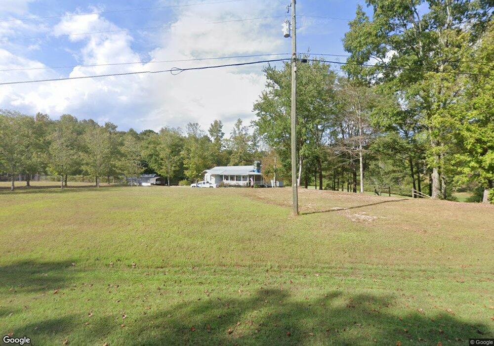
4031 Lovvorn Rd Carrollton, GA 30117
Estimated Value: $386,000 - $557,000
3
Beds
2
Baths
2,622
Sq Ft
$173/Sq Ft
Est. Value
About This Home
This home is located at 4031 Lovvorn Rd, Carrollton, GA 30117 and is currently estimated at $453,026, approximately $172 per square foot. 4031 Lovvorn Rd is a home located in Carroll County with nearby schools including Bowdon Elementary School, Bowdon Middle School, and Bowdon High School.
Ownership History
Date
Name
Owned For
Owner Type
Purchase Details
Closed on
Aug 19, 2005
Sold by
Upchurch Donald R
Bought by
Rogers Reginald G and Rogers Roxie P
Current Estimated Value
Home Financials for this Owner
Home Financials are based on the most recent Mortgage that was taken out on this home.
Original Mortgage
$255,000
Interest Rate
5.64%
Mortgage Type
New Conventional
Purchase Details
Closed on
Apr 23, 1986
Bought by
Upchurch Donald R and Upchurch Estelle
Create a Home Valuation Report for This Property
The Home Valuation Report is an in-depth analysis detailing your home's value as well as a comparison with similar homes in the area
Home Values in the Area
Average Home Value in this Area
Purchase History
| Date | Buyer | Sale Price | Title Company |
|---|---|---|---|
| Rogers Reginald G | $264,900 | -- | |
| Upchurch Donald R | -- | -- |
Source: Public Records
Mortgage History
| Date | Status | Borrower | Loan Amount |
|---|---|---|---|
| Closed | Rogers Reginald G | $255,000 |
Source: Public Records
Tax History Compared to Growth
Tax History
| Year | Tax Paid | Tax Assessment Tax Assessment Total Assessment is a certain percentage of the fair market value that is determined by local assessors to be the total taxable value of land and additions on the property. | Land | Improvement |
|---|---|---|---|---|
| 2024 | $500 | $167,639 | $41,163 | $126,476 |
| 2023 | $500 | $149,061 | $32,930 | $116,131 |
| 2022 | $595 | $115,094 | $21,954 | $93,140 |
| 2021 | $600 | $98,375 | $17,563 | $80,812 |
| 2020 | $602 | $87,895 | $15,966 | $71,929 |
| 2019 | $586 | $82,364 | $15,966 | $66,398 |
| 2018 | $544 | $73,902 | $14,922 | $58,980 |
| 2017 | $550 | $73,902 | $14,922 | $58,980 |
| 2016 | $550 | $73,902 | $14,922 | $58,980 |
| 2015 | $645 | $84,711 | $26,281 | $58,431 |
| 2014 | $651 | $84,712 | $26,281 | $58,431 |
Source: Public Records
Map
Nearby Homes
- 3707 Lovvorn Rd
- 3699 Lovvorn Rd
- 1852 Burwell Rd
- 1175 Burwell Mount Zion Rd
- 370 Simms Rd
- 5119 W Highway 166
- 5147 W Hwy 166
- 245 Delia Peace Rd
- 90 Washington St
- 0 Wynn Rd
- 33 & 67 Lambert Ln
- 183 Madden Rd
- 778 Harrison Rd
- 96 Old Bowdon Rd
- 92 Old Bowdon Rd
- 37 Cedar Dr
- 103 Red Oak Dr
- 64 Twin Oak Dr
- 102 Red Oak Dr
- 3989 Lovvorn Rd
- 685 Davenport Mill Rd
- 763 Davenport Mill Rd
- 4005 Lovvorn Rd
- 3956 Lovvorn Rd
- 749 Davenport Mill Rd
- 754 Davenport Mill Rd
- 809 Davenport Mill Rd
- 596 Davenport Mill Rd
- 572 Davenport Mill Rd
- 4140 Lovvorn Rd
- 0 Davenport Mill Rd Unit 7274962
- 0 Davenport Mill Rd Unit 8967195
- 0 Davenport Mill Rd Unit 8959333
- 790 Davenport Mill Rd
- 4221 Lovvorn Rd
- 831 Burwell Mount Zion Rd
- 629 Burwell Mount Zion Rd
- 570 Burwell Mount Zion Rd
- 520 Davenport Mill Rd