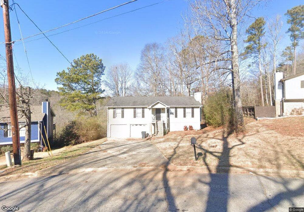
4032 Cindy Dr Douglasville, GA 30135
Estimated Value: $175,000 - $239,000
3
Beds
2
Baths
1,300
Sq Ft
$167/Sq Ft
Est. Value
About This Home
This home is located at 4032 Cindy Dr, Douglasville, GA 30135 and is currently estimated at $217,432, approximately $167 per square foot. 4032 Cindy Dr is a home located in Douglas County with nearby schools including Mt. Carmel Elementary School, Chestnut Log Middle School, and New Manchester High School.
Ownership History
Date
Name
Owned For
Owner Type
Purchase Details
Closed on
Jun 7, 2016
Sold by
Colfin Ai Ga 1 Llc
Bought by
Csh 2016 1 Borrower Llc
Current Estimated Value
Purchase Details
Closed on
Jan 15, 2016
Sold by
White Dena J
Bought by
Euliano Meghan
Purchase Details
Closed on
Feb 3, 2015
Sold by
Regions Bank
Bought by
Federal National Mtg Associati
Purchase Details
Closed on
Jul 2, 2013
Sold by
Steele Annette A
Bought by
Colfin Ai Ga 1 Llc
Purchase Details
Closed on
Nov 20, 1995
Sold by
Hud
Bought by
Cooper Annette
Purchase Details
Closed on
Jul 5, 1995
Sold by
Us Bancorp Mort
Bought by
Hud
Create a Home Valuation Report for This Property
The Home Valuation Report is an in-depth analysis detailing your home's value as well as a comparison with similar homes in the area
Home Values in the Area
Average Home Value in this Area
Purchase History
| Date | Buyer | Sale Price | Title Company |
|---|---|---|---|
| Csh 2016 1 Borrower Llc | -- | -- | |
| Euliano Meghan | $89,900 | -- | |
| Federal National Mtg Associati | -- | -- | |
| Regions Bank | $65,000 | -- | |
| Colfin Ai Ga 1 Llc | $51,000 | -- | |
| Cooper Annette | -- | -- | |
| Hud | -- | -- | |
| Us Bancorp Mort | $54,900 | -- |
Source: Public Records
Mortgage History
| Date | Status | Borrower | Loan Amount |
|---|---|---|---|
| Closed | Cooper Annette | $0 |
Source: Public Records
Tax History Compared to Growth
Tax History
| Year | Tax Paid | Tax Assessment Tax Assessment Total Assessment is a certain percentage of the fair market value that is determined by local assessors to be the total taxable value of land and additions on the property. | Land | Improvement |
|---|---|---|---|---|
| 2024 | $3,215 | $77,360 | $19,040 | $58,320 |
| 2023 | $3,215 | $74,360 | $19,040 | $55,320 |
| 2022 | $2,252 | $55,520 | $11,200 | $44,320 |
| 2021 | $1,714 | $49,960 | $12,200 | $37,760 |
| 2020 | $1,638 | $39,480 | $9,720 | $29,760 |
| 2019 | $1,506 | $38,320 | $9,720 | $28,600 |
| 2018 | $1,295 | $32,720 | $8,480 | $24,240 |
| 2017 | $1,305 | $32,640 | $9,280 | $23,360 |
| 2016 | $1,278 | $31,400 | $8,600 | $22,800 |
| 2015 | $1,007 | $24,020 | $6,800 | $17,220 |
| 2014 | $838 | $22,716 | $6,920 | $15,796 |
| 2013 | -- | $21,516 | $7,160 | $14,356 |
Source: Public Records
Map
Nearby Homes
- 2627 Carol Cir
- 2539 Slater Mill Rd
- 2529 Slater Mill Rd
- 0 Slater Mill Rd Unit 7591224
- 0 Slater Mill Rd Unit 10535776
- 2519 Slater Mill Rd
- 2509 Slater Mill Rd
- 2499 Slater Mill Rd
- 3825 Bentley Dr
- 4155 Prestley Mill Rd
- 3811 Paul St
- 5260 Prestley Crossing Ln
- 3159 W Point Cir
- 5264 Prestley Crossing Ln
- 0 Presley Place Unit 9066983
- 5326 Presley Place
- 1604 Haven Cir
- 4912 Saint Johns Dr
- 4000 Landmark Dr
- 3721 Longview Dr