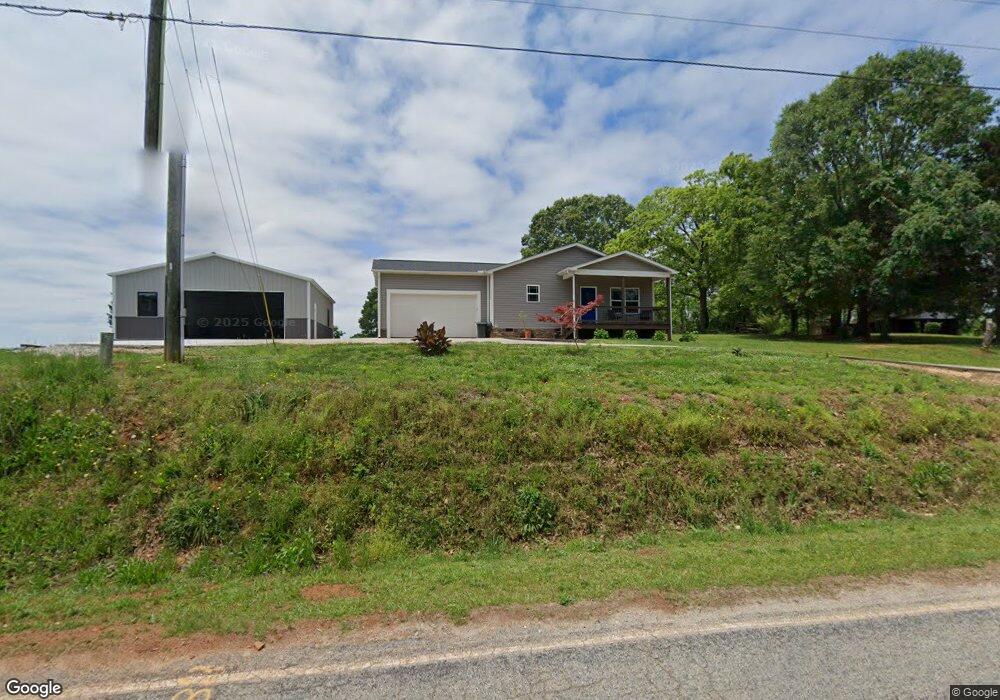
4032 Safety Harbor Rd West Union, SC 29696
Estimated Value: $302,839 - $558,000
3
Beds
2
Baths
1,308
Sq Ft
$315/Sq Ft
Est. Value
About This Home
This home is located at 4032 Safety Harbor Rd, West Union, SC 29696 and is currently estimated at $411,710, approximately $314 per square foot. 4032 Safety Harbor Rd is a home with nearby schools including Keowee Elementary School and Walhalla Middle School.
Ownership History
Date
Name
Owned For
Owner Type
Purchase Details
Closed on
Mar 24, 2023
Sold by
Wholey Tyler S
Bought by
Wholey Tyler S and Wholey Melissa C
Current Estimated Value
Home Financials for this Owner
Home Financials are based on the most recent Mortgage that was taken out on this home.
Original Mortgage
$100,000
Outstanding Balance
$97,064
Interest Rate
6.5%
Mortgage Type
Credit Line Revolving
Estimated Equity
$314,646
Purchase Details
Closed on
Jun 18, 2018
Sold by
Wholey Steven J and Wholey Anna M
Bought by
Wholey Tyler S
Purchase Details
Closed on
Jan 31, 2014
Sold by
Mcalister Kathy D
Bought by
Wholey Steven J and Wholey Anna M
Create a Home Valuation Report for This Property
The Home Valuation Report is an in-depth analysis detailing your home's value as well as a comparison with similar homes in the area
Home Values in the Area
Average Home Value in this Area
Purchase History
| Date | Buyer | Sale Price | Title Company |
|---|---|---|---|
| Wholey Tyler S | -- | -- | |
| Wholey Tyler S | $162,000 | None Available | |
| Wholey Steven J | $90,000 | -- |
Source: Public Records
Mortgage History
| Date | Status | Borrower | Loan Amount |
|---|---|---|---|
| Open | Wholey Tyler S | $100,000 |
Source: Public Records
Tax History Compared to Growth
Tax History
| Year | Tax Paid | Tax Assessment Tax Assessment Total Assessment is a certain percentage of the fair market value that is determined by local assessors to be the total taxable value of land and additions on the property. | Land | Improvement |
|---|---|---|---|---|
| 2024 | $594 | $5,662 | $576 | $5,086 |
| 2023 | $602 | $5,662 | $576 | $5,086 |
| 2022 | $602 | $5,662 | $576 | $5,086 |
| 2021 | $28 | $5,419 | $606 | $4,813 |
| 2020 | $603 | $5,419 | $606 | $4,813 |
| 2019 | $603 | $0 | $0 | $0 |
| 2018 | $29 | $0 | $0 | $0 |
| 2017 | $28 | $0 | $0 | $0 |
| 2016 | $28 | $0 | $0 | $0 |
| 2015 | -- | $0 | $0 | $0 |
| 2014 | -- | $981 | $801 | $180 |
| 2013 | -- | $0 | $0 | $0 |
Source: Public Records
Map
Nearby Homes
- 147 Mcalister Rd
- 141 W Waters Edge Ln
- 98 E W Waters Edge Ln
- 306 Bridgeport Dr
- Lot 61 Hardwood Pointe Dr
- 4014 Hardwood Pointe Dr
- 240 E Waters Edge Ln
- 61 Hardwood Pointe Dr
- 295 Jefferson Rd
- 246 E Waters Edge Ln
- Lot 12 S Towson Trail
- 00 S Towson Trail
- 6004 Glassy Water Way
- Lot 43 Glassy Water Way
- 816 Armada Way
- 825 & 833 Armada Way
- Lot 86 W Waters Edge Ln
- 150 Allmon Ln
- Lot 2 Linn Garden Ln
- Lot 27 Coachmans Trail
- 4034 Safety Harbor Rd
- 4037 Safety Harbor Rd
- 4036 Safety Harbor Rd
- 4030 Safety Harbor Rd
- 4044 Safety Harbor Rd
- 4050 Safety Harbor Rd
- 4021 Safety Harbor Rd
- 4020 Safety Harbor Rd
- 4061 Safety Harbor Rd
- 103 Mcalister Rd
- 123 Mcallister Rd
- 0 Mcallister Rd
- 119 Mcallister Rd
- 110 Mcalister Rd
- 13 Mcalister Rd
- 71 Mcalister Rd
- 4065 Safety Harbor Rd
- Lot 153 Watercrest Rd
- 115 Country Pathway Dr
- 3081 Safety Harbor Rd
